|
|
|
0 members (),
2,434
guests, and
26
robots. |
|
Key:
Admin,
Global Mod,
Mod
|
|
S |
M |
T |
W |
T |
F |
S |
|
|
|
1
|
2
|
3
|
4
|
5
|
|
6
|
7
|
8
|
9
|
10
|
11
|
12
|
|
13
|
14
|
15
|
16
|
17
|
18
|
19
|
|
20
|
21
|
22
|
23
|
24
|
25
|
26
|
|
27
|
28
|
29
|
30
|
|
|
|
|
There are no members with birthdays on this day. |
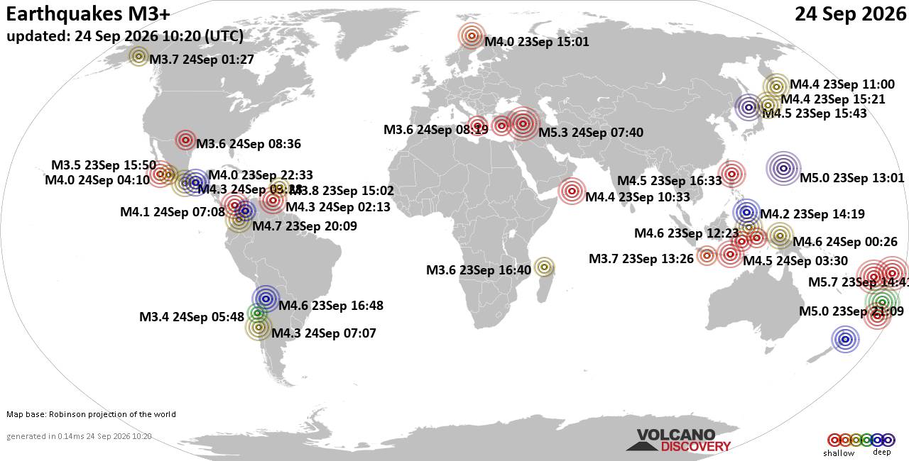
World Earthquake Report for Thursday, 24 September 2026
• Moderate mag. 4.3 earthquake - Madagascar: Mozambique Channel on Thursday, ...
• Small magnitude 3.9 earthquake hits near Hastings, Hastings District, Hawke...
• Volcano earthquake report for Thursday, 24 September 2026
• Light mag. 3.9 earthquake - South Pacific Ocean, 10.2 km south of Hastings,...
• Moderate magnitude 4.1 quake hits 31 miles southeast of Midland, Texas, Uni...
|

#825472
Tue 14 Jul 2026 09:42:PM
|
Joined: Feb 2001
Posts: 678,977
Launch Director
|
|
Launch Director
Joined: Feb 2001
Posts: 678,977 |
SPC Day 3-8 Fire Weather OutlookSPC Day 3-8 Fire Weather Outlook 
Day 3-8 Fire Weather Outlook
NWS Storm Prediction Center Norman OK
0437 PM CDT Tue Jul 14 2026

Valid 161200Z - 221200Z

...Synopsis...
A strong upper ridge will persist over the central/northern Plains
through the end of this week into the early weekend. Following a
northward progressing shortwave trough along the Pacific Northwest
coast on Day 3/Thursday, ensembles indicate the upper ridge will
then translate westward to encompass much of the western CONUS while
the eastern US is expected to remain in a troughing pattern. Daily
chances of thunderstorm activity are possible in the extended
forecast period across the Intermountain West as monsoonal moisture
advects northward once again.

...Portions of northeastern California and the Central Valley,
northwestern Nevada, and far south-central Oregon...
Warm daytime temperatures and low RH will contribute to drying fuels
across the California Coastal Ranges into the Central Valley. ERCs
are forecast to approach the 90-95th percentile by late this week
amid dry and breezy conditions, supporting any new ignitions and the
emergence of lightning holdovers from wet/dry thunderstorms early in
the forecast period. 40% Critical probabilities remain on Day
3/Thursday to account for this threat. Farther north, strong
south-southwesterly flow aloft behind a shortwave trough bypassing
the Pacific Northwest will encourage dry and windy conditions across
northeastern California, northwestern Nevada, and south-central
Oregon on Days 3-4/Thursday-Friday. Preceding days of thunderstorms
and pockets of heavier rainfall may alleviate some fuel concerns;
however, a returning dry airmass and gusty winds may encourage any
lightning holdovers to emerge.

..Elizalde-Garcia.. 07/14/2026

...Please see www.spc.noaa.gov/fire for graphic product...
Read morehttps://www.spc.noaa.gov/products/exper/fire_wx/
|
|



CMS The Best Conveyancing solicitors conveyancing quotes throughout the UK
For any webhosting enquiries please email webmaster@aus-city.com
|
|
Forums60
Topics840,517
Posts875,312
Members2,960
| |
Most Online102,106
Jul 10th, 2026
|
|
|
|
|

|





































