|
|
|
0 members (),
1,726
guests, and
12
robots. |
|
Key:
Admin,
Global Mod,
Mod
|
|
S |
M |
T |
W |
T |
F |
S |
|
|
|
1
|
2
|
3
|
4
|
5
|
|
6
|
7
|
8
|
9
|
10
|
11
|
12
|
|
13
|
14
|
15
|
16
|
17
|
18
|
19
|
|
20
|
21
|
22
|
23
|
24
|
25
|
26
|
|
27
|
28
|
29
|
30
|
|
|
|
|
There are no members with birthdays on this day. |
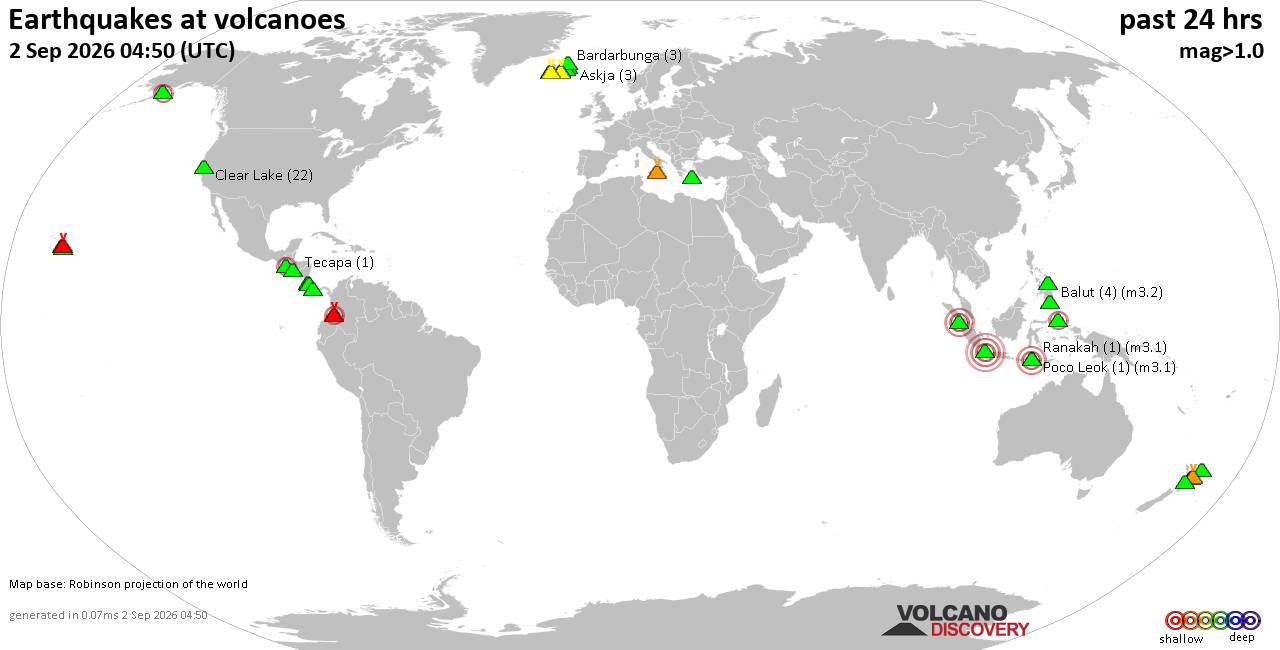
Volcano earthquake report for Wednesday, 2 September 2026
• Moderate mag. 4.0 earthquake - Estado de Oaxaca, Mexico, on Wednesday, Sep ...
• Moderate mag. 4.0 earthquake - Estado de Oaxaca, Mexico, on Wednesday, Sep ...
|

#829587
Mon 27 Jul 2026 08:30:AM
|
Joined: Feb 2001
Posts: 678,977
Launch Director
|
|
Launch Director
Joined: Feb 2001
Posts: 678,977 |
SPC Jul 27, 2026 Day 4-8 Severe Weather OutlookDay 4-8 Outlook 
Day 4-8 Convective Outlook
NWS Storm Prediction Center Norman OK
0326 AM CDT Mon Jul 27 2026

Valid 301200Z - 041200Z

...DISCUSSION...
...Day 4/Thursday...

A short-wave trough is forecast to move through the northern Plains
and upper MS Valley, within the northeast periphery of an upper high
centered over the southern Rockies. At the surface, a weak cold
front is expected to follow the track of the upper-air system with
moderate to strong instability expected by afternoon ahead of the
boundary. Various deterministic and ensemble guidance indicates
thunderstorms developing over the northern Plains into the upper MS
Valley with subsequent movement into the mid MO Valley and perhaps
upper Midwest Thursday night. Forecast vertical shear is on the
margins of that which supports organized storm modes and an
associated greater severe weather threat. Nonetheless, isolated
severe weather appears likely, requiring at least low probabilities
in the Day 3 time frame.


...Day 5/Friday...

The Day 4 short-wave trough is expected to continue southeast
through the Midwest with an associated surface low developing into
the mid MS Valley. A trailing cool front will extend through the
Ozark Plateau into the Southern Plains. Persistent low-level ridging
from the lower Great Lakes into the TN Valley will limit the
eastward extent of more robust air mass destabilization ahead of the
surface low and along the track of the short-wave trough. It does
appear that a corridor of stronger instability and modest vertical
shear will develop from the mid MS Valley into the Ozark Plateau,
where a few severe storms appear possible.


...Day 6-8/Saturday through Monday...

The 00Z ensemble means remain in good agreement in depicting a
stronger short-wave trough and attending belt of mid-level flow
progressing along the international border from the Pacific
northwest to the northern Plains. Some severe weather threat could
materialize along an associated cold front over the northern Plains
on Sunday and the northern Plains into the upper MS Valley on
Monday.
Read morehttps://www.spc.noaa.gov/products/exper/day4-8/
|
|



CMS The Best Conveyancing solicitors conveyancing quotes throughout the UK
For any webhosting enquiries please email webmaster@aus-city.com
|
|
Forums60
Topics817,822
Posts852,615
Members2,960
| |
Most Online102,106
Jul 10th, 2026
|
|
|
|
|

|





































