|
|
|
0 members (),
2,616
guests, and
18
robots. |
|
Key:
Admin,
Global Mod,
Mod
|
|
S |
M |
T |
W |
T |
F |
S |
|
|
|
1
|
2
|
3
|
4
|
5
|
|
6
|
7
|
8
|
9
|
10
|
11
|
12
|
|
13
|
14
|
15
|
16
|
17
|
18
|
19
|
|
20
|
21
|
22
|
23
|
24
|
25
|
26
|
|
27
|
28
|
29
|
30
|
|
|
|
|
There are no members with birthdays on this day. |

Small magnitude 3.6 earthquake strikes near Great Falls, Cascade County, Montana, USA
• Volcano earthquake report for Friday, 18 September 2026
• Possible earthquake reported minutes ago near Great Falls, Montana, USA
• Magnitude 4.6 earthquake strikes near Ponce, Segundo Barrio, Ponce Municipi...
• Small magnitude 3.4 earthquake strikes near Skegness, Lincolnshire, England...
• World Earthquake Report for Friday, 18 September 2026
|

#835324
Wed 19 Aug 2026 09:56:PM
|
Joined: Feb 2001
Posts: 678,977
Launch Director
|
|
Launch Director
Joined: Feb 2001
Posts: 678,977 |
SPC MD 2042MD 2042 CONCERNING SEVERE POTENTIAL...WATCH POSSIBLE FOR PORTIONS OF SOUTHERN MISSOURI INTO FAR NORTHERN ARKANSAS 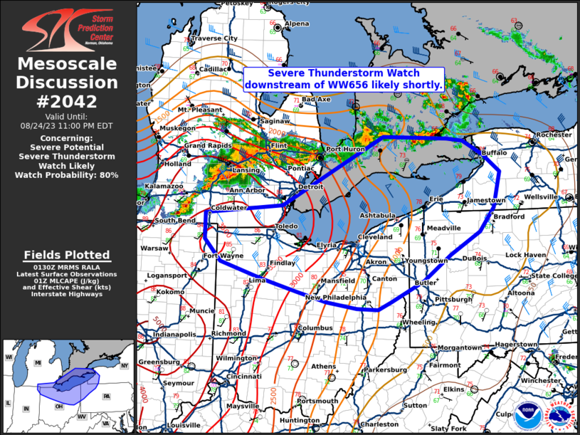
Mesoscale Discussion 2042
NWS Storm Prediction Center Norman OK
0300 PM CDT Wed Aug 19 2026

Areas affected...Portions of southern Missouri into far northern
Arkansas

Concerning...Severe potential...Watch possible

Valid 192000Z - 192200Z

Probability of Watch Issuance...60 percent

SUMMARY...The threat for damaging winds, isolated large hail, and
perhaps a tornado or two will eventually increase within parts of
the Ozarks this afternoon. Timing of storm initiation is not
certain, but a watch may eventually be needed.

DISCUSSION...As cloud cover from earlier convection has cleared,
cumulus agitation is noted in southwest Missouri along a
quasi-dryline-like feature. Temperatures to the southwest of this
boundary have risen into the low 100s F. Destabilization has
occurred to the east of the boundary as well, though some MLCIN is
still evident. 35-40 kt of effective shear across this boundary will
promote eventual supercell development. Given the majority of the
shear exists within the lower half of the troposphere, it is not
certain how long a supercell mode will be maintained. Damaging
winds, isolated large hail, and perhaps a tornado or two will be
possible. A very modest increase in low-level flow during the
evening will mean a modest increase in tornado potential should
supercell modes exist beyond 00Z. A watch is possible this
afternoon, though timing remains uncertain.

..Wendt/Smith.. 08/19/2026

...Please see www.spc.noaa.gov for graphic product...

ATTN...WFO...PAH...MEG...LSX...LZK...SGF...TSA...

LAT...LON   36319370 37089391 37899316 38129136 37379050 36589061
            36249072 35949172 36319370

MOST PROBABLE PEAK TORNADO INTENSITY...UP TO 90 MPH
MOST PROBABLE PEAK WIND GUST...55-70 MPH
MOST PROBABLE PEAK HAIL SIZE...UP TO 1.25 IN
Read morehttps://www.spc.noaa.gov/products/md/md2042.html
|
|



CMS The Best Conveyancing solicitors conveyancing quotes throughout the UK
For any webhosting enquiries please email webmaster@aus-city.com
|
|
Forums60
Topics830,851
Posts865,646
Members2,960
| |
Most Online102,106
Jul 10th, 2026
|
|
|
|
|

|





































