|
|
|
0 members (),
2,518
guests, and
27
robots. |
|
Key:
Admin,
Global Mod,
Mod
|
|
S |
M |
T |
W |
T |
F |
S |
|
|
|
1
|
2
|
3
|
4
|
5
|
|
6
|
7
|
8
|
9
|
10
|
11
|
12
|
|
13
|
14
|
15
|
16
|
17
|
18
|
19
|
|
20
|
21
|
22
|
23
|
24
|
25
|
26
|
|
27
|
28
|
29
|
30
|
|
|
|
|
There are no members with birthdays on this day. |
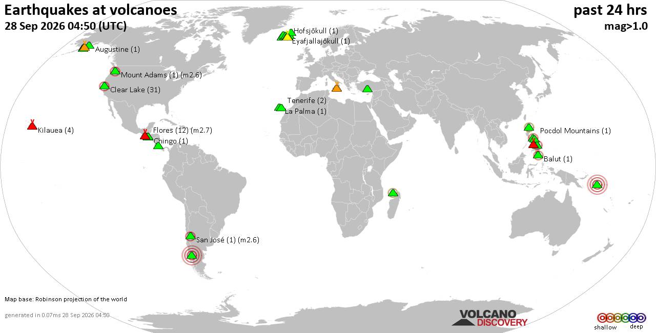
Volcano earthquake report for Monday, 28 September 2026
• M 5.4 - north of Svalbard
• M 2.4 - 70 km SSW of Nikolski, Alaska
• M 4.1 - 105 km SSW of Nikolski, Alaska
• M 1.3 - 11 km SSE of Portola Valley, CA
• M 1.5 - 28 km WNW of Enoch, Utah
|

#837187
Fri 21 Aug 2026 08:57:AM
|
Joined: Feb 2001
Posts: 678,977
Launch Director
|
|
Launch Director
Joined: Feb 2001
Posts: 678,977 |
SPC Aug 21, 2026 Day 4-8 Severe Weather OutlookDay 4-8 Outlook 
Day 4-8 Convective Outlook
NWS Storm Prediction Center Norman OK
0354 AM CDT Fri Aug 21 2026

Valid 241200Z - 291200Z

...DISCUSSION...
A mid-level trough will move across the Northeast on Monday and the
surface front will be mostly offshore, reducing the severe weather
threat. As this trough departs, ridging will build across the
Rockies. This will eventually set up a pattern featuring individual
mid-level shortwave troughs within northwesterly flow from the
northern Plains to the Midwest. Some severe weather will likely
occur with mid-level shortwave troughs within this flow, but these
details likely will not become more clear until the short term.

Model consensus indicates a stronger mid-level shortwave trough
traversing the Pacific Northwest on D7/Thursday. This pattern would
be favorable for some severe weather threat across Montana, but at
this time, it appears moisture will stay farther east. Therefore, no
severe weather is anticipated.
Read morehttps://www.spc.noaa.gov/products/exper/day4-8/
|
|



CMS The Best Conveyancing solicitors conveyancing quotes throughout the UK
For any webhosting enquiries please email webmaster@aus-city.com
|
|
Forums60
Topics844,570
Posts879,365
Members2,960
| |
Most Online102,106
Jul 10th, 2026
|
|
|
|
|

|





































