|
0 members (),
1,560
guests, and
14
robots. |
|
Key:
Admin,
Global Mod,
Mod
|
|
S |
M |
T |
W |
T |
F |
S |
|
|
|
|
|
|
|
1
|
|
2
|
3
|
4
|
5
|
6
|
7
|
8
|
|
9
|
10
|
11
|
12
|
13
|
14
|
15
|
|
16
|
17
|
18
|
19
|
20
|
21
|
22
|
|
23
|
24
|
25
|
26
|
27
|
28
|
29
|
|
30
|
31
|
|
|
|
|
|
|
There are no members with birthdays on this day. |
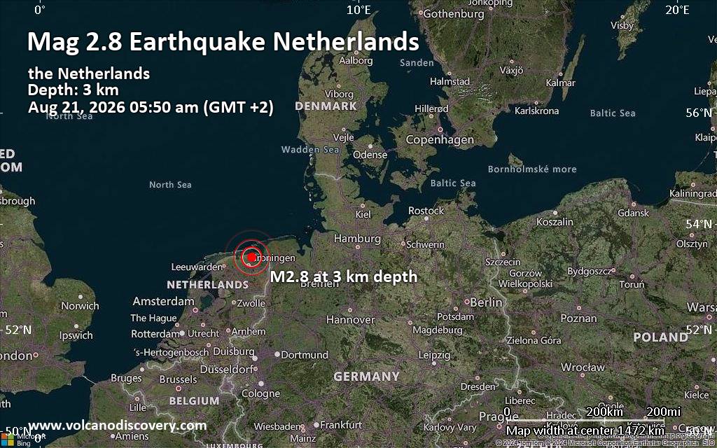
Small tremor of magnitude 2.8 just reported 20 km northeast of Groningen, Netherlands
|
|
|
Joined: Feb 2001
Posts: 678,976
Launch Director
|
OP

Launch Director
Joined: Feb 2001
Posts: 678,976 |
Issued at 1100 PM HST Sat Aug 22 2026 000
WTPA42 PHFO 230844
TCDCP2
Tropical Storm Lala Discussion Number 44
NWS Central Pacific Hurricane Center Honolulu HI CP012026
Issued by NWS National Hurricane Center Miami FL
1100 PM HST Sat Aug 22 2026
Visible satellite images before sunset showed the well-defined
center of Lala surrounded by pronounced curved convective bands.
Infrared cloud top temperatures closer to the center have warmed
within the decaying eyewall. A blend of the latest HFO and JTWC
Dvorak intensity estimates and the earlier scatterometer data
support holding the initial intensity at 60 kt for this advisory.
The storm is moving slowly to the northwest (325/6 kt) with a
mid-level ridge positioned to its north and northeast. This ridge is
forecast to slide eastward and build over the northern Pacific
during the next several days. This should keep Lala on a slow
northwestward track through the forecast period. While the track
models agree on this general scenario, there is notable cross-track
spread in the extended range with the Google Deep Mind and GFS
solutions on opposite sides of the guidance envelope. The updated
NHC track forecast is slightly slower than the previous one, with
small westward adjustments beyond 48 h that trend closer to the
latest corrected multi-model consensus (HCCA).
Lala is centered over waters slightly warmer than 26C in a
relatively weak shear environment. With no baroclinic features
forecast to impart shear on the storm or induce its extratropical
transition, Lala is predicted to only gradually weaken during the
next couple of days. After 48 h, the storm will move over
progressively cooler waters, and the updated NHC prediction shows
steady weakening during the latter half of the forecast. GFS and
ECMWF simulated satellite images suggest Lala could struggle to
sustain organized convection by midweek, and this forecast shows the
system becoming a post-tropical remnant low by 120 h.
FORECAST POSITIONS AND MAX WINDS
INIT 23/0900Z 32.0N 173.7W 60 KT 70 MPH
12H 23/1800Z 32.5N 174.2W 55 KT 65 MPH
24H 24/0600Z 33.1N 174.8W 55 KT 65 MPH
36H 24/1800Z 33.7N 175.3W 50 KT 60 MPH
48H 25/0600Z 34.3N 176.0W 50 KT 60 MPH
60H 25/1800Z 35.0N 176.7W 45 KT 50 MPH
72H 26/0600Z 35.7N 177.5W 40 KT 45 MPH
96H 27/0600Z 37.4N 179.2W 35 KT 40 MPH
120H 28/0600Z 39.0N 179.0E 30 KT 35 MPH...POST-TROP/REMNT LOW
$$
Forecaster Reinhart Source: Tropical Storm Lala Forecast Discussion Number 44
|
|



CMS The Best Conveyancing solicitors conveyancing quotes throughout the UK
For any webhosting enquiries please email webmaster@aus-city.com
|
|
Forums60
Topics800,780
Posts835,570
Members2,960
| |
Most Online102,106
Jul 10th, 2026
|
|
|





































