|
0 members (),
903
guests, and
51
robots. |
|
Key:
Admin,
Global Mod,
Mod
|
|
S |
M |
T |
W |
T |
F |
S |
|
|
|
|
|
|
|
1
|
|
2
|
3
|
4
|
5
|
6
|
7
|
8
|
|
9
|
10
|
11
|
12
|
13
|
14
|
15
|
|
16
|
17
|
18
|
19
|
20
|
21
|
22
|
|
23
|
24
|
25
|
26
|
27
|
28
|
29
|
|
30
|
31
|
|
|
|
|
|
|
There are no members with birthdays on this day. |
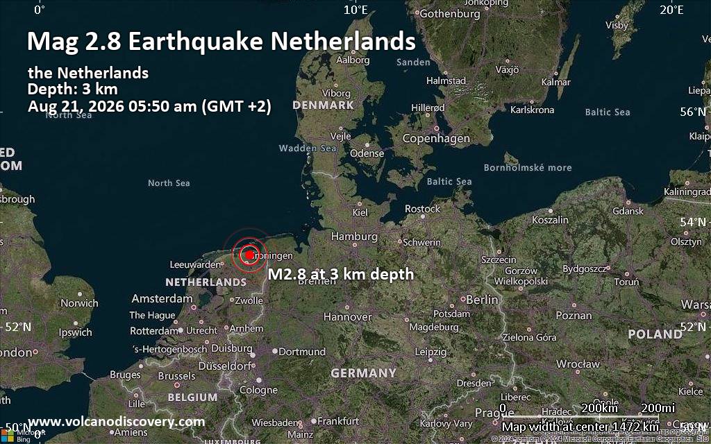
Small tremor of magnitude 2.8 just reported 20 km northeast of Groningen, Netherlands
|
|
|
Joined: Feb 2001
Posts: 678,976
Launch Director
|
OP

Launch Director
Joined: Feb 2001
Posts: 678,976 |
SPC Aug 24, 2026 1630 UTC Day 1 Convective OutlookSPC 1630Z Day 1 Outlook 
Day 1 Convective Outlook
NWS Storm Prediction Center Norman OK
1122 AM CDT Mon Aug 24 2026

Valid 241630Z - 251200Z

...THERE IS A SLIGHT RISK OF SEVERE THUNDERSTORMS ACROSS PARTS OF
THE NORTHERN PLAINS/UPPER MIDWEST...CENTRAL HIGH PLAINS...LOWER
MISSISSIPPI VALLEY/CENTRAL GULF COAST...AND COASTAL CAROLINAS...

...SUMMARY...
Severe thunderstorms capable of producing large hail and severe wind
gusts will be possible this afternoon and evening across parts of
the Upper Midwest as well as the central High Plains.  Other severe
thunderstorms with mainly a damaging wind threat are possible across
the central Gulf Coast and coastal Carolinas.

...Central Gulf Coast...
Satellite/radar mosaic late this morning shows a cluster of storms
moving south along the MS River.  Mostly clear skies will promote
additional heating to the south over the coastal plain, which will
further destabilize the airmass and lead to steepening 0-2 km lapse
rates (in excess of 8 deg C/km) as temperatures warm into the lower
90s deg F.  Deep-layer northerly steering flow will favor southward
movement of the thunderstorm cluster and new updraft development on
the leading edge of the cold pool.  As this convection likely
continues to develop and become surface-based through the mid
afternoon, there will be a corresponding increase in potential for
scattered wet microbursts (55-65 mph gusts capable of wind damage)
with the stronger cores.  This activity will likely push south of
the coast by the early evening.

...Dakotas/Upper Midwest into the Central High Plains...
A mid-level shortwave trough over Alberta/Saskatchewan will move
eastward across the Canadian prairie provinces through tonight, with
a belt of moderately strong flow aloft and multiple MCVs influencing
the northern Plains to Upper Midwest.  Widely scattered
thunderstorms are forecast to develop late this afternoon into the
early evening within a moist/unstable airmass near an
eastward-moving front and weak surface wave across central/eastern
ND.  Other convection may initiate and then move southeastward from
south-central Canada.  Around 35-45 kt of deep-layer shear will
support supercells initially with a large hail threat.  The
development of east/southeastward-moving clusters should eventually
occur this evening, with scattered severe gusts possible.

Farther south and a bit more removed from the stronger cyclonic flow
aloft, additional high-based thunderstorms are expected to form by
late afternoon/early evening across the Black Hills/western NE in
the vicinity of the surface front.  Strengthening and sufficient
veering of winds with height through the mid levels should support
initial supercells capable of large hail, prior to a clustering of
these southeastward-moving thunderstorms.  The risk for scattered
severe gusts may linger through mid/late evening across the central
High Plains before increasing MLCIN encourages gradual weakening.

...Coastal Carolinas...
A larger-scale low/troughing centered over the St. Lawrence Valley
will maintain cyclonic mid to high-level flow over the region this
afternoon.  The 12 UTC Charleston, SC and Newport, NC raobs showed a
very unstable airmass in place to the southeast of a cold front
draped over the Carolinas.  Veering and strengthening flow with
height will support deep-layer shear (30-35 kt) favorable for storm
organization.  The stronger storms will be capable of a
hail/wind-damage risk this afternoon.  See MCD #2112 for short-term
details through early afternoon regarding severe potential.

...Northern Great Basin into the Central Rockies...
Isolated to scattered high-based thunderstorms are expected to
develop this afternoon across parts of the northern Great Basin into
the central Rockies amid steepening low-level lapse rates with a
very well-mixed boundary layer.  Since this convection will develop
along the periphery of stronger flow aloft, modest organization is
possible even though low-level moisture and related instability
should remain weak.  Occasional dry microbursts may occur, some of
which could pose an isolated threat for severe gusts.

...Maine...
Partly cloudy skies will promote some heating and resulting in
weak instability (500-1000 J/kg MLCAPE) by early to mid afternoon.
Forecast soundings show elongated hodographs due to a 100+ kt upper
speed max overhead.  A few of the stronger thunderstorms may be
capable of a localized hail/wind risk for a few hours before this
marginal threat subsides by early evening.

..Smith/Chalmers.. 08/24/2026
Read morehttps://www.spc.noaa.gov/products/outlook/day1otlk_1630.html
|
|



CMS The Best Conveyancing solicitors conveyancing quotes throughout the UK
For any webhosting enquiries please email webmaster@aus-city.com
|
|
Forums60
Topics801,004
Posts835,795
Members2,960
| |
Most Online102,106
Jul 10th, 2026
|
|
|





































