|
0 members (),
1,384
guests, and
27
robots. |
|
Key:
Admin,
Global Mod,
Mod
|
|
S |
M |
T |
W |
T |
F |
S |
|
|
|
|
|
1
|
2
|
3
|
|
4
|
5
|
6
|
7
|
8
|
9
|
10
|
|
11
|
12
|
13
|
14
|
15
|
16
|
17
|
|
18
|
19
|
20
|
21
|
22
|
23
|
24
|
|
25
|
26
|
27
|
28
|
29
|
30
|
31
|
|
There are no members with birthdays on this day. |
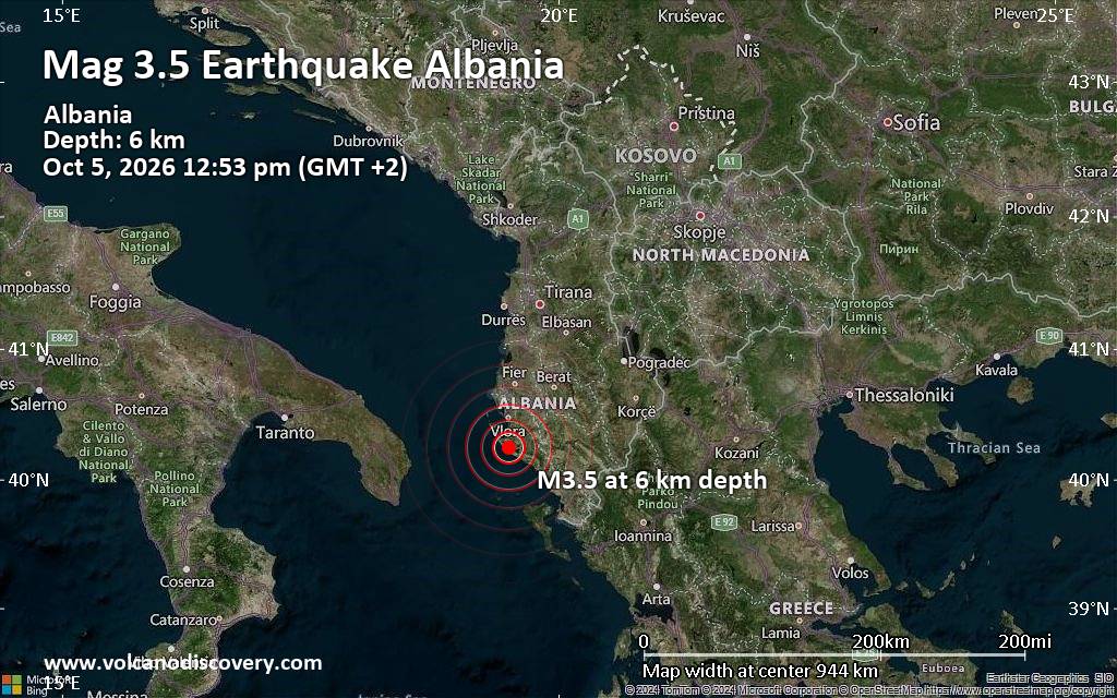
Magnitude 3.5 earthquake strikes near Vlore, Bashkia Vlorë, Qarku i Vlores, Albania
• World Earthquake Report for Monday, 5 October 2026
• M 5.5 - Volcano Islands, Japan region
• M 1.9 - 15 km ESE of Pearsall, Texas
• M 0.8 - 5 km SSW of Redlands, CA
• M 3.0 - 50 km WNW of Ninilchik, Alaska
|

#837791
Mon 24 Aug 2026 05:12:PM
|
Joined: Feb 2001
Posts: 678,977
Launch Director
|
|
Launch Director
Joined: Feb 2001
Posts: 678,977 |
SPC Aug 24, 2026 1730 UTC Day 2 Convective OutlookSPC 1730Z Day 2 Outlook 
Day 2 Convective Outlook
NWS Storm Prediction Center Norman OK
1209 PM CDT Mon Aug 24 2026

Valid 251200Z - 261200Z

...THERE IS A SLIGHT RISK OF SEVERE THUNDERSTORMS ACROSS PORTIONS OF
THE CENTRAL PLAINS...

...SUMMARY...
Scattered severe storms are likely over the central Plains tomorrow
(Tuesday), with more isolated severe storms possible over the Upper
Mississippi Valley and Gulf coastline. Over all areas, severe gusts
are the main threat, though a couple instances of hail or a tornado
are also possible over the Upper Mississippi Valley.

...Synopsis...
Upper ridging will dominate most of the CONUS as an upper trough
over the Northeast ejects into the Atlantic tomorrow (Tuesday).
Multiple embedded impulses are expected to pivot around the upper
ridge over the central U.S., encouraging surface troughing over the
Plains states. Low-level moisture advection beneath seasonably cool
temperatures aloft, along with modest forcing for ascent with the
surface trough, will encourage strong to severe thunderstorm
development across portions of the High Plains to the Upper MS
Valley.

...Portions of the central Plains...
Upslope flow of low-level moisture toward the higher
terrain/immediate lee of the Rockies will encourage thunderstorm
development tomorrow afternoon across the central High Plains. A
deep and relatively dry boundary layer will develop through the day,
with high-based pulse cellular and multicellular storms expected
(given relatively poor tropospheric vertical shear). Lapse rates
from the surface to 500 mb will reach the 8-9 C/km range, with
robust updrafts likely. These storms will quickly become outflow
dominant, leading to the cold-pool merger and the subsequent
organization of one or more loosely organized MCSs. Given steep
boundary layer lapse rates, efficient evaporative cooling will
promote the potential of severe gusts with the more organized storm
clusters, from far southern NE to the TX Panhandle.

...Parts of the Upper MS Valley...
By late afternoon, thunderstorms are poised to develop immediately
ahead of a surface trough as a 500 mb impulse and associated wind
maximum overspreads the Upper MS Valley. Surface dewpoints should
reach the low to mid 60s F, but will be overspread by modest
mid-level lapse rates (i.e. 6-7 C/km), yielding 2000-3000 J/kg
MLCAPE. Forecast hodographs are elongated, with some low-level
curvature noted. Supercells are expected to be the main storm mode,
accompanied by a sparse risk of all severe convective hazards.

...Eastern parts of the Gulf Coast...
Pulse cellular storms will develop along the Gulf Coast again
tomorrow, where mid 70s F surface dewpoints will yield enough
buoyancy to support strong thunderstorms. MLCAPE will likely exceed
2000 J/kg over several locales, with PWATS well over 2 inches
expected. As such, water-loaded downdrafts will promote wet
microbursts capable of producing wind damage.

..Squitieri.. 08/24/2026
Read morehttps://www.spc.noaa.gov/products/outlook/day2otlk_1730.html
|
|



CMS The Best Conveyancing solicitors conveyancing quotes throughout the UK
For any webhosting enquiries please email webmaster@aus-city.com
|
|
Forums60
Topics857,582
Posts892,377
Members2,960
| |
Most Online102,106
Jul 10th, 2026
|
|
|









































