|
1 members (Webmaster),
3,230
guests, and
28
robots. |
|
Key:
Admin,
Global Mod,
Mod
|
|
S |
M |
T |
W |
T |
F |
S |
|
|
|
1
|
2
|
3
|
4
|
5
|
|
6
|
7
|
8
|
9
|
10
|
11
|
12
|
|
13
|
14
|
15
|
16
|
17
|
18
|
19
|
|
20
|
21
|
22
|
23
|
24
|
25
|
26
|
|
27
|
28
|
29
|
30
|
|
|
|
|
There are no members with birthdays on this day. |
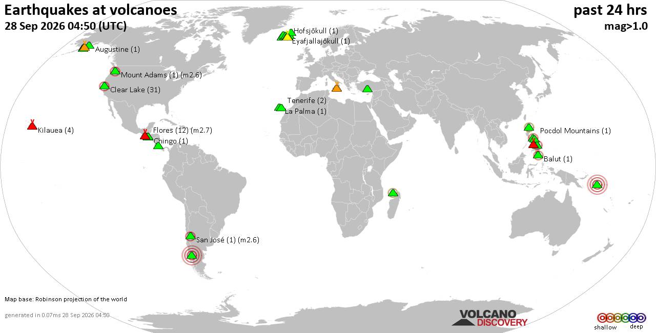
Volcano earthquake report for Monday, 28 September 2026
• M 2.8 - 42 km N of Chase, Alaska
• Moderate mag. 4.8 earthquake - Eastern Gulf of Aden on Monday, Sep 28, 2026...
• M 1.0 - 4 km ENE of Huntsville, Utah
• M 2.1 - 1 km NNW of Pāhala, Hawaii
• M 1.7 - 13 km SSW of Jal, New Mexico
|
|
|
Joined: Feb 2001
Posts: 678,977
Launch Director
|
|
Launch Director
Joined: Feb 2001
Posts: 678,977 |
SPC Day 2 Fire Weather OutlookSPC Day 2 Fire Weather Outlook 
Day 2 Fire Weather Outlook
NWS Storm Prediction Center Norman OK
0229 PM CDT Mon Sep 28 2026

Valid 291200Z - 301200Z

...Sacramento Valley and Southern California...
Surface high pressure filtering into the Intermountain West as a
closed upper low progresses into the Desert Southwest will
contribute to dry northerly flow across portions of the Sacramento
Valley and parts of southern CA D2/Tuesday. Northerly winds of 10-15
mph will funnel into the Sacramento Valley Tuesday as a thermal
trough strengthens over the region. Temperatures in the 90s and RH
reductions of close to 10% are expected by Tuesday afternoon. This
hot and dry environment will align with enhanced north winds to
support elevated fire weather conditions amid a drying fuelscape.
Northerly, offshore wind trajectories and RH as low as 15% will also
affect southern Santa Barbara County and the mountains and foothills
of Ventura and Los Angeles Counties. Wind speeds in favored terrain
gaps should reach 15-20 mph with higher gusts of 40-45 mph. Thus,
Elevated highlights have been maintained for portions of southern
CA.

...North-Central Montana...
50-60 knot mid-level zonal flow and tightening surface pressure
gradient across the northern High Plains will contribute to dry
downslope flow over portions of north-central MT Tuesday. The
existing elevated area was shifted slightly eastward accounting for
latest model guidance consensus showing a upward trend in RH and
cloud cover along and just downstream of higher terrain.

..Williams.. 09/28/2026

.PREV DISCUSSION... /ISSUED 0159 AM CDT Mon Sep 28 2026/

...Synopsis...
...Southern California...
Surface high pressure expanding across the Great Basin as an upper
low moves into the Southwest will maintain dry, breezy offshore flow
across parts of southern CA on Tuesday. Northerly winds of 15-20
mph, with gusts to 30-45, are possible in wind-prone areas across
southern Santa Barbara County and the mountains and foothills of
Ventura and Los Angeles Counties. RH of 15-20 percent, combined with
increasingly dry fuels, will support elevated fire-weather
conditions.

...North-central Montana...
Increasing westerly flow aloft and a tightening surface pressure
gradient across the northern Rockies/High Plains will promote
breezy, downslope winds across north-central MT on Tuesday. Westerly
surface winds of 15-25 mph and minimum RH of 15-20 percent will
overlap dry fuels, yielding elevated fire-weather conditions.

...Please see www.spc.noaa.gov/fire for graphic product...
Read morehttps://www.spc.noaa.gov/products/fire_wx/fwdy2.html
|
|



CMS The Best Conveyancing solicitors conveyancing quotes throughout the UK
For any webhosting enquiries please email webmaster@aus-city.com
|
|
Forums60
Topics845,197
Posts879,992
Members2,960
| |
Most Online102,106
Jul 10th, 2026
|
|
|









































