|
|
|
2 members (Alisa, Webmaster),
2,090
guests, and
26
robots. |
|
Key:
Admin,
Global Mod,
Mod
|
|
S |
M |
T |
W |
T |
F |
S |
|
|
|
1
|
2
|
3
|
4
|
5
|
|
6
|
7
|
8
|
9
|
10
|
11
|
12
|
|
13
|
14
|
15
|
16
|
17
|
18
|
19
|
|
20
|
21
|
22
|
23
|
24
|
25
|
26
|
|
27
|
28
|
29
|
30
|
|
|
|
|
There are no members with birthdays on this day. |
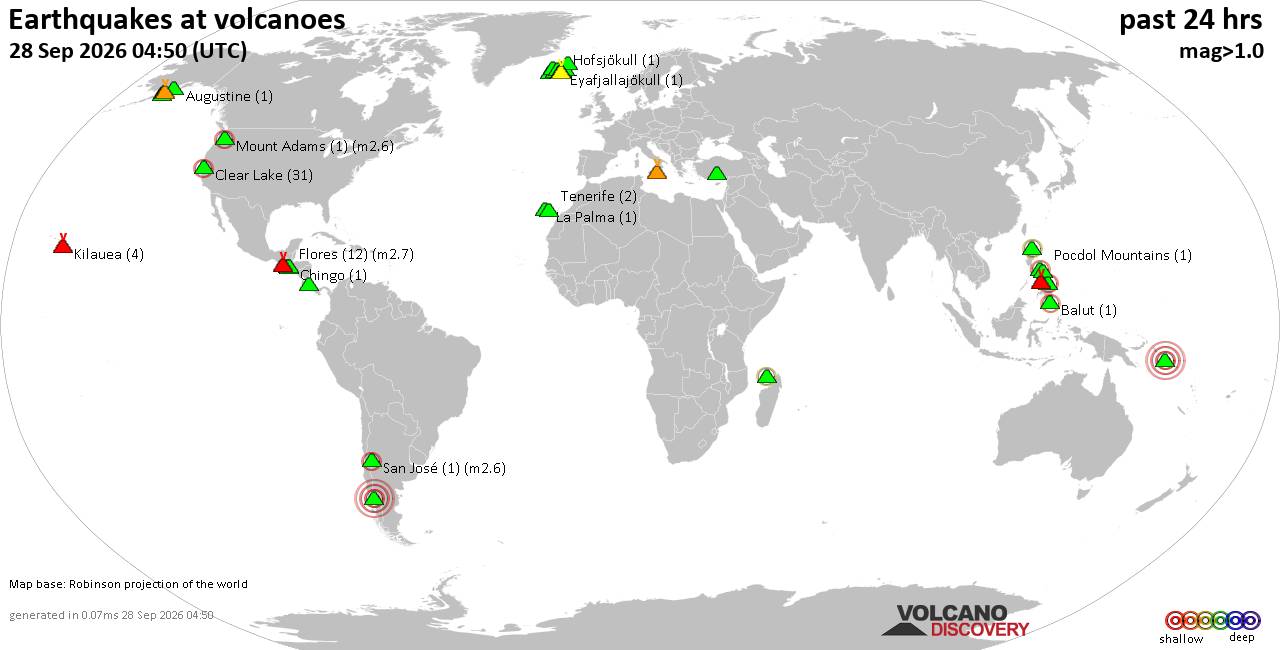
Volcano earthquake report for Monday, 28 September 2026
• M 4.9 - 2 km SW of Sakai, Japan
• M 1.9 - 7 km N of Hope, Alaska
• M 2.0 - 46 km W of Ninilchik, Alaska
• M 0.8 - 152 km W of Adak, Alaska
• M 1.7 - 11 km WSW of Lake Pillsbury, CA
|
|
|
Joined: Feb 2001
Posts: 678,977
Launch Director
|
|
Launch Director
Joined: Feb 2001
Posts: 678,977 |
SPC Sep 28, 2026 2000 UTC Day 1 Convective OutlookSPC 2000Z Day 1 Outlook 
Day 1 Convective Outlook
NWS Storm Prediction Center Norman OK
0258 PM CDT Mon Sep 28 2026

Valid 282000Z - 291200Z

...THERE IS A MARGINAL RISK OF SEVERE THUNDERSTORMS ACROSS PARTS OF
THE NORTHERN PLAINS...

...SUMMARY...
Isolated strong to severe thunderstorms may occur this afternoon and
evening across parts of western/northern South Dakota and vicinity.

...20z Update...
Latest observations depict a corridor of stronger surface heating
and less prevalent cloud cover in the vicinity of northwestern South
Dakota, with surface temperatures noted to have warmed into the
low/mid 70s F downstream of developing convection near the WY/SD
border. Thus, the existing Level 1/Marginal risk was expanded
slightly to the northwest with this outlook update. See recently
issued MCD #2330 and the text below for additional information.

Elsewhere, the forecast remains generally on track, with only minor
adjustments made to the general thunder area based on latest
observational trends.

..Chalmers/Lyons.. 09/28/2026

.PREV DISCUSSION... /ISSUED 1128 AM CDT Mon Sep 28 2026/

...Northern Plains...
Clouds and elevated thunderstorms remain prevalent late this morning
across parts of the Dakotas. A narrow window for strong to locally
severe thunderstorms may exist this afternoon/evening across parts
of western/northern SD and vicinity as convection develops
along/east of a weak surface trough. While lapse rates aloft should
remain modest, filtered daytime heating with surface temperatures
reaching the mid/upper 70s will probably be sufficient for robust
thunderstorm development. A belt of modestly enhanced southwesterly
mid-level flow will extend across the northern Rockies/Plains today,
and 30-40 kt of deep-layer shear should support updraft
organization. Current expectations are for thunderstorms to
initially form near the Black Hills by 20-22Z, and then spread
east-northeastward along/near a surface front through the evening.
The stronger cells may be capable of producing isolated hail and
gusty winds, before convection tends to become elevated with
eastward extent across northern SD/southern ND by late evening.

...Lower Colorado River Valley...
Showers and thunderstorms should develop this afternoon as an
anomalously moist low-level airmass spreads northward ahead of a
mid-level shortwave trough forecast to move from CA/NV to the lower
CO River Valley through the period. Cloudiness and weak mid-level
lapse rates should limit instability through early afternoon, before
cloud cover gradually diminishes through early evening. A stronger
thunderstorm or two may occur parts of interior southern
CA/northwest AZ/southern NV, but the overall risk for severe
hail/wind appears too limited to include any probabilities for this
region at this time.
Read morehttps://www.spc.noaa.gov/products/outlook/day1otlk_2000.html
|
|



CMS The Best Conveyancing solicitors conveyancing quotes throughout the UK
For any webhosting enquiries please email webmaster@aus-city.com
|
|
Forums60
Topics845,684
Posts880,479
Members2,960
| |
Most Online102,106
Jul 10th, 2026
|
|
|
|
|

|









































