|
|
|
0 members (),
2,090
guests, and
24
robots. |
|
Key:
Admin,
Global Mod,
Mod
|
|
S |
M |
T |
W |
T |
F |
S |
|
|
|
1
|
2
|
3
|
4
|
5
|
|
6
|
7
|
8
|
9
|
10
|
11
|
12
|
|
13
|
14
|
15
|
16
|
17
|
18
|
19
|
|
20
|
21
|
22
|
23
|
24
|
25
|
26
|
|
27
|
28
|
29
|
30
|
|
|
|
|
There are no members with birthdays on this day. |
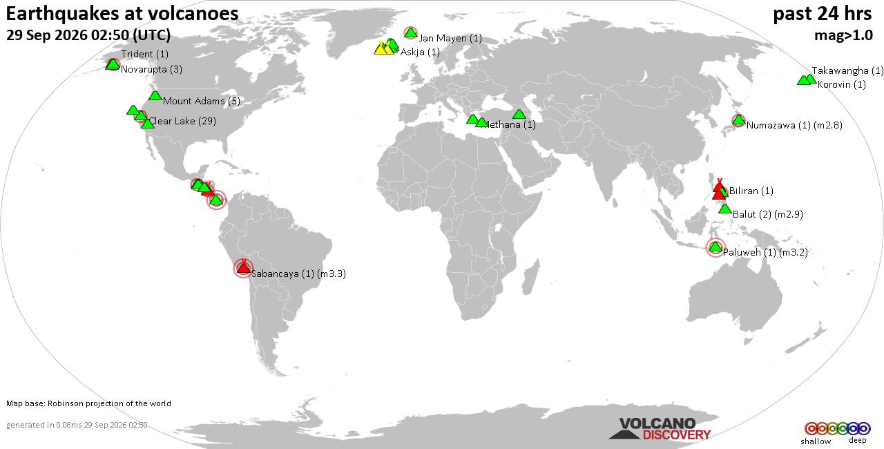
Volcano earthquake report for Tuesday, 29 September 2026
• M 1.9 - 4 km SW of Guánica, Puerto Rico
• M 2.6 - 4 km NNE of Aguas Buenas, Puerto Rico
• M 1.5 - 16 km WSW of Johannesburg, CA
• World Earthquake Report for Tuesday, 29 September 2026
• M 1.6 - 30 km NW of Beluga, Alaska
|
|
|
Joined: Feb 2001
Posts: 678,977
Launch Director
|
|
Launch Director
Joined: Feb 2001
Posts: 678,977 |
SPC Sep 29, 2026 0600 UTC Day 1 Convective OutlookSPC 1200Z Day 1 Outlook 
Day 1 Convective Outlook
NWS Storm Prediction Center Norman OK
1235 AM CDT Tue Sep 29 2026

Valid 291200Z - 301200Z

...THERE IS A MARGINAL RISK OF SEVERE THUNDERSTORMS FROM SOUTHERN
AND EASTERN NM INTO WEST TX...

...SUMMARY...
Isolated severe thunderstorm gusts and a couple of tornadoes will be
possible this afternoon into tonight from southern and eastern New
Mexico into west Texas.

...Synopsis...
A mid/upper-level low and attendant trough are forecast to move
across the Desert Southwest through the period. In response to the
approaching deep trough, Hurricane Polo is forecast to move from the
Gulf of California into Sonora this morning. While the tropical
cyclone is forecast to weaken over the mountainous terrain of
northern Mexico later today, phasing of the midlevel remnant of Polo
with the approaching deep mid/upper-level trough will result in a
consolidating surface low that is forecast to move across eastern NM
and west TX through the evening.

...Southern/eastern NM into west TX...
Widespread convection is expected this afternoon into tonight from
southern/eastern NM into west TX, as increasing large-scale ascent
overspreads a very moist environment. The influence of the remnant
tropical system will result in poor midlevel lapse rates, but
increasing deep-layer flow/shear and enlarging low-level hodographs
will favor some storm organization. The widespread storm coverage
will result in a tendency toward complex or linear storm modes with
time, though occasional supercells will also be possible. The weak
lapse rates and modest buoyancy are expected to limit the magnitude
of severe potential, but a localized tornado and severe-gust threat
could accompany any organized storm structures this afternoon and
evening.

...Arizona...
Widespread convection is expected across parts of AZ this morning
into the afternoon, in association with the primary mid/upper-level
low. Some enhancement to deep-layer shear and low-level SRH is
expected to accompany this system, but extensive cloudiness and
precipitation will inhibit diurnal heating and destabilization. At
this time, organized severe potential appears relatively low, but
locally gusty winds and transient rotation may occur with the
strongest convective elements. Trends will continue to monitored
regarding potential for pockets of locally greater destabilization
through the day.

..Dean/Weinman.. 09/29/2026
Read morehttps://www.spc.noaa.gov/products/outlook/day1otlk_1200.html
|
|



CMS The Best Conveyancing solicitors conveyancing quotes throughout the UK
For any webhosting enquiries please email webmaster@aus-city.com
|
|
Forums60
Topics846,322
Posts881,117
Members2,960
| |
Most Online102,106
Jul 10th, 2026
|
|
|
|
|

|









































