|
|
|
0 members (),
2,076
guests, and
24
robots. |
|
Key:
Admin,
Global Mod,
Mod
|
|
S |
M |
T |
W |
T |
F |
S |
|
|
|
1
|
2
|
3
|
4
|
5
|
|
6
|
7
|
8
|
9
|
10
|
11
|
12
|
|
13
|
14
|
15
|
16
|
17
|
18
|
19
|
|
20
|
21
|
22
|
23
|
24
|
25
|
26
|
|
27
|
28
|
29
|
30
|
|
|
|
|
There are no members with birthdays on this day. |
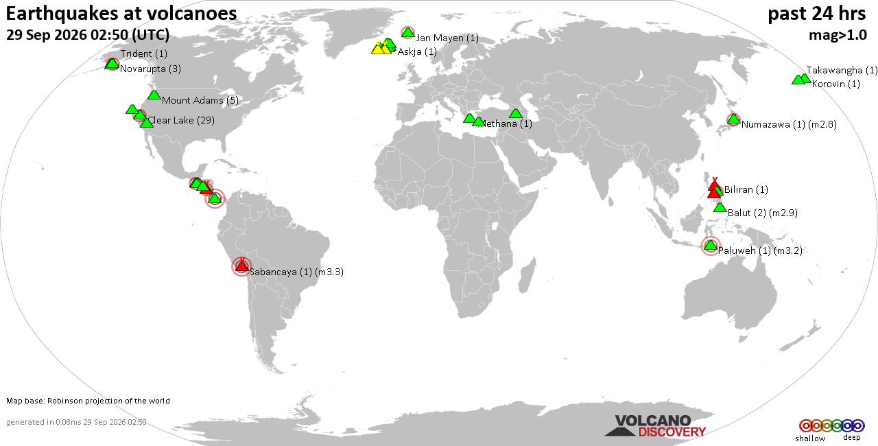
Volcano earthquake report for Tuesday, 29 September 2026
• M 1.0 - 7 km NW of The Geysers, CA
• M 1.8 - 57 km S of Whites City, New Mexico
• M 1.8 - 57 km S of Whites City, New Mexico
• M 2.2 - 8 km W of Cotati, CA
• M 3.5 - 184 km SE of Perryville, Alaska
|
|
|
Joined: Feb 2001
Posts: 678,977
Launch Director
|
|
Launch Director
Joined: Feb 2001
Posts: 678,977 |
SPC Day 3-8 Fire Weather OutlookSPC Day 3-8 Fire Weather Outlook 
Day 3-8 Fire Weather Outlook
NWS Storm Prediction Center Norman OK
0418 PM CDT Tue Sep 29 2026

Valid 011200Z - 071200Z

...Synopsis...
An upper-level low over the southern/central Plains on Day
3/Thursday will accelerate northeastward and merge into broader
westerly flow across the Midwest and Northeast by Day 4/Friday.
Widespread rainfall across the southern and central Plains and
Midwest will reduce fire weather concerns across this region.
Persistent warm and dry conditions amid very dry fuels across the
Mid-South Day 3/Thursday will give way to increasing Gulf moisture,
rising humidity and at least some rainfall across the region
beginning Day 4/Friday as cold front moves into the Ohio and
Tennessee River Valleys.

West of the Continental Divide, a building ridge through late week
will support a considerable warming and drying trend across the
Western U.S. although resultant weak surface pressure gradients and
light winds will limit a broader fire weather threat. A weak
mid/upper wave could bring a thunderstorm threat to the Oregon and
Northern California vicinity on Day 6/Sunday although remaining
forecast uncertainty in timing and convective coverage precludes
introducing dry thunderstorm probabilities at this time. The overall
ridging pattern across the West is likely to extend into next week,
resulting in drying/curing of fuels.

..Williams.. 09/29/2026

...Please see www.spc.noaa.gov/fire for graphic product...
Read morehttps://www.spc.noaa.gov/products/exper/fire_wx/
|
|



CMS The Best Conveyancing solicitors conveyancing quotes throughout the UK
For any webhosting enquiries please email webmaster@aus-city.com
|
|
Forums60
Topics847,853
Posts882,648
Members2,960
| |
Most Online102,106
Jul 10th, 2026
|
|
|
|
|

|









































