|
0 members (),
2,077
guests, and
24
robots. |
|
Key:
Admin,
Global Mod,
Mod
|
|
S |
M |
T |
W |
T |
F |
S |
|
|
|
1
|
2
|
3
|
4
|
5
|
|
6
|
7
|
8
|
9
|
10
|
11
|
12
|
|
13
|
14
|
15
|
16
|
17
|
18
|
19
|
|
20
|
21
|
22
|
23
|
24
|
25
|
26
|
|
27
|
28
|
29
|
30
|
|
|
|
|
There are no members with birthdays on this day. |
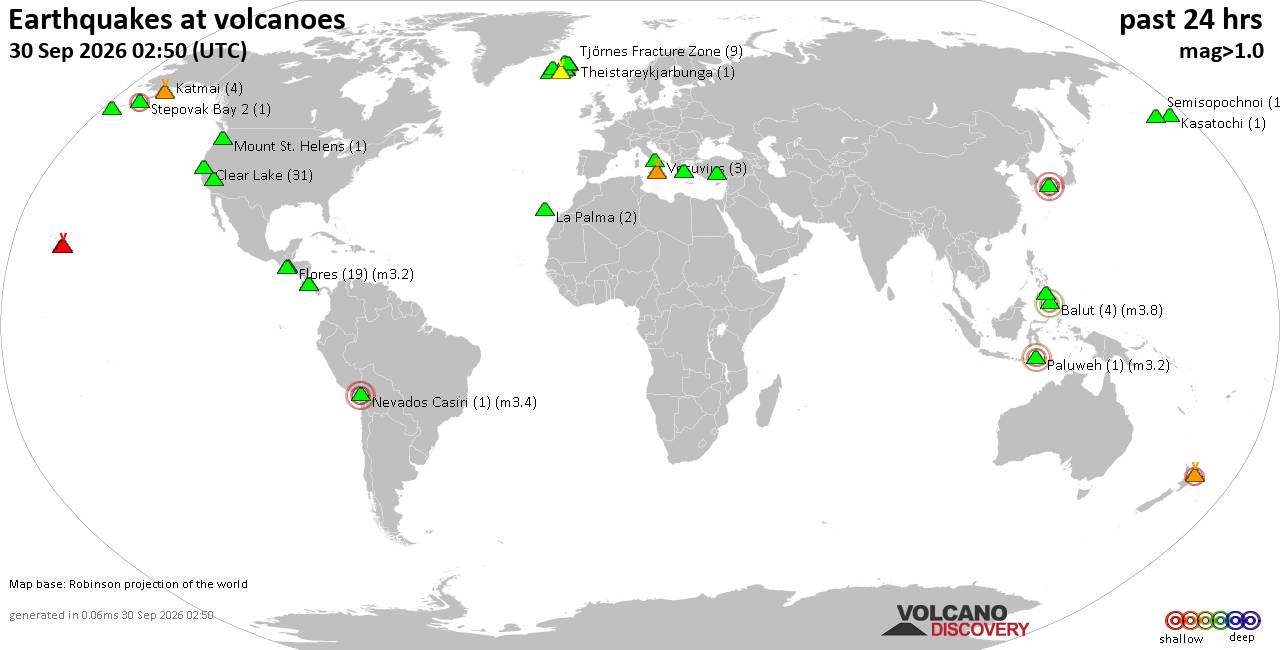
Volcano earthquake report for Wednesday, 30 September 2026
• M 1.4 - 8 km SW of Anza, CA
• M 1.8 - 47 km SSW of Cantwell, Alaska
• M 2.4 - 263 km W of Adak, Alaska
• M 3.8 - 4 km SE of Piru, CA
• M 4.2 - 6 km WNW of Wauna, Washington
|
|
|
Joined: Feb 2001
Posts: 678,977
Launch Director
|
|
Launch Director
Joined: Feb 2001
Posts: 678,977 |
SPC MD 2337MD 2337 CONCERNING SEVERE POTENTIAL...WATCH POSSIBLE FOR PORTIONS OF CENTRAL KANSAS INTO EXTREME NORTHERN OKLAHOMA 
Mesoscale Discussion 2337
NWS Storm Prediction Center Norman OK
0221 PM CDT Wed Sep 30 2026

Areas affected...portions of central Kansas into extreme northern
Oklahoma

Concerning...Severe potential...Watch possible

Valid 301921Z - 302145Z

Probability of Watch Issuance...60 percent

SUMMARY...A few of the stronger storms may produce brief tornadoes
this afternoon. Timing of a Tornado Watch is uncertain, but one will
likely be needed at some point within the next few hours.

DISCUSSION...A surface low continues to move northeastward, with
airmass recovery noted with an approaching dry slot and accompanying
70 kt 300 mb jet streak (currently over the TX Panhandle). A surface
warm front continues to track northward, with the warm sector
characterized by 80+ F surface temperatures and upper 60s to 70 F
dewpoints. Along the warm front and OK/KS border, regional VADs are
depicting appreciably curved/elongated hodographs and 200-300 m2/s2
sfc-3km SRH given backed surface flow. The current thinking is that
low-topped supercells will eventually develop and continue to
intensify through the afternoon as destabilization continues along
the warm front and the 300 mb jet streak overspreads KS. Storms near
the warm front will have the best low-level rotation potential, with
a few tornadoes possible (albeit brief given poor tropospheric lapse
rates and marginal MLCAPE constrained to very thin profiles).

The primary question at the moment is when storms will become severe
given the anticipated slow storm evolution. As such, convective
trends will continue to be closely monitored to determine the most
appropriate time for Tornado Watch issuance.

..Squitieri/Mosier.. 09/30/2026

...Please see www.spc.noaa.gov for graphic product...

ATTN...WFO...TOP...ICT...OUN...GID...DDC...

LAT...LON   37239961 38239932 38929890 39369855 39599808 39749690
            39559613 38999565 37629604 36979697 36789744 36679789
            36639857 36679909 37239961

MOST PROBABLE PEAK TORNADO INTENSITY...85-110 MPH
MOST PROBABLE PEAK WIND GUST...UP TO 60 MPH
Read morehttps://www.spc.noaa.gov/products/md/md2337.html
|
|



CMS The Best Conveyancing solicitors conveyancing quotes throughout the UK
For any webhosting enquiries please email webmaster@aus-city.com
|
|
Forums60
Topics849,779
Posts884,574
Members2,960
| |
Most Online102,106
Jul 10th, 2026
|
|
|









































