|
|
|
1 members (Webmaster),
1,700
guests, and
25
robots. |
|
Key:
Admin,
Global Mod,
Mod
|
|
S |
M |
T |
W |
T |
F |
S |
|
1
|
2
|
3
|
4
|
5
|
6
|
7
|
|
8
|
9
|
10
|
11
|
12
|
13
|
14
|
|
15
|
16
|
17
|
18
|
19
|
20
|
21
|
|
22
|
23
|
24
|
25
|
26
|
27
|
28
|
|
29
|
30
|
|
|
|
|
|
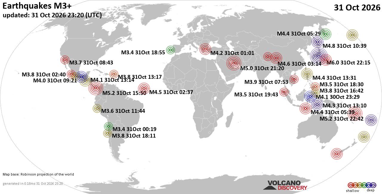
World Earthquake Report for Saturday, 31 October 2026
• M 2.4 - 6 km SW of Volcano, Hawaii
• M 3.1 - 10 km WSW of Hope, Alaska
• M 2.4 - 6 km SW of Volcano, Hawaii
• M 0.2 - 10 km N of Borrego Springs, CA
• M -0.7 - 61 km ENE of Pedro Bay, Alaska
• M 0.6 - 19 km NNE of Ridgecrest, CA
|

#887443
Thu 01 Oct 2026 05:51:AM
|
Joined: Feb 2001
Posts: 678,977
Launch Director
|
|
Launch Director
Joined: Feb 2001
Posts: 678,977 |
SPC Oct 1, 2026 0600 UTC Day 2 Convective OutlookSPC 0600Z Day 2 Outlook 
Day 2 Convective Outlook
NWS Storm Prediction Center Norman OK
1248 AM CDT Thu Oct 01 2026

Valid 021200Z - 031200Z

...NO SEVERE THUNDERSTORM AREAS FORECAST...

...SUMMARY...
No severe thunderstorms are expected across the U.S. on Friday or
Friday night.

...DISCUSSION...
West-northwesterly mid-level flow will be in place over much of the
northern U.S. on Friday, as multiple shortwave troughs move
east-southeastward through the flow. At the surface, a cold front
will advance southeastward from the mid Mississippi Valley into the
Southeast. Surface dewpoints to the south of the front over the Gulf
Coast region will be in the 70s F. This moist airmass will become
weakly unstable by afternoon over most areas. Isolated to scattered
thunderstorms will be possible within zones of focused low-level
convergence. Deep-layer shear is forecast to be relatively weak,
which will limit any severe potential.

..Broyles.. 10/01/2026
Read morehttps://www.spc.noaa.gov/products/outlook/day2otlk_0600.html
|
|



CMS The Best Conveyancing solicitors conveyancing quotes throughout the UK
For any webhosting enquiries please email webmaster@aus-city.com
|
|
Forums60
Topics904,556
Posts939,353
Members2,960
| |
Most Online102,106
Jul 10th, 2026
|
|
|
|
|

|









































