|
0 members (),
1,475
guests, and
27
robots. |
|
Key:
Admin,
Global Mod,
Mod
|
|
S |
M |
T |
W |
T |
F |
S |
|
|
|
|
|
1
|
2
|
3
|
|
4
|
5
|
6
|
7
|
8
|
9
|
10
|
|
11
|
12
|
13
|
14
|
15
|
16
|
17
|
|
18
|
19
|
20
|
21
|
22
|
23
|
24
|
|
25
|
26
|
27
|
28
|
29
|
30
|
31
|
|
There are no members with birthdays on this day. |
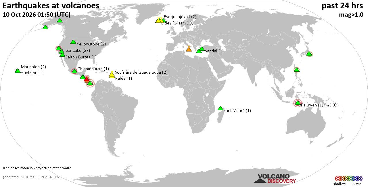
Volcano earthquake report for Saturday, 10 October 2026
• M 3.4 - 31 km NE of Punta Cana, Dominican Republic
• M 4.7 - 2 km WNW of El Cacao, Panama
• M 4.7 - 2 km WNW of El Cacao, Panama
• M 4.7 - 2 km WNW of El Cacao, Panama
• M 4.5 - 103 km SW of Puerto Madero, Mexico
|

#890869
Fri 02 Oct 2026 08:54:PM
|
Joined: Feb 2001
Posts: 678,977
Launch Director
|
|
Launch Director
Joined: Feb 2001
Posts: 678,977 |
SPC Day 3-8 Fire Weather OutlookSPC Day 3-8 Fire Weather Outlook 
Day 3-8 Fire Weather Outlook
NWS Storm Prediction Center Norman OK
0348 PM CDT Fri Oct 02 2026

Valid 041200Z - 101200Z

An upper-level high centered over southern/eastern NV will continue
on Day 3/Sunday before breaking down early next week.
Simultaneously, as this break down occurs, westerly surface winds
will become gusty, especially over the lee slopes adjacent to
portions of the northern High Plains - particularly on Day 4/Monday
and Day 5/Tuesday. However, while dead fuel moistures will be drier
as a result of this event, the combination of antecedent fuel
conditions and wind/RH is currently expected to remain below
critical thresholds. After being suppressed by the passing trough
over the northern tier of the CONUS, the ridge will build back
farther east into the Intermountain West mid to late next week as
the pattern remains unsettled.

The upper-level high will contribute to easterly flow over southern
coastal CA, supporting a stronger than average offshore flow regime.
Given the warm and dry conditions preceding and following this
event, fuels will remain receptive. The tightening pressure gradient
will support breezy (10-20 mph) and gusty (30+ mph) offshore flow
amid minimum RHs near 15-20% and well above normal heat over much of
the highlighted area. Atypically, the strongest offshore winds are
anticipated to occur during the daytime hours on Day 3/Sunday. Thus,
40% probabilities of critical wind/RH remain in the forecast.

..Stearns.. 10/02/2026

...Please see www.spc.noaa.gov/fire for graphic product...
Read morehttps://www.spc.noaa.gov/products/exper/fire_wx/
|
|



CMS The Best Conveyancing solicitors conveyancing quotes throughout the UK
For any webhosting enquiries please email webmaster@aus-city.com
|
|
Forums60
Topics867,917
Posts902,713
Members2,960
| |
Most Online102,106
Jul 10th, 2026
|
|
|









































