|
|
|
0 members (),
2,446
guests, and
23
robots. |
|
Key:
Admin,
Global Mod,
Mod
|
|
S |
M |
T |
W |
T |
F |
S |
|
|
|
|
|
1
|
2
|
3
|
|
4
|
5
|
6
|
7
|
8
|
9
|
10
|
|
11
|
12
|
13
|
14
|
15
|
16
|
17
|
|
18
|
19
|
20
|
21
|
22
|
23
|
24
|
|
25
|
26
|
27
|
28
|
29
|
30
|
31
|
|
There are no members with birthdays on this day. |
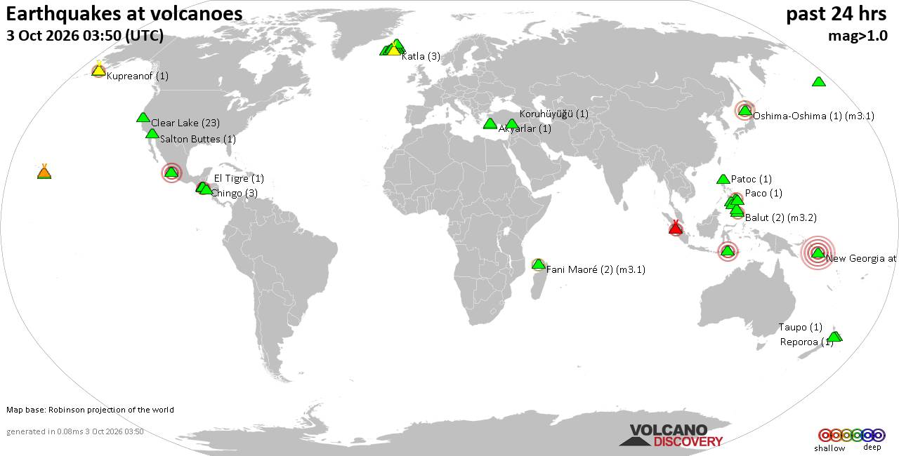
Volcano earthquake report for Saturday, 3 October 2026
• Moderate mag. 4.0 earthquake - Near Coast OF Ecuador on Saturday, Oct 3, 20...
• M 4.5 - 56 km SSE of Mawlaik, Burma (Myanmar)
• M 4.9 - 72 km NE of Sittwe, Burma (Myanmar)
• M 4.9 - 72 km NE of Sittwe, Burma (Myanmar)
• M 4.9 - 72 km NE of Sittwe, Burma (Myanmar)
|
|
|
Joined: Feb 2001
Posts: 678,977
Launch Director
|
|
Launch Director
Joined: Feb 2001
Posts: 678,977 |
SPC Oct 3, 2026 1730 UTC Day 2 Convective OutlookSPC 1730Z Day 2 Outlook 
Day 2 Convective Outlook
NWS Storm Prediction Center Norman OK
1216 PM CDT Sat Oct 03 2026

Valid 041200Z - 051200Z

...NO SEVERE THUNDERSTORM AREAS FORECAST...

...SUMMARY...
Severe storms are not forecast for Sunday.

...Synopsis...
An upper low over southern Canada is forecast to intensify as it
traverses the northern and eastern Great Lakes. A leading shortwave
trough will quickly move from the eastern Lakes into the Northeast,
with an attendant portion of the surface cold front moving quickly
offshore. The remainder of the front will gradually move southward
with cooler temperatures and high pressure developing in its wake
over the central US.

Ahead of the front from east TX, to the Gulf Coast States and far
eastern Atlantic shores, a seasonably warm and very moist air mass
will support modest diurnal destabilization with MLCAPE generally
less than 1000 J/kg. Scattered thunderstorms are expected through
the day ahead of the front and along typical sea-breeze boundaries.
However, very weak mid-level lapse rates and little deep-layer shear
suggests storm organization will be minimal. While a sporadic wet
microburst is possible with the stronger forecast storm clusters
(near and just offshore southern AL/FL Coasts), severe potential is
expected to remain low.

To the west, shortwave ridging will persist, forcing northwesterly
flow aloft and stable conditions over much of the CONUS. Isolated
thunderstorms may occur over a small part of central/southwest CO
where cooler mid-level temperatures are expected near the higher
terrain. However, minimal instability will limit storm intensity.

..Lyons.. 10/03/2026
Read morehttps://www.spc.noaa.gov/products/outlook/day2otlk_1730.html
|
|



CMS The Best Conveyancing solicitors conveyancing quotes throughout the UK
For any webhosting enquiries please email webmaster@aus-city.com
|
|
Forums60
Topics855,300
Posts890,095
Members2,960
| |
Most Online102,106
Jul 10th, 2026
|
|
|
|
|

|









































