|
|
|
0 members (),
2,629
guests, and
24
robots. |
|
Key:
Admin,
Global Mod,
Mod
|
|
S |
M |
T |
W |
T |
F |
S |
|
|
|
|
|
1
|
2
|
3
|
|
4
|
5
|
6
|
7
|
8
|
9
|
10
|
|
11
|
12
|
13
|
14
|
15
|
16
|
17
|
|
18
|
19
|
20
|
21
|
22
|
23
|
24
|
|
25
|
26
|
27
|
28
|
29
|
30
|
31
|
|
There are no members with birthdays on this day. |
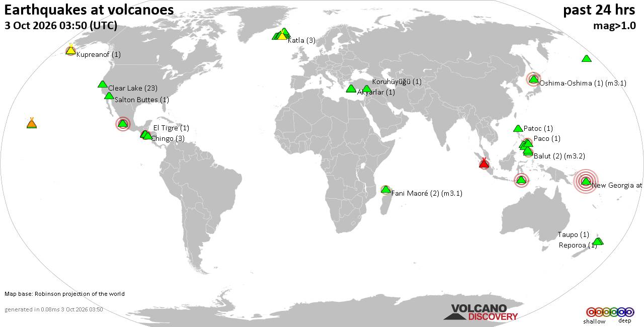
Volcano earthquake report for Saturday, 3 October 2026
• M 2.4 - 9 km E of Alum Rock, CA
• M 1.6 - 3 km NE of Sabana Grande, Puerto Rico
• M 4.2 - 6 km WNW of Wauna, Washington
• M 2.1 - 4 km WSW of Guánica, Puerto Rico
• M 5.1 - 182 km SSE of Vilyuchinsk, Russia
|
|
|
Joined: Feb 2001
Posts: 678,977
Launch Director
|
|
Launch Director
Joined: Feb 2001
Posts: 678,977 |
SPC Oct 3, 2026 2000 UTC Day 1 Convective OutlookSPC 2000Z Day 1 Outlook 
Day 1 Convective Outlook
NWS Storm Prediction Center Norman OK
0246 PM CDT Sat Oct 03 2026

Valid 032000Z - 041200Z

...NO SEVERE THUNDERSTORM AREAS FORECAST...

...SUMMARY...
Organized severe thunderstorms are not forecast through tonight.

...20z Update...
Only minor adjustments were made to thunder to account for recent
trends. Please see previous discussion below.

..Thornton.. 10/03/2026

.PREV DISCUSSION... /ISSUED 1100 AM CDT Sat Oct 03 2026/

...Synopsis and Discussion...
A shortwave trough embedded within the mid-level westerlies across
the northern CONUS will continue to track quickly eastward across
the northern Plains and Upper Midwest through the period. Showers
and low-topped thunderstorms ongoing over parts of the Dakotas will
spread into MN this afternoon. Low-level moisture will remain quite
limited (surface dewpoints generally in the 40s), but a pocket of
weak instability should support occasional lightning flashes with
this activity. Convectively enhanced wind gusts may occur as
low-level lapse rates gradually steepen this afternoon, but the
overall risk for severe winds is expected to remain low owing to the
minimal instability forecast.

A nearly stationary surface front extending from south/coastal TX
into the Southeast and Carolinas will once again serve as a focus
for thunderstorms this afternoon as diurnal heating of a moist
airmass occurs across these regions. Generally poor lapse rates
aloft and weak deep-layer shear should limit the threat for
organized severe thunderstorms through tonight. A greater
concentration of convection may focus along/near the central Gulf
Coast, as a weak mid/upper-level wave centered over the Bay of
Campeche aids northward low-level moisture transport across this
region through the period. Still, low-level winds should remain
weak, and current expectations are for this convection to be
disorganized.
Read morehttps://www.spc.noaa.gov/products/outlook/day1otlk_2000.html
|
|



CMS The Best Conveyancing solicitors conveyancing quotes throughout the UK
For any webhosting enquiries please email webmaster@aus-city.com
|
|
Forums60
Topics855,383
Posts890,178
Members2,960
| |
Most Online102,106
Jul 10th, 2026
|
|
|
|
|

|









































