|
|
|
0 members (),
1,504
guests, and
24
robots. |
|
Key:
Admin,
Global Mod,
Mod
|
|
S |
M |
T |
W |
T |
F |
S |
|
|
|
|
|
1
|
2
|
3
|
|
4
|
5
|
6
|
7
|
8
|
9
|
10
|
|
11
|
12
|
13
|
14
|
15
|
16
|
17
|
|
18
|
19
|
20
|
21
|
22
|
23
|
24
|
|
25
|
26
|
27
|
28
|
29
|
30
|
31
|
|
There are no members with birthdays on this day. |
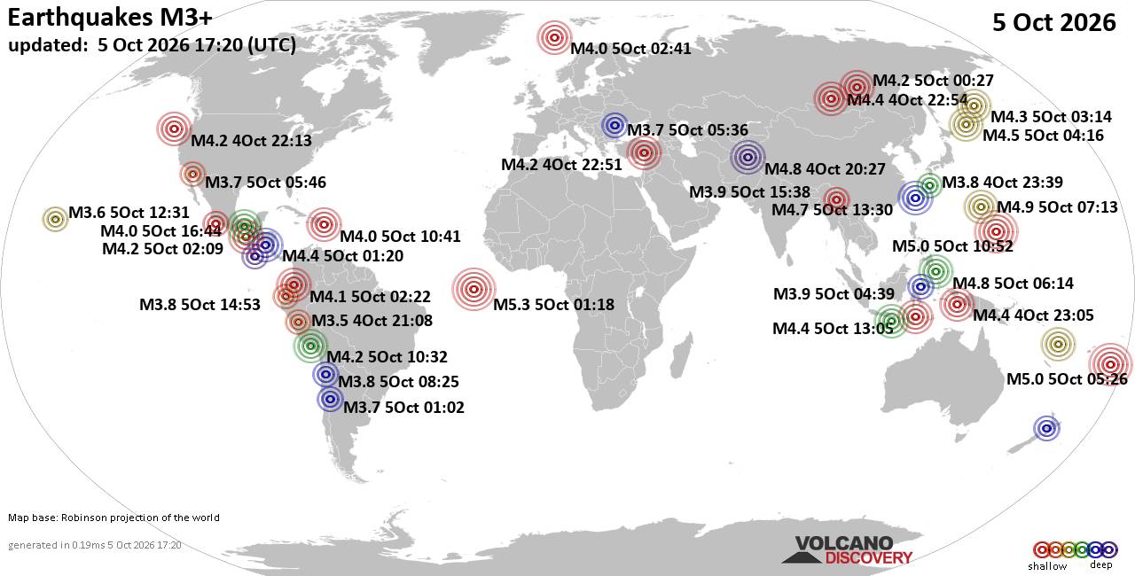
World Earthquake Report for Monday, 5 October 2026
• Strong mag. 5.0 earthquake - Iceland on Monday, Oct 5, 2026, at 05:28 pm (R...
• M -0.1 - 57 km W of Tyonek, Alaska
• M 4.4 - 62 km ENE of Shikotan, Russia
• M 0.7 - 21 km SSE of Midland, Texas
• M 1.0 - 6 km NW of The Geysers, CA
|
|
|
Joined: Feb 2001
Posts: 678,977
Launch Director
|
|
Launch Director
Joined: Feb 2001
Posts: 678,977 |
SPC Day 2 Fire Weather OutlookSPC Day 2 Fire Weather Outlook 
Day 2 Fire Weather Outlook
NWS Storm Prediction Center Norman OK
0230 PM CDT Mon Oct 05 2026

Valid 061200Z - 071200Z

...NO CRITICAL AREAS...

The forecast remains on track for Day 2/Tuesday; please see the
previous discussion for details.

..Elizalde-Garcia.. 10/05/2026

.PREV DISCUSSION... /ISSUED 1151 PM CDT Sun Oct 04 2026/

...Synopsis...
A jet streak will move into parts of the Dakotas on Tuesday. Dry,
breezy post-frontal conditions will be possible from the lee of the
northern Rockies into the western/central Dakotas. Overall, winds
will be rather light for most areas. Within the Dakotas, winds
immediately behind the front could reach near 15-20 mph with higher
gusts. Low fuel receptiveness (on account of cooler temperatures and
precipitation during the last week) should preclude a greater fire
weather threat, but locally elevated conditions may occur.

...Please see www.spc.noaa.gov/fire for graphic product...
Read morehttps://www.spc.noaa.gov/products/fire_wx/fwdy2.html
|
|



CMS The Best Conveyancing solicitors conveyancing quotes throughout the UK
For any webhosting enquiries please email webmaster@aus-city.com
|
|
Forums60
Topics858,207
Posts893,002
Members2,960
| |
Most Online102,106
Jul 10th, 2026
|
|
|
|
|

|









































