|
|
|
0 members (),
1,504
guests, and
24
robots. |
|
Key:
Admin,
Global Mod,
Mod
|
|
S |
M |
T |
W |
T |
F |
S |
|
|
|
|
|
1
|
2
|
3
|
|
4
|
5
|
6
|
7
|
8
|
9
|
10
|
|
11
|
12
|
13
|
14
|
15
|
16
|
17
|
|
18
|
19
|
20
|
21
|
22
|
23
|
24
|
|
25
|
26
|
27
|
28
|
29
|
30
|
31
|
|
There are no members with birthdays on this day. |
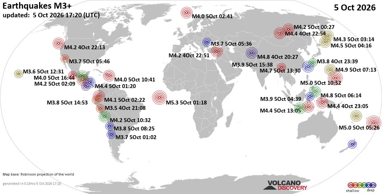
World Earthquake Report for Monday, 5 October 2026
• Strong mag. 5.0 earthquake - Iceland on Monday, Oct 5, 2026, at 05:28 pm (R...
• M -0.1 - 57 km W of Tyonek, Alaska
• M 4.4 - 62 km ENE of Shikotan, Russia
• M 0.7 - 21 km SSE of Midland, Texas
• M 1.0 - 6 km NW of The Geysers, CA
|
|
|
Joined: Feb 2001
Posts: 678,977
Launch Director
|
|
Launch Director
Joined: Feb 2001
Posts: 678,977 |
SPC Oct 5, 2026 2000 UTC Day 1 Convective OutlookSPC 2000Z Day 1 Outlook 
Day 1 Convective Outlook
NWS Storm Prediction Center Norman OK
0256 PM CDT Mon Oct 05 2026

Valid 052000Z - 061200Z

...NO SEVERE THUNDERSTORM AREAS FORECAST...

...SUMMARY...
Organized severe thunderstorms are not forecast through tonight.

...20z Update...
No changes are needed to the current D1 Convective Outlook. See
previous discussion below for more information.

..Thornton.. 10/05/2026

.PREV DISCUSSION... /ISSUED 1128 AM CDT Mon Oct 05 2026/

...Synopsis and Discussion...
Rather strong west-southwesterly low/mid-level flow will overspread
the Northeast and northern Mid-Atlantic today as an upper trough/low
over Quebec moves eastward through the period. While locally gusty
winds may occur with low-topped convection across parts of New
England, limited low-level moisture and related meager instability
will likely hinder an organized severe wind threat.

Showers and occasional thunderstorms will persist today over
portions of the Southeast as a slow-moving front remains draped from
the northern Gulf into southern GA/northern FL. A moist airmass is
in place south of this boundary, but weak low/mid-level winds, poor
lapse rates aloft, and effective bulk shear less than 30 kt will
hamper updraft organization and severe potential.

Elsewhere, isolated convection may continue today across parts of
the Sierra into Great Basin, and over parts of the southern/central
Rockies, as a weak upper trough develops eastward. Elevated
thunderstorms may also occur late this afternoon through tonight
across parts of the Upper Midwest. For all these regions, weak
instability will greatly limit the risk for severe thunderstorms.
Read morehttps://www.spc.noaa.gov/products/outlook/day1otlk_2000.html
|
|



CMS The Best Conveyancing solicitors conveyancing quotes throughout the UK
For any webhosting enquiries please email webmaster@aus-city.com
|
|
Forums60
Topics858,207
Posts893,002
Members2,960
| |
Most Online102,106
Jul 10th, 2026
|
|
|
|
|

|









































