|
0 members (),
2,956
guests, and
26
robots. |
|
Key:
Admin,
Global Mod,
Mod
|
|
S |
M |
T |
W |
T |
F |
S |
|
|
|
|
|
1
|
2
|
3
|
|
4
|
5
|
6
|
7
|
8
|
9
|
10
|
|
11
|
12
|
13
|
14
|
15
|
16
|
17
|
|
18
|
19
|
20
|
21
|
22
|
23
|
24
|
|
25
|
26
|
27
|
28
|
29
|
30
|
31
|
|
There are no members with birthdays on this day. |
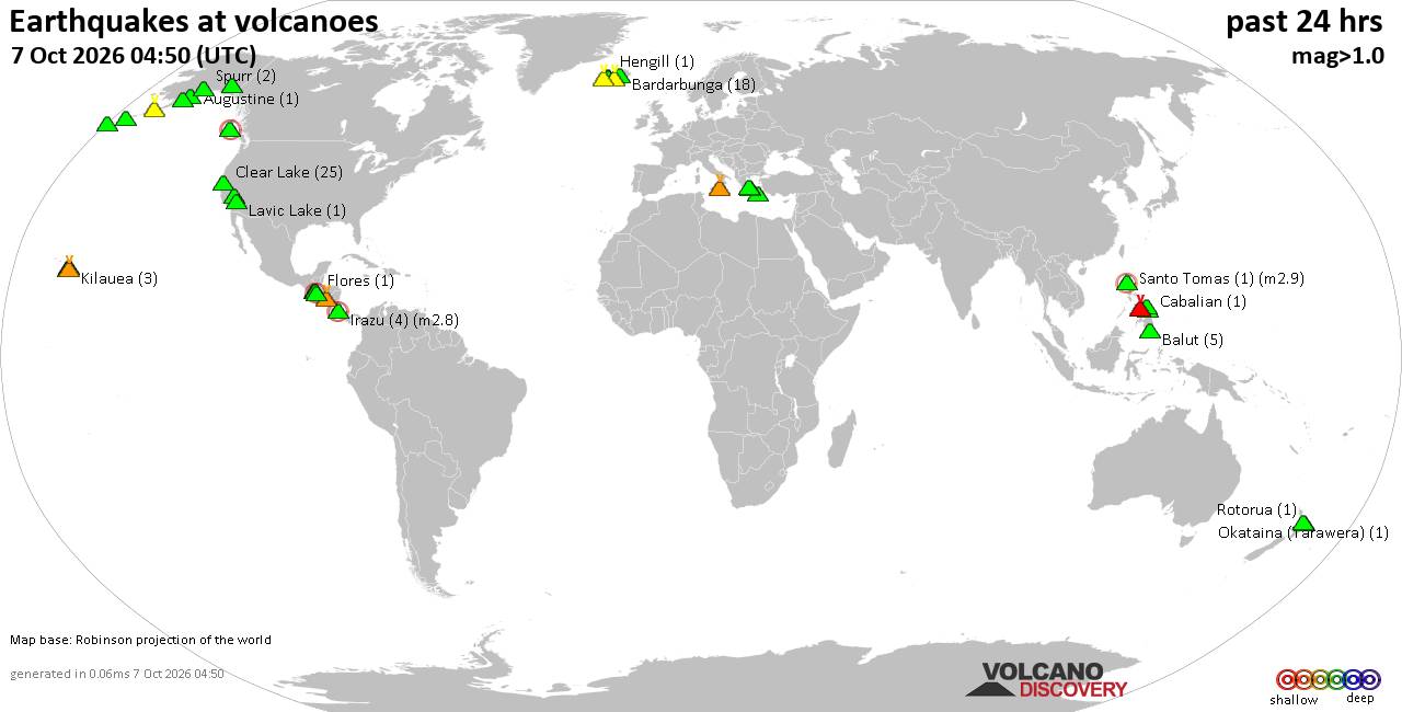
Volcano earthquake report for Wednesday, 7 October 2026
• M 1.7 - 65 km WNW of Ninilchik, Alaska
• M 5.5 - 92 km NNW of Aleneva, Alaska
• Moderate mag. 4.0 earthquake - South Pacific Ocean, 10.2 km east of Manokwa...
• M 2.2 - 11 km SE of Mammoth Lakes, CA
• M 2.8 - 11 km SE of Leilani Estates, Hawaii
|
|
|
Joined: Feb 2001
Posts: 678,977
Launch Director
|
|
Launch Director
Joined: Feb 2001
Posts: 678,977 |
SPC Day 3-8 Fire Weather OutlookSPC Day 3-8 Fire Weather Outlook 
Day 3-8 Fire Weather Outlook
NWS Storm Prediction Center Norman OK
0459 PM CDT Tue Oct 06 2026

Valid 081200Z - 141200Z

...Synopsis...
An upper ridge over the western CONUS will begin to break down on
Day 3/Thursday as an upper-level trough dives southward through the
weekend. Forecast guidance indicates this system will introduce
increased winds, but also usher in cooler temperatures and
precipitation chances over the parts of the Pacific Northwest and
Northern Rockies primarily on Days 5-6/Saturday-Sunday. Beyond Day
6/Sunday, low predictability in the progression of the upper trough
precludes additional areas of concern; however, gusty northerly
winds behind the trough could induce a fire weather threat across
northern CA where fuels remain dry.

A tropical system is expected to impact the central Gulf Coast later
this week, bringing precipitation chances to portions of the MS
Valley and Mid-South this weekend where ERCs are approaching the
80-90th percentile. Prior to the arrival of deeper Gulf moisture,
dry and locally breezy conditions may overlap pockets of receptive
fuels in the lower MS Valley on Day 4/Friday.

...Days 4-5/Friday-Saturday...
Ahead of the aforementioned trough approaching the Pacific
Northwest, increasing southwesterly flow is likely to support
widespread strong surface winds (sustained near 20 mph) amid
above-normal temperatures and dry afternoon RH near 10-20%.
Additionally, a southward progressing dry cold front and
accompanying wind shift will enhance fire weather concerns. After
several days of dry conditions and above-normal temperatures through
the workweek, fuels will be conditioned for ignition across much of
the central latitudes of the western CONUS as this wind event
approaches. Thus, 40% probabilities of Critical wind/RH conditions
have been introduced over the northwestern Great Basin on Day
4/Friday, and maintained across much of MT/WY.

Guidance has trended towards slightly lower probabilities of
Critical fire weather conditions in western WY on Day 5/Saturday,
resulting in minor adjustments to the existing 40% Critical
probabilities. A cold front is expected to stall across the northern
Great Basin, potentially allowing an area of dry and breezy
conditions to evolve east of the northern Sierra into central NV.
Additional probabilities may be needed as confidence increases in
the overall pattern evolution.

..Elizalde-Garcia.. 10/06/2026

...Please see www.spc.noaa.gov/fire for graphic product...
Read morehttps://www.spc.noaa.gov/products/exper/fire_wx/
|
|



CMS The Best Conveyancing solicitors conveyancing quotes throughout the UK
For any webhosting enquiries please email webmaster@aus-city.com
|
|
Forums60
Topics861,215
Posts896,010
Members2,960
| |
Most Online102,106
Jul 10th, 2026
|
|
|









































