|
|
|
0 members (),
1,345
guests, and
25
robots. |
|
Key:
Admin,
Global Mod,
Mod
|
|
S |
M |
T |
W |
T |
F |
S |
|
|
|
|
|
1
|
2
|
3
|
|
4
|
5
|
6
|
7
|
8
|
9
|
10
|
|
11
|
12
|
13
|
14
|
15
|
16
|
17
|
|
18
|
19
|
20
|
21
|
22
|
23
|
24
|
|
25
|
26
|
27
|
28
|
29
|
30
|
31
|
|
There are no members with birthdays on this day. |
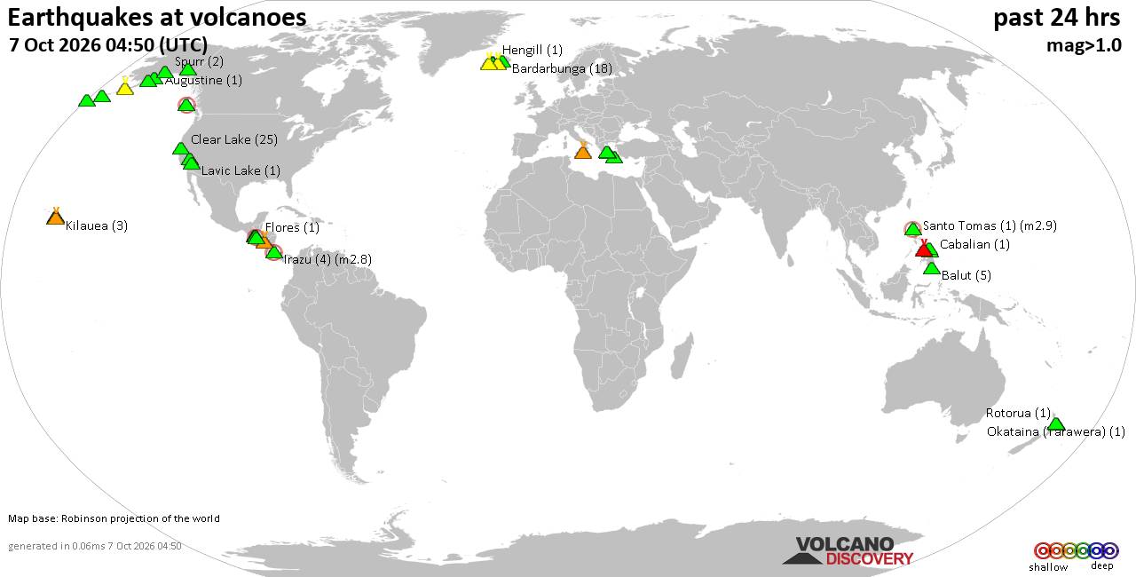
Volcano earthquake report for Wednesday, 7 October 2026
• M 1.2 - 10 km SSW of Idyllwild, CA
• M 1.7 - 10 km W of Boonville, CA
• M 2.4 - 6 km SE of Chickasha, Oklahoma
• M 1.5 - 1 km WNW of Loma Linda, CA
• M 1.5 - 49 km SSE of Tanana, Alaska
• M 1.7 - 8 km ESE of Prunedale, CA
|
|
|
Joined: Feb 2001
Posts: 678,977
Launch Director
|
|
Launch Director
Joined: Feb 2001
Posts: 678,977 |
SPC Oct 7, 2026 2000 UTC Day 1 Convective OutlookSPC 2000Z Day 1 Outlook 
Day 1 Convective Outlook
NWS Storm Prediction Center Norman OK
0241 PM CDT Wed Oct 07 2026

Valid 072000Z - 081200Z

...NO SEVERE THUNDERSTORM AREAS FORECAST...

...SUMMARY...
Organized severe thunderstorms are unlikely across the contiguous
United States through tonight.

...20Z Update...
No changes were needed with this update. Within the exit region of a
robust midlevel jet overspreading the Midwest, a couple of strong
low-topped thunderstorms are possible across the Upper Great Lakes
this afternoon, and over the Lower Great Lakes this evening/tonight.
While enhanced low/midlevel flow accompanying the jet and steep
lapse rates could aid in a few strong wind gusts (potentially 40-50
mph) across both areas, limited buoyancy and increasing low-level
static stability over the Lower Great Lakes should limit the overall
severe risk.

..Weinman.. 10/07/2026

.PREV DISCUSSION... /ISSUED 1120 AM CDT Wed Oct 07 2026/

...Central portion of the Florida Peninsula...
A diffuse frontal zone modulated by scattered showers and isolated
thunderstorm activity will remain draped over the central portion of
the FL Peninsula through tonight.  A very moist tropospheric profile
(sampled by the 12 UTC Tampa Bay raob) featuring weak lapse rates
will limit overall updraft strength with scattered convection this
afternoon across the Peninsula.  Weak flow (at or below 20 kt) from
surface through 300 mb will also act to restrict storm organization
potential.  Although a brief tornado/waterspout near the coast
cannot be ruled out, it appears the risk for transient supercell
structures and an associated threat for a brief tornado appear
sufficiently low to preclude introducing severe probabilities this
outlook update.

...Northern New York...
Isolated low-topped thunderstorms will be possible late today and
more so into tonight, influenced by an amplifying upstream
upper-level trough and approaching cold front.  Overall buoyancy
will be limited, but still sufficient for the possibility of
thunderstorms.  Furthermore, some convective enhancement/gusty winds
are plausible tonight given the increasing magnitude of the
low/mid-tropospheric flow and steepening lapse rates atop the
boundary layer.
Read morehttps://www.spc.noaa.gov/products/outlook/day1otlk_2000.html
|
|



CMS The Best Conveyancing solicitors conveyancing quotes throughout the UK
For any webhosting enquiries please email webmaster@aus-city.com
|
|
Forums60
Topics862,367
Posts897,162
Members2,960
| |
Most Online102,106
Jul 10th, 2026
|
|
|
|
|

|









































