|
|
|
0 members (),
2,562
guests, and
17
robots. |
|
Key:
Admin,
Global Mod,
Mod
|
|
S |
M |
T |
W |
T |
F |
S |
|
1
|
2
|
3
|
4
|
5
|
6
|
7
|
|
8
|
9
|
10
|
11
|
12
|
13
|
14
|
|
15
|
16
|
17
|
18
|
19
|
20
|
21
|
|
22
|
23
|
24
|
25
|
26
|
27
|
28
|
|
29
|
30
|
|
|
|
|
|
|
There are no members with birthdays on this day. |
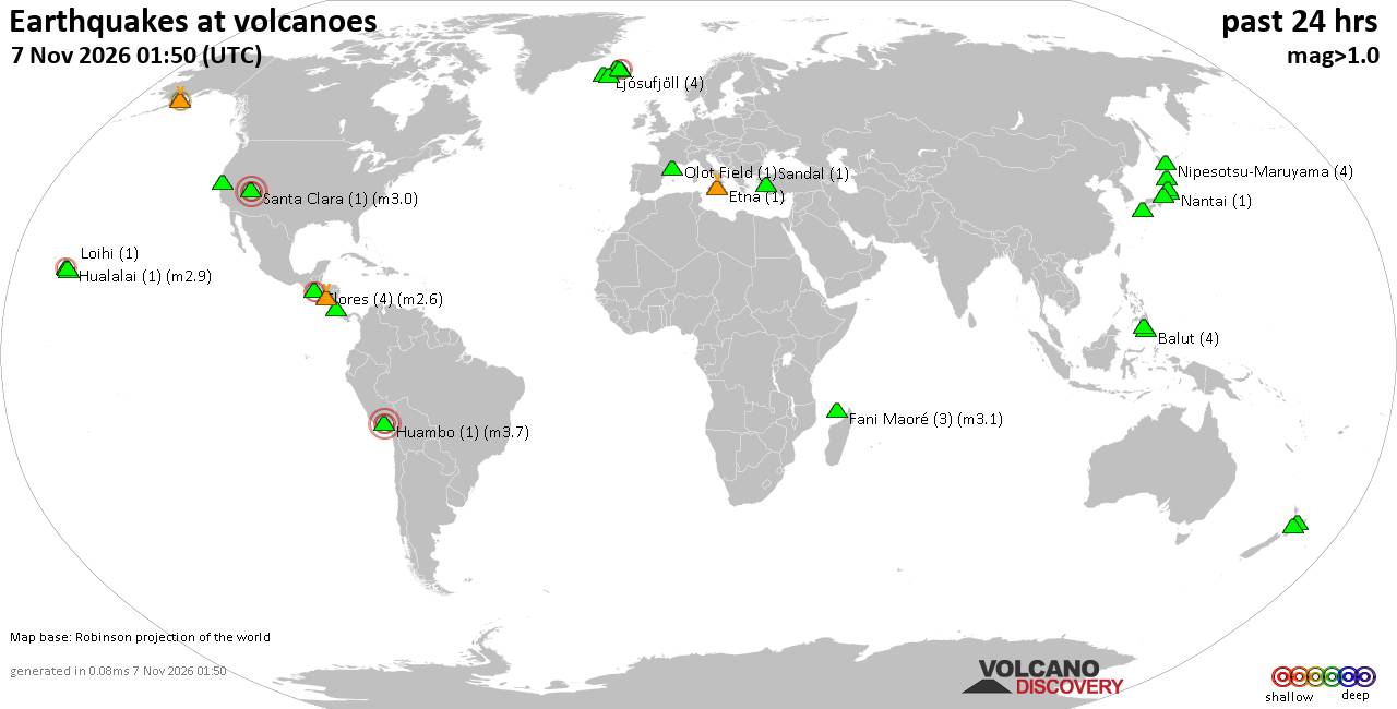
Volcano earthquake report for Saturday, 7 November 2026
• M 4.6 - 208 km WSW of Pistol River, Oregon
• M 1.4 - 0 km ENE of American Canyon, CA
• M 2.0 - 14 km WNW of Bayview, CA
• M 6.8 - 203 km NW of Port-Olry, Vanuatu
• M 1.6 - 23 km W of Volcano, Hawaii
|

#901670
Fri 09 Oct 2026 01:01:AM
|
Joined: Feb 2001
Posts: 800,656
Launch Director
|
|
Launch Director
Joined: Feb 2001
Posts: 800,656 |
SPC Oct 9, 2026 0100 UTC Day 1 Convective OutlookSPC 0100Z Day 1 Outlook 
Day 1 Convective Outlook
NWS Storm Prediction Center Norman OK
0758 PM CDT Thu Oct 08 2026

Valid 090100Z - 091200Z

...THERE IS A MARGINAL RISK OF SEVERE THUNDERSTORMS ACROSS PARTS OF
THE FLORIDA PENINSULA AND IOWA...

...SUMMARY...
Localized severe thunderstorms may occur across the west-central
part of the Florida Peninsula and across parts of Iowa tonight.

...Florida Peninsula...
Water vapor imagery currently shows a plume of mid-level moisture
associated with Hurricane Isaias from the central Gulf of America
northeastward across much of the Southeast. Thunderstorms associated
with Isaias will move inland across the Florida Peninsula this
evening into tonight. Over the southern half of Florida, the RAP
shows MLCAPE in the 1000 to 1500 J/kg range. The most favorable zone
for rotating storms will be along the northern edge of the stronger
instability near and to the southeast of Tampa Bay. RAP forecast
soundings in the area have veering winds with height in the lowest 3
km with enough low-level shear for an isolated tornado threat.

...Iowa...
At mid-levels, west-northwesterly flow is located over the central
and northern U.S. A subtle shortwave trough appears to be moving
through South Dakota. Lift will be maximized in the mid Missouri
Valley ahead of this feature, along the far eastern edge of a
central Plains low-level speed max. As low-level flow increases this
evening, elevated storms will continue to develop over western and
central Iowa. RAP forecast soundings in west-central Iowa show a
sharp temperature inversion at low-levels, with steep lapse rates
above 900 mb. The resulting MUCAPE is forecast to be in the 1500 to
2000 J/kg range. This combined with about 50 knots of effective
shear should be enough for an isolated hail threat.

..Broyles.. 10/09/2026
Read morehttps://www.spc.noaa.gov/products/outlook/day1otlk_0100.html
|
|



CMS The Best Conveyancing solicitors conveyancing quotes throughout the UK
For any webhosting enquiries please email webmaster@aus-city.com
|
|
Forums60
Topics915,206
Posts950,003
Members2,960
| |
Most Online102,106
Jul 10th, 2026
|
|
|
|
|

|









































