|
0 members (),
1,655
guests, and
25
robots. |
|
Key:
Admin,
Global Mod,
Mod
|
|
S |
M |
T |
W |
T |
F |
S |
|
|
|
|
|
1
|
2
|
3
|
|
4
|
5
|
6
|
7
|
8
|
9
|
10
|
|
11
|
12
|
13
|
14
|
15
|
16
|
17
|
|
18
|
19
|
20
|
21
|
22
|
23
|
24
|
|
25
|
26
|
27
|
28
|
29
|
30
|
31
|
|
There are no members with birthdays on this day. |
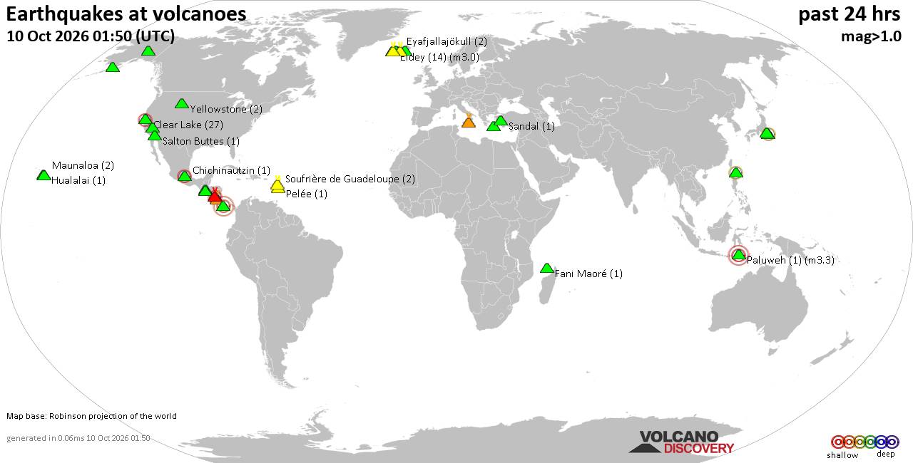
Volcano earthquake report for Saturday, 10 October 2026
• M 1.7 - 8 km W of Palomar Observatory, CA
• Moderate mag. 4.5 earthquake - Tonga on Saturday, Oct 10, 2026, at 08:38 am...
• M 2.2 - 6 km SE of Houston, Alaska
• M 2.0 - 9 km NNE of Pāhala, Hawaii
• M 3.2 - 2 km SW of Signal Hill, CA
|
|
|
Joined: Feb 2001
Posts: 678,977
Launch Director
|
|
Launch Director
Joined: Feb 2001
Posts: 678,977 |
Issued at 200 AM PDT Sat Oct 10 2026 000
WTPZ33 KNHC 100852
TCPEP3
BULLETIN
Tropical Storm Rachel Advisory Number 53
NWS National Hurricane Center Miami FL EP182026
200 AM PDT Sat Oct 10 2026
...RACHEL HOLDING STEADY WHILE ACCELERATING NORTHEASTWARD...
SUMMARY OF 200 AM PDT...0900 UTC...INFORMATION
----------------------------------------------
LOCATION...24.2N 121.4W
ABOUT 640 MI...1035 KM SSW OF SAN DIEGO CALIFORNIA
MAXIMUM SUSTAINED WINDS...60 MPH...95 KM/H
PRESENT MOVEMENT...NE OR 50 DEGREES AT 22 MPH...35 KM/H
MINIMUM CENTRAL PRESSURE...992 MB...29.30 INCHES
WATCHES AND WARNINGS
--------------------
CHANGES WITH THIS ADVISORY:
None.
SUMMARY OF WATCHES AND WARNINGS IN EFFECT:
A Tropical Storm Warning is in effect for...
* West coast of Baja California, from San Jose de Las Palomas
northward to the U.S./Mexico Border
* East coast of Baja California, from Isla San Luis northward to
Puerto Penasco
A Tropical Storm Watch is in effect for...
* Southern California coast from the U.S/Mexico Border northward to
the San Diego/Orange County Line
* East coast of Baja California, from Bahia De Los Angeles
northward to Isla San Luis
* Northwest Mexico from Puerto Libertad to Puerto Penasco
A Tropical Storm Warning means that tropical storm conditions are
expected somewhere within the warning area within 36 hours.
A Tropical Storm Watch means that tropical storm conditions are
possible within the watch area, generally within 48 hours.
Interests in northern Baja California, northern Gulf of California,
and Southern California should continue to monitor the progress of
Rachel.
For storm information specific to your area in the United
States, including possible inland watches and warnings, please
monitor products issued by your local National Weather Service
forecast office. For storm information specific to your area
outside of the United States, please monitor products issued by
your national meteorological service.
DISCUSSION AND OUTLOOK
----------------------
At 200 AM PDT (0900 UTC), the center of Tropical Storm Rachel was
located near latitude 24.2 North, longitude 121.4 West. Rachel is
moving toward the northeast near 22 mph (35 km/h). A turn toward
the north-northeast, accompanied by an additional increase in
forward speed, is expected through Sunday. On the forecast track,
the center of Rachel is expected to approach and move ashore near
the U.S./Mexico border tonight.
Maximum sustained winds are near 60 mph (95 km/h) with higher gusts.
Some additional strengthening is possible through tonight, but
rapid weakening is expected after Rachel moves inland over Baja
California and the southwestern United States on Sunday.
Tropical-storm-force winds extend outward up to 125 miles (205 km)
from the center.
The estimated minimum central pressure is 992 mb (29.30 inches).
HAZARDS AFFECTING LAND
----------------------
Key messages for Rachel can be found in the Tropical Cyclone
Discussion under AWIPS header MIATCDEP3 and WMO header WTPZ43 KNHC.
WIND: Tropical storm conditions are expected to reach portions of
northern Baja California within the Tropical Storm Warning area
beginning later today and continuing into Sunday morning. Tropical
storm conditions are also possible within the Tropical Storm Watch
area in extreme Southern California, eastern Baja California, and
portions of northwest Mexico beginning tonight or early Sunday.
Strong gusty winds associated with the system are expected to spread
over interior portions of the Southwest United States, especially in
areas of higher terrain, later today through early next week.
RAINFALL: Rachel will bring 1 to 3 inches of rain to portions of
Baja California this weekend.
Rachel and its associated moisture will also bring rainfall of 1 to
3 inches, with maximum amounts locally up to 5 inches in portions of
the Southwest United States this weekend. This will lead to
increasing coverage of rainfall and potential for significant flash
and urban flooding.
For a complete depiction of forecast rainfall associated with
Rachel, please see the National Weather Service Storm Total Rainfall
Graphic available at hurricanes.gov/graphics_ep3.shtml?rainqpf and
the Flash Flood Risk graphic at
hurricanes.gov/graphics_ep3.shtml?ero.
SURF: Waves generated by Rachel will continue to build along the
coasts of Southern California and northern Baja California today.
These waves, combined with an incoming long-period southerly swell,
will cause life-threatening surf and rip current conditions. Coastal
flooding and erosion are expected to worsen tonight into Sunday
morning as the highest waves coincide with the high tides and water
levels that are already running well above predicted levels.
Moderate to major coastal flooding is expected, with hazardous
coastal conditions continuing into early next week. Please consult
products from your local weather office.
NEXT ADVISORY
-------------
Next intermediate advisory at 500 AM PDT.
Next complete advisory at 800 AM PDT.
$$
Forecaster Gibbs Source: Tropical Storm Rachel Public Advisory Number 53
|
|



CMS The Best Conveyancing solicitors conveyancing quotes throughout the UK
For any webhosting enquiries please email webmaster@aus-city.com
|
|
Forums60
Topics867,400
Posts902,196
Members2,960
| |
Most Online102,106
Jul 10th, 2026
|
|
|









































