|
|
|
0 members (),
1,475
guests, and
27
robots. |
|
Key:
Admin,
Global Mod,
Mod
|
|
S |
M |
T |
W |
T |
F |
S |
|
|
|
|
|
1
|
2
|
3
|
|
4
|
5
|
6
|
7
|
8
|
9
|
10
|
|
11
|
12
|
13
|
14
|
15
|
16
|
17
|
|
18
|
19
|
20
|
21
|
22
|
23
|
24
|
|
25
|
26
|
27
|
28
|
29
|
30
|
31
|
|
There are no members with birthdays on this day. |
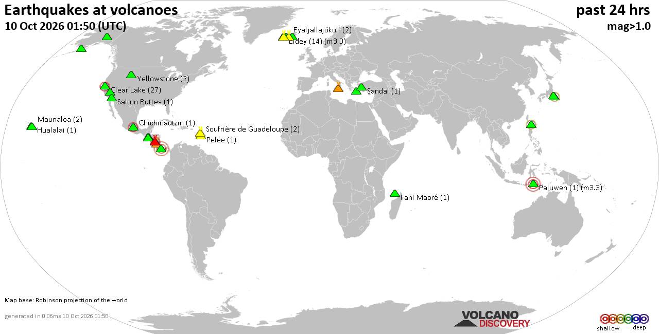
Volcano earthquake report for Saturday, 10 October 2026
• M 3.4 - 31 km NE of Punta Cana, Dominican Republic
• M 4.7 - 2 km WNW of El Cacao, Panama
• M 4.7 - 2 km WNW of El Cacao, Panama
• M 4.7 - 2 km WNW of El Cacao, Panama
• M 4.5 - 103 km SW of Puerto Madero, Mexico
|
|
|
Joined: Feb 2001
Posts: 678,977
Launch Director
|
|
Launch Director
Joined: Feb 2001
Posts: 678,977 |
SPC Oct 10, 2026 Day 4-8 Severe Weather OutlookDay 4-8 Outlook 
Day 4-8 Convective Outlook
NWS Storm Prediction Center Norman OK
0320 AM CDT Sat Oct 10 2026

Valid 131200Z - 181200Z

...DISCUSSION...
The 00Z models have slowed the progression of an upper low and
associated trough from the Great Basin into the central Rockies on
Days 4 and 5/Tuesday and Wednesday. By Day 6/Thursday and beyond,
model spread increases in the handling of that midlevel system,
leading to greater uncertainty in the evolution of the large-scale
pattern.

...Day 4/Tuesday...

There is some model signal that a subtle disturbance embedded within
a belt of enhanced mid/upper-level flow will progress from the
southern Rockies into the central High Plains, aiding in the
deepening of a lee cyclone over southeast CO. Elsewhere, a
low-amplitude disturbance is forecast to advance from the Great
Lakes into the Northeast, in tandem with another surface low. A
frontal system will connect the two lows, stretching from the lower
Great Lakes through the OH Valley into the central Plains. A dryline
will extend south from the lee cyclone to along the TX-NM border. A
moist and unstable air mass will reside south of the front,
especially over the central and southern Plains, where richer
boundary-layer moisture is expected to reside.

Isolated severe storms appear possible along the front Tuesday
afternoon and evening, especially in the Northeast, and from the
lower-MO Valley into the central and southern Plains. The most
probable location for organized severe storm potential is over the
southern High Plains in the vicinity of the lee cyclone and
strengthening low-level jet where stronger forcing for ascent and
vertical shear will coincide with a moderately unstable air mass.


...Day 5/Wednesday...

The slowing of the upper-air system and the potential for
thunderstorms Tuesday night into Wednesday morning lead to greater
uncertainty in where the strongest instability will develop by
afternoon. Isolated severe storms appear possible along and south of
a surface front from the southern Mid-Atlantic into the central and
southern Plains. However, confidence in delineating an area of more
concentrated severe weather potential has diminished. And as such,
the previously included 15% contour will be removed for this
forecast update.


...Days 6 through 8/Thursday through Saturday...

As alluded to above, spread increases across the models (especially
the deterministic solutions) in the handling of the central Rockies
low/trough. However, the general signal is for a trend toward a
less-favorable synoptic pattern for severe storms by next weekend.
Read morehttps://www.spc.noaa.gov/products/exper/day4-8/
|
|



CMS The Best Conveyancing solicitors conveyancing quotes throughout the UK
For any webhosting enquiries please email webmaster@aus-city.com
|
|
Forums60
Topics867,917
Posts902,713
Members2,960
| |
Most Online102,106
Jul 10th, 2026
|
|
|
|
|

|









































