|
|
|
0 members (),
962
guests, and
27
robots. |
|
Key:
Admin,
Global Mod,
Mod
|
|
S |
M |
T |
W |
T |
F |
S |
|
|
|
|
|
1
|
2
|
3
|
|
4
|
5
|
6
|
7
|
8
|
9
|
10
|
|
11
|
12
|
13
|
14
|
15
|
16
|
17
|
|
18
|
19
|
20
|
21
|
22
|
23
|
24
|
|
25
|
26
|
27
|
28
|
29
|
30
|
31
|
|
There are no members with birthdays on this day. |
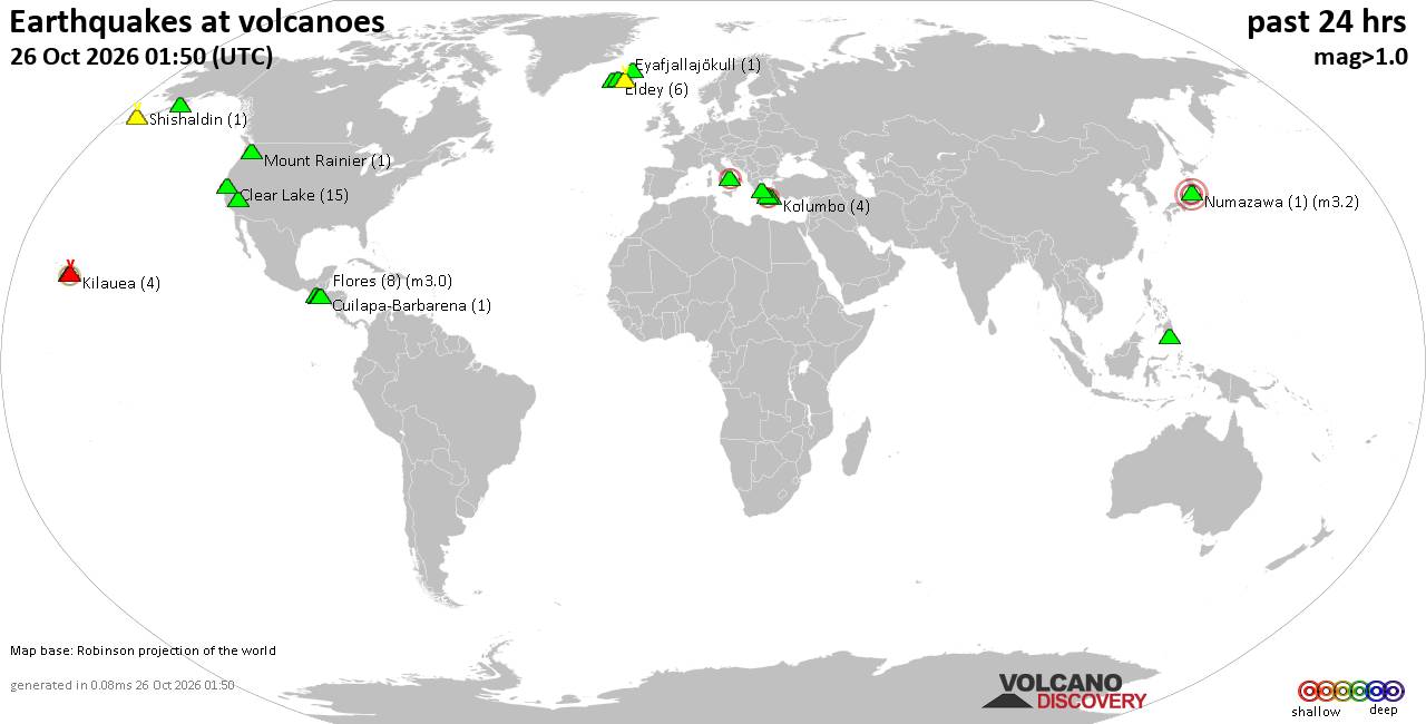
Volcano earthquake report for Monday, 26 October 2026
• M 4.6 - 193 km SE of Attu Station, Alaska
• M 1.3 - 62 km SW of Dugway, Utah
• M 0.7 - 1 km ENE of Calimesa, CA
• M 0.5 - 23 km ENE of Ashford, Washington
• M 1.7 - 14 km SSE of Fern Forest, Hawaii
• M 1.2 - 7 km ESE of Cloverdale, CA
|

#906102
Sun 11 Oct 2026 05:15:PM
|
Joined: Feb 2001
Posts: 678,977
Launch Director
|
|
Launch Director
Joined: Feb 2001
Posts: 678,977 |
Atlantic Tropical Weather Outlook


000
ABNT20 KNHC 111715
TWOAT
Tropical Weather Outlook
NWS National Hurricane Center Miami FL
200 PM EDT Sun Oct 11 2026
For the North Atlantic...Caribbean Sea and the Gulf of America:
Eastern Tropical Atlantic:
An elongated area of low pressure centered a few hundred miles
southwest of the Cabo Verde Islands is producing a large but
disorganized area of showers and thunderstorms, extending from these
islands southwestward into the eastern Tropical Atlantic.
Environmental conditions appear only marginally conducive for some
development of this system over the next day or two before
upper-level winds become too strong for any further development by
midweek. Regardless, heavy rainfall is expected over the next few
days for portions of the Cabo Verde Islands as the system moves
slowly northward to north-northwestward.
* Formation chance through 48 hours...low...20 percent.
* Formation chance through 7 days...low...20 percent.
$$
Forecaster Evans/Papin
|
|



CMS The Best Conveyancing solicitors conveyancing quotes throughout the UK
For any webhosting enquiries please email webmaster@aus-city.com
|
|
Forums60
Topics895,131
Posts929,928
Members2,960
| |
Most Online102,106
Jul 10th, 2026
|
|
|
|
|

|









































