|
0 members (),
3,195
guests, and
16
robots. |
|
Key:
Admin,
Global Mod,
Mod
|
|
S |
M |
T |
W |
T |
F |
S |
|
1
|
2
|
3
|
4
|
5
|
6
|
7
|
|
8
|
9
|
10
|
11
|
12
|
13
|
14
|
|
15
|
16
|
17
|
18
|
19
|
20
|
21
|
|
22
|
23
|
24
|
25
|
26
|
27
|
28
|
|
29
|
30
|
|
|
|
|
|
|
There are no members with birthdays on this day. |
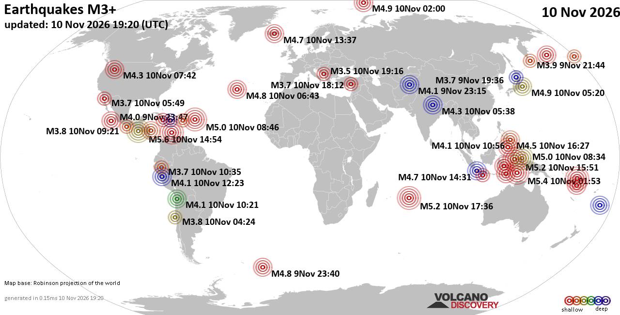
World Earthquake Report for Tuesday, 10 November 2026
• M 0.7 - 3 km SW of San Juan Bautista, CA
• Moderate mag. 4.1 earthquake - Philippine Sea, 52 km east of Siargao Island...
• M 1.3 - 15 km NNE of Milford, Utah
• M 2.0 - 37 km W of Petrolia, CA
• M 0.5 - 6 km SSW of Warner Springs, CA
• M 4.3 - 18 km SE of Joseph, Oregon
|

#906106
Sun 11 Oct 2026 05:27:PM
|
Joined: Feb 2001
Posts: 800,656
Launch Director
|
|
Launch Director
Joined: Feb 2001
Posts: 800,656 |
SPC MD 2361MD 2361 CONCERNING TORNADO WATCH 680... FOR PORTIONS OF CENTRAL INTO NORTHERN NORTH CAROLINA 
Mesoscale Discussion 2361
NWS Storm Prediction Center Norman OK
1104 AM CDT Sun Oct 11 2026

Areas affected...portions of central into northern North Carolina

Concerning...Tornado Watch 680...

Valid 111604Z - 111730Z

The severe weather threat for Tornado Watch 680 continues.

SUMMARY...A few tornadoes remain a concern over the next few hours.
The best chance for tornadoes will be ahead of a surface low over
central to northern NC.

DISCUSSION...A band of organized thunderstorms are beginning to show
slightly greater supercell characteristics as it advances eastward
toward an instability axis, where favorable low-level shear is also
present. Surface temperatures are warming into the upper 70s F, amid
mid 70s F dewpoints, yielding over 1000 J/kg MLCAPE per 15Z
mesoanalysis. Furthermore, the RAX VAD depicts an appreciable curved
low-level hodograph, with over 250 m2/s2 0-3 km SRH, with nearly 150
m2/s2 contained in the lowest 500 m AGL. As such, a
high-shear/moderate CAPE environment is present to support a
continued isolated tornado threat. While a tornado is possible with
any storm along the primary confluence band, the best chance for a
tornado will be with the northern storms given their proximity to
the surface low, and locally backed winds.

..Squitieri.. 10/11/2026

...Please see www.spc.noaa.gov for graphic product...

ATTN...WFO...AKQ...MHX...RAH...ILM...

LAT...LON   33567809 33677858 33887877 34337895 35457913 35807911
            36437876 36447866 36597821 36627763 36437735 35847732
            35027752 34367772 33857792 33567809

MOST PROBABLE PEAK TORNADO INTENSITY...100-125 MPH
MOST PROBABLE PEAK WIND GUST...UP TO 60 MPH
Read morehttps://www.spc.noaa.gov/products/md/md2361.html
|
|



CMS The Best Conveyancing solicitors conveyancing quotes throughout the UK
For any webhosting enquiries please email webmaster@aus-city.com
|
|
Forums60
Topics920,725
Posts955,522
Members2,960
| |
Most Online102,106
Jul 10th, 2026
|
|
|









































