|
|
|
0 members (),
1,392
guests, and
26
robots. |
|
Key:
Admin,
Global Mod,
Mod
|
|
S |
M |
T |
W |
T |
F |
S |
|
|
|
|
|
1
|
2
|
3
|
|
4
|
5
|
6
|
7
|
8
|
9
|
10
|
|
11
|
12
|
13
|
14
|
15
|
16
|
17
|
|
18
|
19
|
20
|
21
|
22
|
23
|
24
|
|
25
|
26
|
27
|
28
|
29
|
30
|
31
|
|
There are no members with birthdays on this day. |
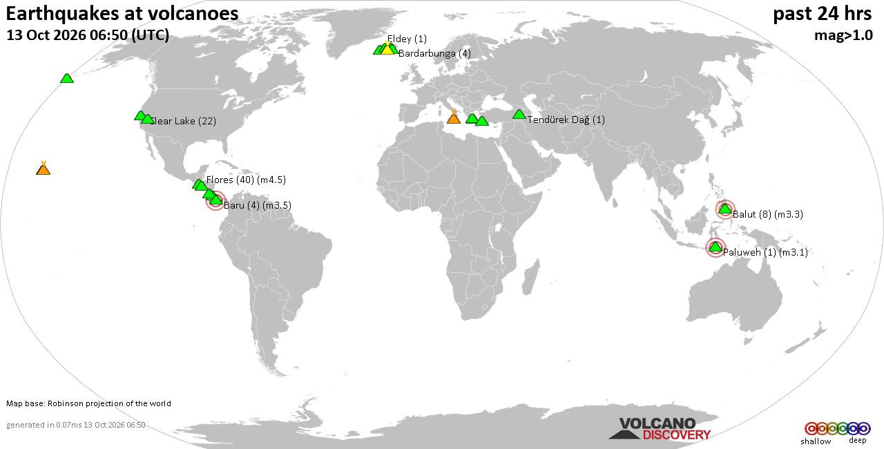
Volcano earthquake report for Tuesday, 13 October 2026
• M 2.7 - 19 km SSW of Leilani Estates, Hawaii
• M 2.5 - 5 km SSW of Pāhala, Hawaii
• M 1.9 - 15 km NE of Milford, Utah
• M 1.8 - 116 km E of Cordova, Alaska
• M 1.2 - 15 km NE of Little Lake, CA
• M 2.0 - 82 km ESE of Ugashik, Alaska
|
|
|
Joined: Feb 2001
Posts: 678,977
Launch Director
|
|
Launch Director
Joined: Feb 2001
Posts: 678,977 |
SPC Oct 13, 2026 Day 4-8 Severe Weather OutlookDay 4-8 Outlook 
Day 4-8 Convective Outlook
NWS Storm Prediction Center Norman OK
0330 AM CDT Tue Oct 13 2026

Valid 161200Z - 211200Z

...DISCUSSION...
...Day 4/Friday...

An intense midlevel trough will progress from the Great Lakes to off
the Atlantic Coast by Saturday morning. An associated surface low is
forecast to develop from the lower Great Lakes to off the New
England coast while a trailing cold front advances through much of
the eastern CONUS. A moist and at least marginally unstable air mass
is forecast in portions of the Mid-Atlantic by afternoon, with
thunderstorms possible along and ahead of the front. Vertical shear
is expected to be relatively strong, suggesting the potential for
isolated severe weather. Level-1/Marginal Risk probabilities may be
required in the subsequent Day 3 Outlook for this time period.


...Days 5 through 8/Saturday through Tuesday...

A considerably drier and more stable low-level air mass will persist
at many locations over the weekend with non-severe storms possible
in portions of FL and the lower-CO Valley. By early next week, there
is good model agreement that a midlevel trough will move into the
western CONUS. In response, a deepening lee trough over the High
Plains will lead to increasing moisture return, particularly over
the southern Plains by Tuesday. However, no severe weather is
expected through that time frame.
Read morehttps://www.spc.noaa.gov/products/exper/day4-8/
|
|



CMS The Best Conveyancing solicitors conveyancing quotes throughout the UK
For any webhosting enquiries please email webmaster@aus-city.com
|
|
Forums60
Topics873,200
Posts907,996
Members2,960
| |
Most Online102,106
Jul 10th, 2026
|
|
|
|
|

|









































