|
0 members (),
1,392
guests, and
26
robots. |
|
Key:
Admin,
Global Mod,
Mod
|
|
S |
M |
T |
W |
T |
F |
S |
|
|
|
|
|
1
|
2
|
3
|
|
4
|
5
|
6
|
7
|
8
|
9
|
10
|
|
11
|
12
|
13
|
14
|
15
|
16
|
17
|
|
18
|
19
|
20
|
21
|
22
|
23
|
24
|
|
25
|
26
|
27
|
28
|
29
|
30
|
31
|
|
There are no members with birthdays on this day. |
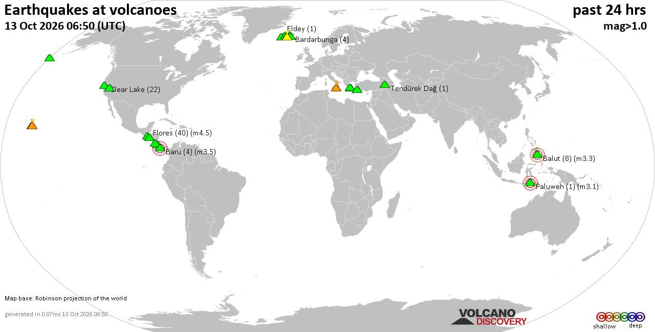
Volcano earthquake report for Tuesday, 13 October 2026
• M 2.7 - 19 km SSW of Leilani Estates, Hawaii
• M 2.5 - 5 km SSW of Pāhala, Hawaii
• M 1.9 - 15 km NE of Milford, Utah
• M 1.8 - 116 km E of Cordova, Alaska
• M 1.2 - 15 km NE of Little Lake, CA
• M 2.0 - 82 km ESE of Ugashik, Alaska
|
|
|
Joined: Feb 2001
Posts: 678,977
Launch Director
|
|
Launch Director
Joined: Feb 2001
Posts: 678,977 |
SPC Oct 13, 2026 1730 UTC Day 2 Convective OutlookSPC 1730Z Day 2 Outlook 
Day 2 Convective Outlook
NWS Storm Prediction Center Norman OK
1230 PM CDT Tue Oct 13 2026

Valid 141200Z - 151200Z

...THERE IS A SLIGHT RISK OF SEVERE THUNDERSTORMS FROM WESTERN NORTH
TEXAS...ACROSS OKLAHOMA...TO THE WESTERN OZARK PLATEAU...

...SUMMARY...
Severe thunderstorms capable of mainly damaging wind gusts, isolated
hail and a tornado or two are possible across portions of the
southern Plains into the Ozark Plateau, and in the parts of the
upper Ohio Valley and Mid-Atlantic Wednesday afternoon and evening.

...Southern Plains to the Ozarks...
An upper low, initially over the Four Corners, is forecast move
eastward over the High Plains while southwesterly flow aloft
increases. A series of convectively enhanced vorticity maxima will
move along a cold front through the Mid-Atlantic, OH and mid-MS
Valleys, and into portions of the southern Plains. Western portions
of the front, modified by convection, may eventually stall and
perhaps retreat north Wed night in response to falling pressures
with a deepening lee low over eastern CO and the central Plains.

Scattered to numerous thunderstorms, in one or more clusters, are
likely to be ongoing from the mid MS valley into southern/eastern KS
and central OK at 12z Wed. The cold front will likely be reinforced
by the convection with the morning outflow potentially causing it to
sag slowly across central OK and the western Ozarks Plateau through
the day. To the south of the boundary, the air mass should remain
very moist (70s F dewpoints), with modest heating contributing to
weak to moderate diurnal destabilization. Large-scale ascent will
gradually increase as the upper low approaches, aiding in
thunderstorm redevelopment along the dryline across the TX
Panhandle/western OK, and within the broader warm sector by early
afternoon. Increasing deep-layer shear (40-50 kt) will be supportive
of a mix of organized supercells and lines/clusters. Damaging winds
are the most likely threat given modest low/mid-level lapse rates
and a mixed convective mode. However, isolated hail and perhaps a
tornado, are also possible with any more persistent supercells.

As the main upper low moves eastward into the evening/overnight, the
stalled surface front may gradually return northward as a warm front
across OK and KS. The air mass will remain very moist, aided by
further moisture advection associated with a developing 30-40 kt
low-level jet. As low-level warm air advection increases near the
boundary, storm redevelopment is possible through the
evening/overnight. Expanding low-level hodographs (ESRH 150-200
m2/s2) and the very moist PBL could support a tornado or two with
any supercells or linear clusters able to develop near the surface
low and warm front into early Thursday.

...OH Valley to the Mid Atlantic...
Daytime heating combined with boundary-layer dewpoints in the mid
60s to low 70s F is expected to contribute to pockets of moderate
instability with MLCAPE near 1000 J/kg by mid-late afternoon ahead
of the cold front. Thunderstorms ongoing over the mid MS valley, and
additional development from the aforementioned vorticity maxima, are
expected to increase in areal coverage along the front through the
afternoon. Steepening low-level lapse rates coupled with
strengthening west-southwesterly winds with height (yielding up to
35-40 kt of deep-layer shear) appear supportive of isolated damaging
wind gusts into evening.

..Lyons.. 10/13/2026
Read morehttps://www.spc.noaa.gov/products/outlook/day2otlk_1730.html
|
|



CMS The Best Conveyancing solicitors conveyancing quotes throughout the UK
For any webhosting enquiries please email webmaster@aus-city.com
|
|
Forums60
Topics873,200
Posts907,996
Members2,960
| |
Most Online102,106
Jul 10th, 2026
|
|
|









































