|
0 members (),
1,392
guests, and
26
robots. |
|
Key:
Admin,
Global Mod,
Mod
|
|
S |
M |
T |
W |
T |
F |
S |
|
|
|
|
|
1
|
2
|
3
|
|
4
|
5
|
6
|
7
|
8
|
9
|
10
|
|
11
|
12
|
13
|
14
|
15
|
16
|
17
|
|
18
|
19
|
20
|
21
|
22
|
23
|
24
|
|
25
|
26
|
27
|
28
|
29
|
30
|
31
|
|
There are no members with birthdays on this day. |
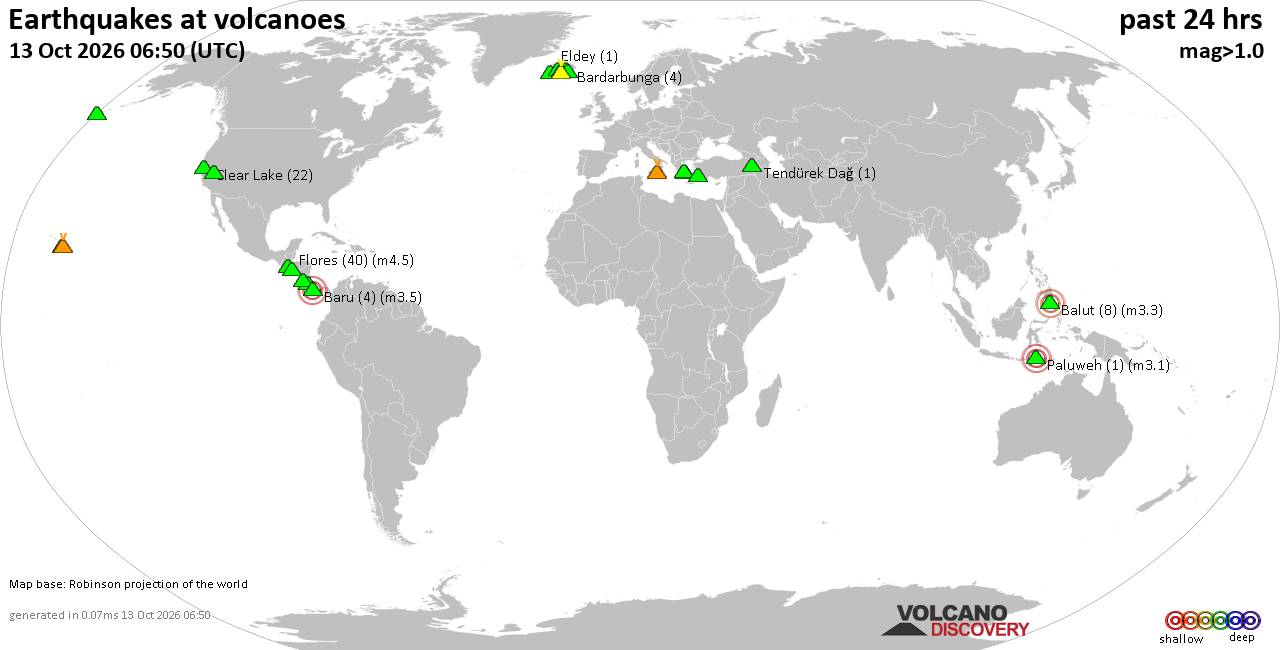
Volcano earthquake report for Tuesday, 13 October 2026
• M 2.7 - 19 km SSW of Leilani Estates, Hawaii
• M 2.5 - 5 km SSW of Pāhala, Hawaii
• M 1.9 - 15 km NE of Milford, Utah
• M 1.8 - 116 km E of Cordova, Alaska
• M 1.2 - 15 km NE of Little Lake, CA
• M 2.0 - 82 km ESE of Ugashik, Alaska
|
|
|
Joined: Feb 2001
Posts: 678,977
Launch Director
|
|
Launch Director
Joined: Feb 2001
Posts: 678,977 |
SPC Oct 13, 2026 2000 UTC Day 1 Convective OutlookSPC 2000Z Day 1 Outlook 
Day 1 Convective Outlook
NWS Storm Prediction Center Norman OK
0250 PM CDT Tue Oct 13 2026

Valid 132000Z - 141200Z

...THERE IS A SLIGHT RISK OF SEVERE THUNDERSTORMS FROM PARTS OF
NORTHWEST MISSOURI/KANSAS INTO THE SOUTHERN HIGH PLAINS...

...SUMMARY...
Widely scattered severe storms capable of large hail, severe gusts,
and possibly a tornado are expected over portions of the central and
southern Plains into the Lower Missouri Valley this afternoon into
tonight.  More isolated severe weather may occur from southwest
Texas into the mid Mississippi Valley, and in parts of New York.

...20z Update...
A minor expansion was made to the Level 1/Marginal Risk area across
portions of far northeast Oklahoma, far southeast Kansas, and
southwest Missouri. The latest guidance indicates potential for a
few damaging wind gusts to occur if storms can remain organized late
into the overnight and propagate into this region. The low-level jet
is forecast to develop this evening across much of Oklahoma and
remain present through the overnight, offering support to sustain
convection.

Otherwise, the balance of the previous forecast remains on track.
See the discussion below for more details.

..Karstens/Guyer.. 10/13/2026

.PREV DISCUSSION... /ISSUED 1129 AM CDT Tue Oct 13 2026/

...Southern High Plains into KS and the mid MS Valley...
Regional 12 UTC raob data over the southern Great Plains showed a
very moist boundary layer (15-17 g/kg lowest 100-mb mean mixing
ratios at Norman and Lamont, OK and Midland and Fort Worth, TX)
streaming northward.  Late morning surface mesoanalysis places a
front extending southwestward from a surface low over northern Lower
MI through the mid MS/lower MO Valleys and into southeast CO.  The
frontal zone is forecast to gradually shift south, primarily after
dark.

Ample heating via clear skies through mid afternoon will contribute
to moderate buoyancy (2000-2500 J/kg MLCAPE) developing along and
south of the aforementioned front, westward to a triple point, and
southward into west TX east of a dryline.  The erosion of convective
inhibition will likely lead to initial widely scattered storm
development over central KS per recent CAM data by mid-late
afternoon.  Strong mid to high-level flow will support supercells
early in the convective life cycle with some of the stronger
thunderstorms.  Storm coverage is forecast to increase through the
early evening from northwest OK and KS into the lower MO Valley.

Will maintain previous categorical risk with minimal change.
However, have enlarged the level-1 wind intensity and introduced a
level-1 hail intensity to account for organized storm modes and a
risk for hail 1.5 to 2.5 inches in diameter from the eastern TX
Panhandle into central KS.  The overall tornado risk is uncertain
and will be limited to a certain extent by modest low-level shear
despite the supercell mode and a very moist boundary layer.  A few
small clusters will likely evolve during the evening with a mix of
supercellular and multicells capable of severe gusts 60-80 mph.  The
severe threat should become more isolated with time given increasing
nocturnal stabilization and widespread storm interactions.

...Parts of western/central NY...
A low-amplitude midlevel shortwave trough will continue to move
quickly eastward through eastern Ontario through the Northeast
today.  An attendant surface low will eastward just ahead of the
parent shortwave.  Increasing low-level moisture and afternoon
temperatures in the upper 70s will promote modest buoyancy, although
clouds/precipitation and relatively warm low to mid-level
temperatures result in some uncertainty regarding airmass
destabilization.

Increasing deep-layer westerly flow (particularly around 850 mb)
amid low-level southwesterlies will result in notably curved
low-level hodographs.  As a result, any sustained surface-based
storms could organize, supporting a threat for localized wind damage
and possibly a tornado.  Modest buoyancy is expected to
limit the overall magnitude and coverage of the severe potential.
Read morehttps://www.spc.noaa.gov/products/outlook/day1otlk_2000.html
|
|



CMS The Best Conveyancing solicitors conveyancing quotes throughout the UK
For any webhosting enquiries please email webmaster@aus-city.com
|
|
Forums60
Topics873,200
Posts907,996
Members2,960
| |
Most Online102,106
Jul 10th, 2026
|
|
|









































