|
0 members (),
1,854
guests, and
26
robots. |
|
Key:
Admin,
Global Mod,
Mod
|
|
S |
M |
T |
W |
T |
F |
S |
|
|
|
|
|
1
|
2
|
3
|
|
4
|
5
|
6
|
7
|
8
|
9
|
10
|
|
11
|
12
|
13
|
14
|
15
|
16
|
17
|
|
18
|
19
|
20
|
21
|
22
|
23
|
24
|
|
25
|
26
|
27
|
28
|
29
|
30
|
31
|
|
There are no members with birthdays on this day. |
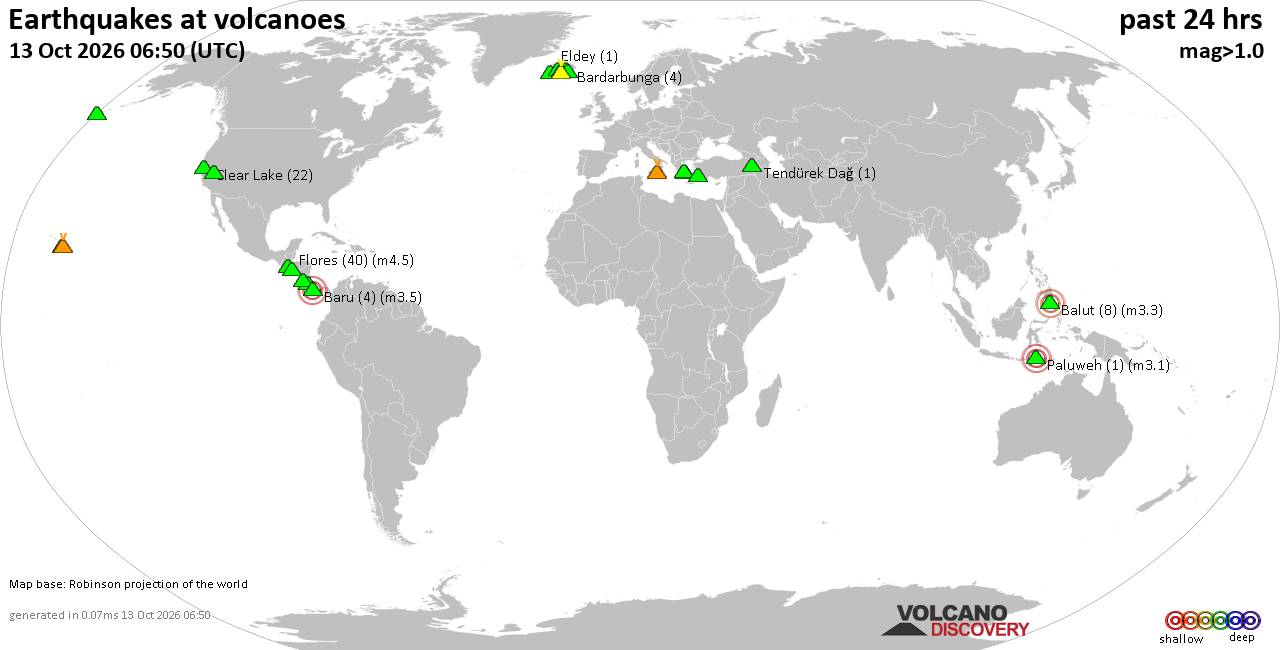
Volcano earthquake report for Tuesday, 13 October 2026
• M 0.3 - 92 km NNW of Karluk, Alaska
• M 3.7 - 23 km NNW of Whites City, New Mexico
• M 1.5 Quarry Blast - 5 km NNW of Boron, CA
• M 1.5 - 7 km N of Geneva, Washington
• M 0.4 - 66 km ENE of Pedro Bay, Alaska
• M 4.4 - 20 km WSW of Palestina, Colombia
|
|
|
Joined: Feb 2001
Posts: 678,977
Launch Director
|
|
Launch Director
Joined: Feb 2001
Posts: 678,977 |
SPC MD 2370MD 2370 CONCERNING SEVERE THUNDERSTORM WATCH 682... FOR PORTIONS OF SOUTHERN AND EASTERN KANSAS INTO WESTERN MISSOURI 
Mesoscale Discussion 2370
NWS Storm Prediction Center Norman OK
0626 PM CDT Tue Oct 13 2026

Areas affected...portions of southern and eastern Kansas into
western Missouri

Concerning...Severe Thunderstorm Watch 682...

Valid 132326Z - 140100Z

The severe weather threat for Severe Thunderstorm Watch 682
continues.

SUMMARY...The severe weather risk continues across Severe
Thunderstorm Watch 682, with a locally greater short-term severe
risk likely across portions of south-central Kansas and northeastern
Kansas into western Missouri.

DISCUSSION...Scattered strong to severe thunderstorms have developed
along a progressive cold front across portions of southern and
eastern Kansas over the past few hours, with isolated reports of
severe wind gusts and large hail noted through 2320 UTC. Large hail
will continue to be the predominant severe threat in the near-term
owing to strong effective shear and elongated hodographs as
discrete/semi-discrete supercells evolve east-southeastward along
surface cold front from northeastern Kansas into western Missouri
and across south-central Kansas. A tornado or two also remains
possible, especially with any supercell structure(s) that can be
maintained for another hour or two within the vicinity of the
surface triple point across southern Kansas as a southerly low-level
jet strengthens. Although, this remains somewhat uncertain owing to
the quick southward progression of the surface cold front that has
undercut some stronger updrafts.

With time, continued linear forcing along the surface cold front
coupled with increasing cell interactions and deep-layer shear
vectors oriented parallel to the front will continue to favor
upscale growth into one or more convective clusters. This will
support a transition toward damaging/severe wind gusts as the
primary severe risk, particularly across south-central Kansas and
northeastern Kansas/western Missouri where storms can remain
surface-based along/ahead of the cold front.

..Chalmers.. 10/13/2026

...Please see www.spc.noaa.gov for graphic product...

ATTN...WFO...EAX...TOP...ICT...DDC...

LAT...LON   37329970 38039861 39379608 39759517 39879456 39839414
            39559386 39059398 38589454 37769624 37039800 37019849
            37039906 37119962 37329970

MOST PROBABLE PEAK TORNADO INTENSITY...85-110 MPH
MOST PROBABLE PEAK WIND GUST...65-80 MPH
MOST PROBABLE PEAK HAIL SIZE...1.50-2.50 IN
Read morehttps://www.spc.noaa.gov/products/md/md2370.html
|
|



CMS The Best Conveyancing solicitors conveyancing quotes throughout the UK
For any webhosting enquiries please email webmaster@aus-city.com
|
|
Forums60
Topics873,727
Posts908,523
Members2,960
| |
Most Online102,106
Jul 10th, 2026
|
|
|









































