|
0 members (),
1,854
guests, and
26
robots. |
|
Key:
Admin,
Global Mod,
Mod
|
|
S |
M |
T |
W |
T |
F |
S |
|
|
|
|
|
1
|
2
|
3
|
|
4
|
5
|
6
|
7
|
8
|
9
|
10
|
|
11
|
12
|
13
|
14
|
15
|
16
|
17
|
|
18
|
19
|
20
|
21
|
22
|
23
|
24
|
|
25
|
26
|
27
|
28
|
29
|
30
|
31
|
|
There are no members with birthdays on this day. |
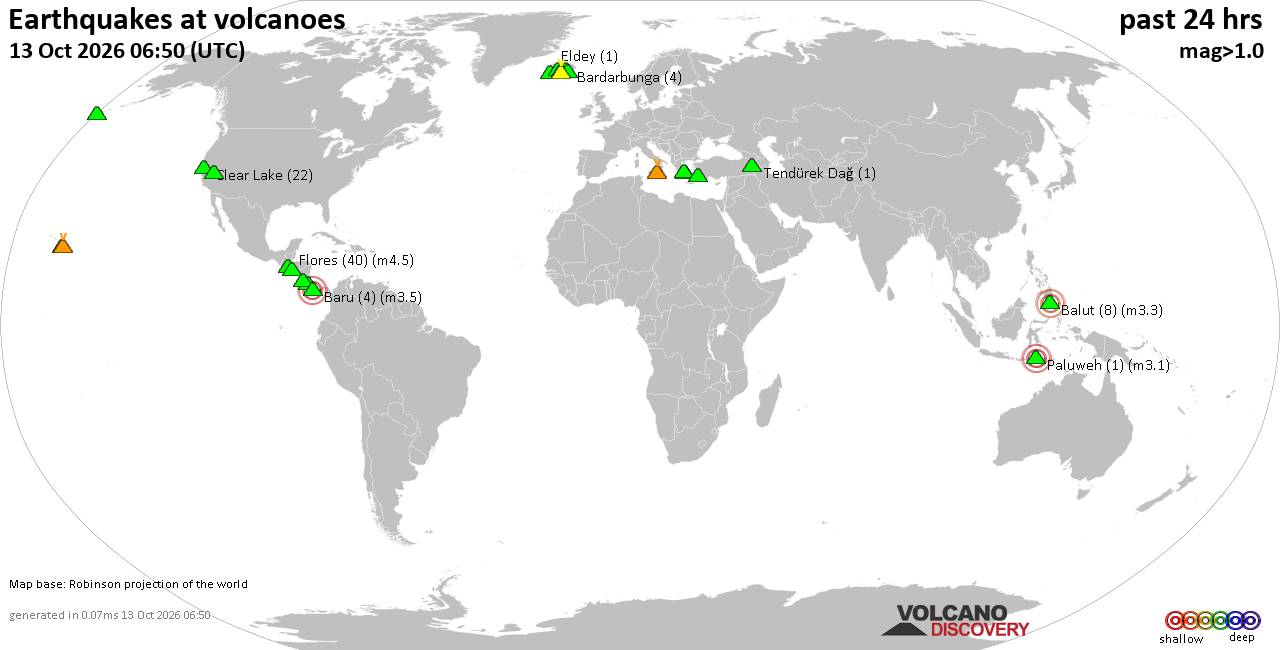
Volcano earthquake report for Tuesday, 13 October 2026
• M 0.3 - 92 km NNW of Karluk, Alaska
• M 3.7 - 23 km NNW of Whites City, New Mexico
• M 1.5 Quarry Blast - 5 km NNW of Boron, CA
• M 1.5 - 7 km N of Geneva, Washington
• M 0.4 - 66 km ENE of Pedro Bay, Alaska
• M 4.4 - 20 km WSW of Palestina, Colombia
|
|
|
Joined: Feb 2001
Posts: 678,977
Launch Director
|
|
Launch Director
Joined: Feb 2001
Posts: 678,977 |
SPC MD 2369MD 2369 CONCERNING SEVERE THUNDERSTORM WATCH 683... FOR PARTS OF THE TEXAS SOUTH PLAINS INTO NORTHWESTERN OKLAHOMA 
Mesoscale Discussion 2369
NWS Storm Prediction Center Norman OK
0559 PM CDT Tue Oct 13 2026

Areas affected...parts of the Texas South Plains into northwestern
Oklahoma

Concerning...Severe Thunderstorm Watch 683...

Valid 132259Z - 140100Z

The severe weather threat for Severe Thunderstorm Watch 683
continues.

SUMMARY...Stronger storms may continue to pose a risk for severe
hail another couple of hours, before strong to severe wind gusts
become the more prominent potential severe hazard through the 7-9 PM
CDT time frame.

DISCUSSION...Low-level warm advection and convergence along the
diffuse dryline are rather weak, and much of the region remains on
the northwestern periphery of a prominent mid-level ridge.  However,
forcing for ascent associated with one or two subtle perturbations
within a belt of moderate (40+ kt near/above 500 mb) southwesterly
mid/upper flow developing northeastward around the ridging may be
contributing to the ongoing increase in thunderstorm development.

This is occurring within seasonably high boundary-layer moisture
content beneath modestly steep lower/mid-tropospheric lapse rates
supportive of sizable CAPE on the order of 2000-3000 J/kg.  However,
thermodynamic profiles are rather warm with relatively high freezing
and potential wet-bulb zero levels.  Not much change is expected
into early evening, but the risk for severe hail may continue at
least a few more hours.  Gradually, modest strengthening of
southerly low-level flow and lift above consolidating cold pools may
contribute to increasing upscale growth through 00-02Z.  As this
occurs, the risk for large hail probably will diminish, but
organizing structures within evolving lines or clusters may pose
increasing potential for strong to severe surface gusts.

..Kerr.. 10/13/2026

...Please see www.spc.noaa.gov for graphic product...

ATTN...WFO...OUN...LUB...AMA...MAF...

LAT...LON   36620031 36929933 36629845 35149922 33150084 32910160
            33210186 34260174 35350105 36620031

MOST PROBABLE PEAK TORNADO INTENSITY...UP TO 90 MPH
MOST PROBABLE PEAK WIND GUST...65-80 MPH
MOST PROBABLE PEAK HAIL SIZE...1.50-2.50 IN
Read morehttps://www.spc.noaa.gov/products/md/md2369.html
|
|



CMS The Best Conveyancing solicitors conveyancing quotes throughout the UK
For any webhosting enquiries please email webmaster@aus-city.com
|
|
Forums60
Topics873,727
Posts908,523
Members2,960
| |
Most Online102,106
Jul 10th, 2026
|
|
|









































