|
1 members (Alisa),
1,531
guests, and
24
robots. |
|
Key:
Admin,
Global Mod,
Mod
|
|
S |
M |
T |
W |
T |
F |
S |
|
|
|
|
|
1
|
2
|
3
|
|
4
|
5
|
6
|
7
|
8
|
9
|
10
|
|
11
|
12
|
13
|
14
|
15
|
16
|
17
|
|
18
|
19
|
20
|
21
|
22
|
23
|
24
|
|
25
|
26
|
27
|
28
|
29
|
30
|
31
|
|
There are no members with birthdays on this day. |
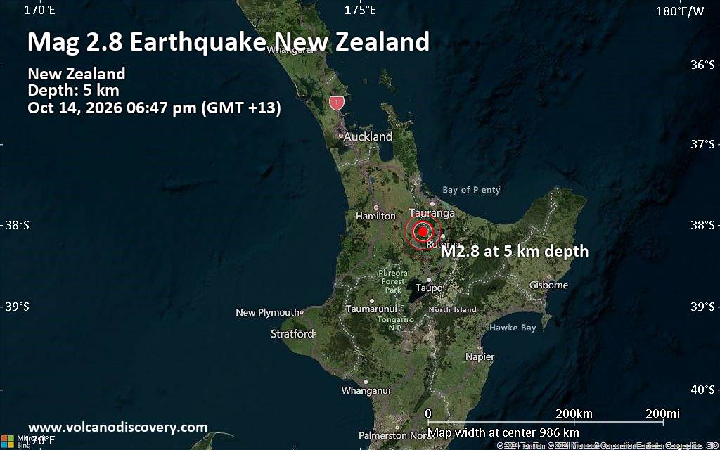
Small magnitude 2.8 quake hits 24 km northwest of Rotorua, New Zealand, in the early evening
• M 1.5 - 30 km W of Nikiski, Alaska
• M 0.5 - 10 km SSE of Idyllwild, CA
• M 1.0 - 13 km SE of Livermore, CA
• M 7.7 - 12 km WSW of Pitaloza Arriba, Panama
• Volcano earthquake report for Wednesday, 14 October 2026
|
|
|
Joined: Feb 2001
Posts: 678,977
Launch Director
|
|
Launch Director
Joined: Feb 2001
Posts: 678,977 |
SPC MD 2372MD 2372 CONCERNING SEVERE THUNDERSTORM WATCH 682... FOR PORTIONS OF SOUTHERN/EASTERN KANSAS INTO NORTHERN MISSOURI 
Mesoscale Discussion 2372
NWS Storm Prediction Center Norman OK
0858 PM CDT Tue Oct 13 2026

Areas affected...portions of southern/eastern Kansas into northern
Missouri

Concerning...Severe Thunderstorm Watch 682...

Valid 140158Z - 140400Z

The severe weather threat for Severe Thunderstorm Watch 682
continues.

SUMMARY...An isolated severe risk for primarily damaging/severe wind
gusts continues across portions of Severe Thunderstorm Watch 682.

DISCUSSION...Scattered strong to occasionally severe thunderstorms
remain ongoing along a progressive surface cold front extending from
northern Missouri into south-central Kansas as of 0200 UTC. The
strongest of the ongoing thunderstorms is a convective cluster
progressing eastward across western Missouri that produced numerous
reports of damaging/severe wind gusts in the Kansas City metro area
over the past 1-2 hours. Latest high-resolution CAM guidance
suggests that this cluster may continue downstream for at least
another couple of hours, with 1000-2000 J/kg MUCAPE and 30-40 kts of
effective bulk shear helping to maintain some potential for
occasional damaging/severe wind gusts. However, increasing
convective inhibition and decreasing instability with eastward
extent suggest that the overall severe risk will decrease with time
as convection progresses eastward. Thus, a downstream watch is not
currently anticipated, but trends will continue to be monitored.

Farther southwest, scattered elevated thunderstorms remain ongoing
along the cool side of the convectively reinforced surface front.
While regional radar imagery has sampled occasionally stronger
velocity signatures within more robust cores (perhaps associated
with gravity wave processes), the elevated nature of the convection
and greater low-level stability on the cool side of the boundary
suggest that the overall severe risk has decreased, with any
lingering potential for damaging/severe wind gusts and marginally
severe hail likely to remain relatively isolated.

..Chalmers.. 10/14/2026

...Please see www.spc.noaa.gov for graphic product...

ATTN...WFO...LSX...EAX...TOP...ICT...

LAT...LON   37569748 38409631 39209503 39559404 39869294 39899249
            39829220 39589210 39319217 39059286 38859362 38289499
            37339642 37149693 37059721 37129745 37259755 37409756
            37569748

MOST PROBABLE PEAK TORNADO INTENSITY...UP TO 90 MPH
MOST PROBABLE PEAK WIND GUST...55-70 MPH
MOST PROBABLE PEAK HAIL SIZE...UP TO 1.25 IN
Read morehttps://www.spc.noaa.gov/products/md/md2372.html
|
|



CMS The Best Conveyancing solicitors conveyancing quotes throughout the UK
For any webhosting enquiries please email webmaster@aus-city.com
|
|
Forums60
Topics874,194
Posts908,990
Members2,960
| |
Most Online102,106
Jul 10th, 2026
|
|
|









































