|
1 members (Alisa),
1,531
guests, and
24
robots. |
|
Key:
Admin,
Global Mod,
Mod
|
|
S |
M |
T |
W |
T |
F |
S |
|
|
|
|
|
1
|
2
|
3
|
|
4
|
5
|
6
|
7
|
8
|
9
|
10
|
|
11
|
12
|
13
|
14
|
15
|
16
|
17
|
|
18
|
19
|
20
|
21
|
22
|
23
|
24
|
|
25
|
26
|
27
|
28
|
29
|
30
|
31
|
|
There are no members with birthdays on this day. |
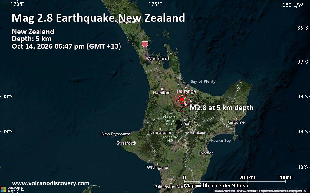
Small magnitude 2.8 quake hits 24 km northwest of Rotorua, New Zealand, in the early evening
• M 1.5 - 30 km W of Nikiski, Alaska
• M 0.5 - 10 km SSE of Idyllwild, CA
• M 1.0 - 13 km SE of Livermore, CA
• M 7.7 - 12 km WSW of Pitaloza Arriba, Panama
• Volcano earthquake report for Wednesday, 14 October 2026
|
|
|
Joined: Feb 2001
Posts: 678,977
Launch Director
|
|
Launch Director
Joined: Feb 2001
Posts: 678,977 |
SPC Oct 14, 2026 0600 UTC Day 1 Convective OutlookSPC 1200Z Day 1 Outlook 
Day 1 Convective Outlook
NWS Storm Prediction Center Norman OK
1250 AM CDT Wed Oct 14 2026

Valid 141200Z - 151200Z

...THERE IS A SLIGHT RISK OF SEVERE THUNDERSTORMS ACROSS PARTS OF
THE SOUTHERN PLAINS...

...SUMMARY...
Thunderstorms with severe wind gusts and potentially a tornado
threat will be possible this afternoon and evening across parts of
the southern Plains. A marginal wind-damage threat will also be
possible from parts of the Ozarks into the central Appalachians.

...Southern Plains...
At mid-levels, southwesterly flow will be in place across much of
the south-central U.S. today, as a large-scale trough and low move
through the Desert Southwest. At the surface, a cold front will
advance southward this morning across northern Oklahoma and the
Texas Panhandle. Numerous thunderstorms will be likely this morning
near the front. The effective boundary is expected to be further
south, which will shift the effective destabilization further south
as well. By early afternoon, an axis of moderate instability is
forecast to be located from west Texas northeastward into
southwestern and south-central Oklahoma, where MLCAPE will likely
range from 1500 to 2000 J/kg. Areas that destabilize significantly
will have potential for severe storms.

RAP forecast soundings near the instability axis by mid to late
afternoon have supercell wind profiles, with gradually veering winds
with height in the low-levels and about 50 knots of southwesterly
flow in the mid-levels. This will support supercell development with
storms that form in the stronger instability and remain discrete.
Supercells will be capable of severe wind gusts, hail and perhaps a
tornado or two. During the evening, a transition to linear mode is
expected, but a threat for embedded supercells will continue. The
more intense line segments could produce severe wind gusts,
potentially above 70 mph.

...Ozarks/Ohio Valley/Central Appalachians...
An anticyclonic flow pattern will be in place over the eastern half
of the nation today. At the surface, a cold front will advance
southward into the Ozarks and Ohio Valley today. To the south of the
boundary, surface dewpoints in the upper 60s to lower 70s F will
likely result in pockets of moderate instability by afternoon. In
spite of limited large-scale ascent, increasing low-level
convergence near the boundary will result in scattered convective
initiation. Deep-layer shear near the front may be strong enough for
a few isolated severe storms in areas that destabilize the most. The
primary threat will be damaging wind gusts.

..Broyles/Chalmers.. 10/14/2026
Read morehttps://www.spc.noaa.gov/products/outlook/day1otlk_1200.html
|
|



CMS The Best Conveyancing solicitors conveyancing quotes throughout the UK
For any webhosting enquiries please email webmaster@aus-city.com
|
|
Forums60
Topics874,194
Posts908,990
Members2,960
| |
Most Online102,106
Jul 10th, 2026
|
|
|









































