|
1 members (Alisa),
1,531
guests, and
24
robots. |
|
Key:
Admin,
Global Mod,
Mod
|
|
S |
M |
T |
W |
T |
F |
S |
|
|
|
|
|
1
|
2
|
3
|
|
4
|
5
|
6
|
7
|
8
|
9
|
10
|
|
11
|
12
|
13
|
14
|
15
|
16
|
17
|
|
18
|
19
|
20
|
21
|
22
|
23
|
24
|
|
25
|
26
|
27
|
28
|
29
|
30
|
31
|
|
There are no members with birthdays on this day. |
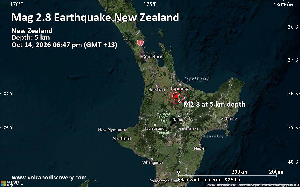
Small magnitude 2.8 quake hits 24 km northwest of Rotorua, New Zealand, in the early evening
• M 1.5 - 30 km W of Nikiski, Alaska
• M 0.5 - 10 km SSE of Idyllwild, CA
• M 1.0 - 13 km SE of Livermore, CA
• M 7.7 - 12 km WSW of Pitaloza Arriba, Panama
• Volcano earthquake report for Wednesday, 14 October 2026
|
|
|
Joined: Feb 2001
Posts: 678,977
Launch Director
|
|
Launch Director
Joined: Feb 2001
Posts: 678,977 |
SPC Day 2 Fire Weather OutlookSPC Day 2 Fire Weather Outlook 
Day 2 Fire Weather Outlook
NWS Storm Prediction Center Norman OK
0105 AM CDT Wed Oct 14 2026

Valid 151200Z - 161200Z

...Synopsis...
A mid-level low over the central Plains will weaken and transition
to an open wave, quickly becoming absorbed within defined troughing
over the Upper Midwest on Day 2/Thursday. Meanwhile, a cutoff low
will detach into the Desert Southwest as ridging amplifies over the
Pacific Northwest. As a result, an increasing offshore pressure
gradient will promote an elevated fire weather threat for portions
of southern CA that have not seen recent rainfall.

...Southern California...
Offshore winds and fire weather impacts will increase across
southern CA as a mid-level cutoff low approaches the Baja Peninsula,
placing east-northeast flow over the region. East-northeast
sustained winds of 15-25 mph (gusts of 30-50 mph in valleys,
possibly up to 60 mph in the mountains) amid RH as low as 10% are
expected to begin Day 2/Thursday morning in western L.A. and Ventura
counties. Localized critical fire weather conditions are possible in
wind-prone corridors, but forecast ERCs only in the 60-70th
percentile range should attenuate broader impacts. Poor overnight
humidity recoveries are expected with persisting strong winds,
yielding continued fire weather impacts into Day 3/Friday. Elevated
highlights were introduced where rainfall-neglected fuels may be
receptive to new fire starts.

On the northern periphery of the mid-level low over southern CA,
easterly winds aloft will contribute to periods of gusty surface
winds amid 10-15% RH in the Sacramento Valley. North to east winds
in the valley and adjacent foothills may approach 10-15 mph, perhaps
up to 20 mph in terrain-favored areas, promoting locally elevated
fire weather conditions. Stronger wind gusts of 30-40 mph are
expected in the higher elevation Sierra; however, modest RH should
alleviate broader fire weather concerns.

..Elizalde-Garcia.. 10/14/2026

...Please see www.spc.noaa.gov/fire for graphic product...
Read morehttps://www.spc.noaa.gov/products/fire_wx/fwdy2.html
|
|



CMS The Best Conveyancing solicitors conveyancing quotes throughout the UK
For any webhosting enquiries please email webmaster@aus-city.com
|
|
Forums60
Topics874,194
Posts908,990
Members2,960
| |
Most Online102,106
Jul 10th, 2026
|
|
|









































