|
0 members (),
3,095
guests, and
26
robots. |
|
Key:
Admin,
Global Mod,
Mod
|
|
S |
M |
T |
W |
T |
F |
S |
|
|
|
|
|
1
|
2
|
3
|
|
4
|
5
|
6
|
7
|
8
|
9
|
10
|
|
11
|
12
|
13
|
14
|
15
|
16
|
17
|
|
18
|
19
|
20
|
21
|
22
|
23
|
24
|
|
25
|
26
|
27
|
28
|
29
|
30
|
31
|
|
There are no members with birthdays on this day. |
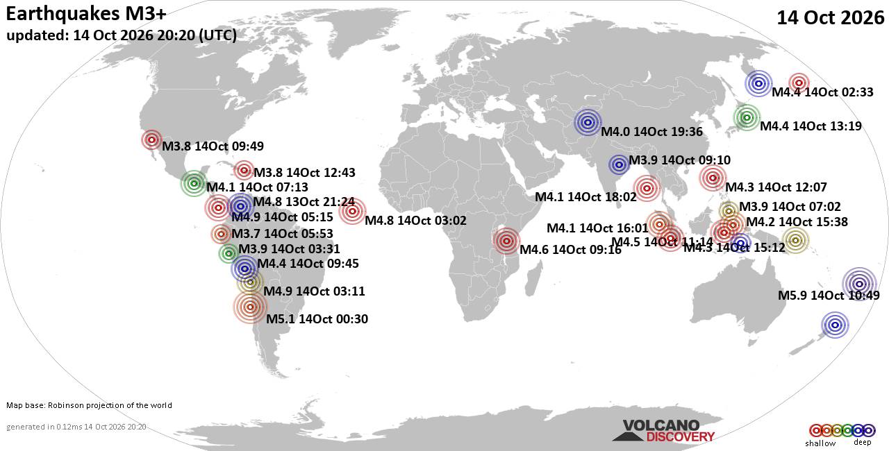
World Earthquake Report for Wednesday, 14 October 2026
• M 0.4 - 9 km WNW of Anza, CA
• M 1.9 - 9 km SW of Susitna, Alaska
• M 1.9 - 27 km NNW of Pāhala, Hawaii
• M 1.1 - 8 km ESE of Cloverdale, CA
• M 1.6 - 7 km ENE of Coleville, California
|
|
|
Joined: Feb 2001
Posts: 678,977
Launch Director
|
|
Launch Director
Joined: Feb 2001
Posts: 678,977 |
SPC MD 2374MD 2374 CONCERNING SEVERE POTENTIAL...WATCH UNLIKELY FOR PORTIONS OF SOUTHERN OHIO...NORTHERN KENTUCKY...AND WESTERN WEST VIRGINIA 
Mesoscale Discussion 2374
NWS Storm Prediction Center Norman OK
0247 PM CDT Wed Oct 14 2026

Areas affected...portions of southern Ohio...northern Kentucky...and
western West Virginia

Concerning...Severe potential...Watch unlikely

Valid 141947Z - 142215Z

Probability of Watch Issuance...20 percent

SUMMARY...Thunderstorms are expected to increase in coverage and
intensity through the afternoon into the early evening hours across
portions of southern Ohio and adjacent areas of Kentucky and West
Virginia.  The strongest storms may pose a damaging wind threat,
however, the overall severe weather threat is expected to remain too
isolated to warrant a watch.

DISCUSSION...Convection associated with a remnant MCV moving
eastward across the Ohio Valley is intensifying as it moves into a
modestly unstable airmass.  Additionally, storms are developing
along an east-west oriented cold front in southern Ohio.  Although
lapse rates are modest and limiting the updraft potential,
deep-layer shear is sufficient to assist with storm organization and
longevity.  The storms will move east-southeastward through the
afternoon and evening posing an isolated risk of damaging winds,
especially for storms that cluster and grow upscale.  The severe
wind threat is expected to remain too marginal/isolated to warrant a
watch, but convective trends will be monitored.

..Jirak/Guyer.. 10/14/2026

...Please see www.spc.noaa.gov for graphic product...

ATTN...WFO...PBZ...RLX...JKL...ILN...LMK...

LAT...LON   38068505 38638425 39278407 40038411 40098242 40068125
            39958068 39708013 39367974 38798001 38358064 37958121
            37758211 37758342 38068505

MOST PROBABLE PEAK WIND GUST...UP TO 60 MPH
Read morehttps://www.spc.noaa.gov/products/md/md2374.html
|
|



CMS The Best Conveyancing solicitors conveyancing quotes throughout the UK
For any webhosting enquiries please email webmaster@aus-city.com
|
|
Forums60
Topics875,352
Posts910,148
Members2,960
| |
Most Online102,106
Jul 10th, 2026
|
|
|









































