|
|
|
1 members (Alisa),
2,521
guests, and
21
robots. |
|
Key:
Admin,
Global Mod,
Mod
|
|
S |
M |
T |
W |
T |
F |
S |
|
|
|
|
|
1
|
2
|
3
|
|
4
|
5
|
6
|
7
|
8
|
9
|
10
|
|
11
|
12
|
13
|
14
|
15
|
16
|
17
|
|
18
|
19
|
20
|
21
|
22
|
23
|
24
|
|
25
|
26
|
27
|
28
|
29
|
30
|
31
|
|
There are no members with birthdays on this day. |
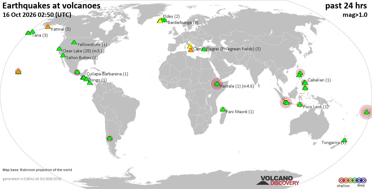
Volcano earthquake report for Friday, 16 October 2026
• M 3.1 - 202 km SE of Atka, Alaska
• M 2.3 - 40 km E of Chase, Alaska
• M 3.6 - 2 km NW of Knik, Alaska
• M 3.3 - 65 km NE of Punta Cana, Dominican Republic
• M 3.6 - 282 km ESE of Chiniak, Alaska
|
|
|
Joined: Feb 2001
Posts: 678,977
Launch Director
|
|
Launch Director
Joined: Feb 2001
Posts: 678,977 |
SPC Oct 16, 2026 1730 UTC Day 2 Convective OutlookSPC 1730Z Day 2 Outlook 
Day 2 Convective Outlook
NWS Storm Prediction Center Norman OK
1224 PM CDT Fri Oct 16 2026

Valid 171200Z - 181200Z

...NO SEVERE THUNDERSTORM AREAS FORECAST...

...SUMMARY...
Severe thunderstorms are not expected Saturday.

...Synopsis...
The majority of the CONUS will be dominated by a cool/dry air mass
with no potential for deep convection in the wake of a cold frontal
passage off the southeast Atlantic coast.  One exception will be
across central/south FL where moist profiles (PW greater than 2
inches) and ascent along the cold front will support scattered
thunderstorms.  A second possible exception will be across the
Desert Southwest as midlevel moisture and ascent increase gradually
near and east of a weak closed low over northern Baja.  Buoyancy
rooted in the midlevels will be weak but could become sufficiently
deep for charge separation and isolated lightning flashes the latter
half of the period.

..Thompson.. 10/16/2026
Read morehttps://www.spc.noaa.gov/products/outlook/day2otlk_1730.html
|
|



CMS The Best Conveyancing solicitors conveyancing quotes throughout the UK
For any webhosting enquiries please email webmaster@aus-city.com
|
|
Forums60
Topics879,145
Posts913,942
Members2,960
| |
Most Online102,106
Jul 10th, 2026
|
|
|
|
|

|









































