|
|
|
1 members (Alisa),
3,778
guests, and
29
robots. |
|
Key:
Admin,
Global Mod,
Mod
|
|
S |
M |
T |
W |
T |
F |
S |
|
1
|
2
|
3
|
4
|
5
|
6
|
7
|
|
8
|
9
|
10
|
11
|
12
|
13
|
14
|
|
15
|
16
|
17
|
18
|
19
|
20
|
21
|
|
22
|
23
|
24
|
25
|
26
|
27
|
28
|
|
29
|
30
|
|
|
|
|
|
|
There are no members with birthdays on this day. |
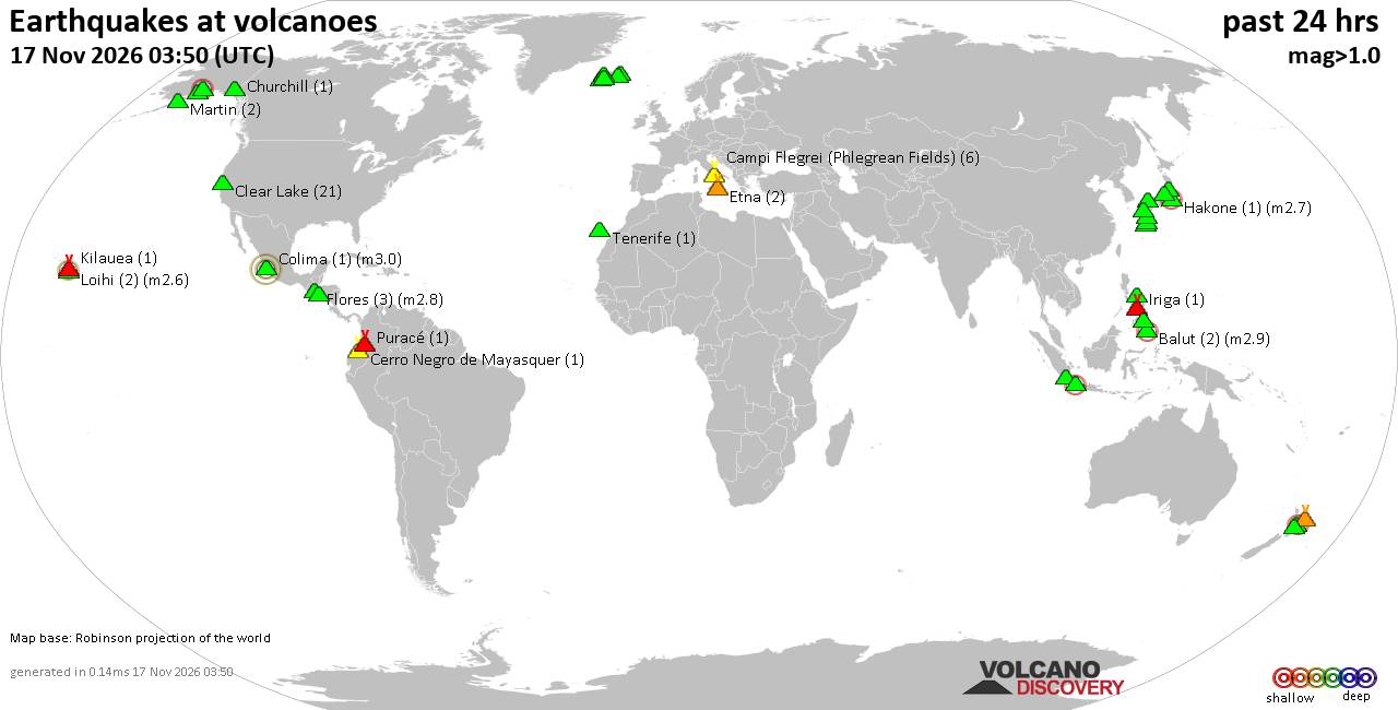
Volcano earthquake report for Tuesday, 17 November 2026
• M 5.1 - 205 km NW of Port-Olry, Vanuatu
• M 1.2 - 67 km NE of Nikolski, Alaska
• M 6.0 - 64 km SSE of Shima, Japan
• M 2.4 - 9 km SSE of Maria Antonia, Puerto Rico
• M 6.6 - 148 km WSW of Tual, Indonesia
• M 2.3 - 29 km WNW of Valdez, Alaska
|

#916877
Sat 17 Oct 2026 12:01:PM
|
Joined: Feb 2001
Posts: 800,656
Launch Director
|
|
Launch Director
Joined: Feb 2001
Posts: 800,656 |
SPC Oct 17, 2026 1300 UTC Day 1 Convective OutlookSPC 1300Z Day 1 Outlook 
Day 1 Convective Outlook
NWS Storm Prediction Center Norman OK
0658 AM CDT Sat Oct 17 2026

Valid 171300Z - 181200Z

...NO SEVERE THUNDERSTORM AREAS FORECAST...

...SUMMARY...
Organized severe thunderstorms are not forecast through tonight.

...Synopsis and Discussion...
Highly amplified upper troughing over the eastern CONUS this morning
will move eastward off the Atlantic Coast today, while a closed
mid/upper-level low eventually develops over the NC Outer Banks and
adjacent western Atlantic. An expansive area of surface high
pressure and related dry and/or stable conditions across much of the
central/eastern states will greatly limit thunderstorm potential
today, with two exceptions. One area will be across parts of the FL
Peninsula along/south of a cold front, where sufficient instability
may support isolated to scattered thunderstorms this afternoon in a
weak deep-layer shear environment. While gusty winds could occur
with the strongest cores that develop, overall severe potential is
expected to remain low. A second area of isolated thunderstorm
potential will exist across parts of southern AZ, on the northeast
periphery of a weak mid/upper-level low centered over the eastern
Pacific and Baja Peninsula.

..Gleason/Kerr.. 10/17/2026
Read morehttps://www.spc.noaa.gov/products/outlook/day1otlk_1300.html
|
|



CMS The Best Conveyancing solicitors conveyancing quotes throughout the UK
For any webhosting enquiries please email webmaster@aus-city.com
|
|
Forums60
Topics931,437
Posts966,234
Members2,960
| |
Most Online102,106
Jul 10th, 2026
|
|
|
|
|

|









































