|
1 members (Alisa),
1,396
guests, and
26
robots. |
|
Key:
Admin,
Global Mod,
Mod
|
|
S |
M |
T |
W |
T |
F |
S |
|
|
|
|
|
1
|
2
|
3
|
|
4
|
5
|
6
|
7
|
8
|
9
|
10
|
|
11
|
12
|
13
|
14
|
15
|
16
|
17
|
|
18
|
19
|
20
|
21
|
22
|
23
|
24
|
|
25
|
26
|
27
|
28
|
29
|
30
|
31
|
|
There are no members with birthdays on this day. |
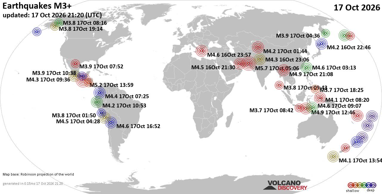
World Earthquake Report for Saturday, 17 October 2026
• Moderate mag. 4.9 earthquake - China on Saturday, Oct 17, 2026, at 09:08 pm...
• M 0.9 - 22 km ESE of Anza, CA
• Light mag. 3.9 earthquake - Hawke's Bay, New Zealand, on Sunday, Oct 18, 20...
• M 1.8 - 9 km SSW of Volcano, Hawaii
• M 1.1 - 55 km E of Whittier, Alaska
|
|
|
Joined: Feb 2001
Posts: 678,977
Launch Director
|
|
Launch Director
Joined: Feb 2001
Posts: 678,977 |
SPC Day 3-8 Fire Weather OutlookSPC Day 3-8 Fire Weather Outlook 
Day 3-8 Fire Weather Outlook
NWS Storm Prediction Center Norman OK
0404 PM CDT Sat Oct 17 2026

Valid 191200Z - 251200Z

...Synopsis...
The upper pattern will remain fairly stagnant across the eastern
half of the CONUS through early next week. Upper ridging will
continue over the central U.S. as a cut-off low meanders along the
Atlantic coast through Day 4/Tuesday. High pressure will build over
Southeast and prevail through the forecast period, promoting warm
daytime temperatures and dry conditions where fuels are growing
increasingly more receptive in the lower MS River Valley (forecast
ERCs at or above the 95th percentile by Day 5/Wednesday). Lighter
prevailing winds should keep broader fire weather concerns low,
however.

Farther west, an upper trough will impinge upon the Pacific
Northwest on Day 3/Monday, increasing southwesterly flow over the
Great Basin. Upper troughing will amplify as it digs into the
southwestern U.S., potentially ejecting into the Great Plains
late-week. This pattern should bring additional precipitation and
cooler temperatures to much of the Intermountain West, and
potentially provide some relief to a drying fuelscape across the
Coast Ranges and Sierra Nevada in California.

...Day 3/Monday - Northeastern California and Northwest Great
Basin...
A robust mid/upper trough is expected to bring enhanced
southwesterly flow back into the western U.S. by early next week.
Dry and breezy conditions in advance of the trough will promote an
increasing fire weather threat over northeastern CA, far
southeastern OR, and northwestern NV on Day 3/Monday where fuels
remain dry in the absence of recent precipitation. Thus, 40%
critical probabilities have been maintained across the region.

..Elizalde-Garcia.. 10/17/2026

...Please see www.spc.noaa.gov/fire for graphic product...
Read morehttps://www.spc.noaa.gov/products/exper/fire_wx/
|
|



CMS The Best Conveyancing solicitors conveyancing quotes throughout the UK
For any webhosting enquiries please email webmaster@aus-city.com
|
|
Forums60
Topics880,529
Posts915,326
Members2,960
| |
Most Online102,106
Jul 10th, 2026
|
|
|









































