|
1 members (Alisa),
1,423
guests, and
25
robots. |
|
Key:
Admin,
Global Mod,
Mod
|
|
S |
M |
T |
W |
T |
F |
S |
|
|
|
|
|
1
|
2
|
3
|
|
4
|
5
|
6
|
7
|
8
|
9
|
10
|
|
11
|
12
|
13
|
14
|
15
|
16
|
17
|
|
18
|
19
|
20
|
21
|
22
|
23
|
24
|
|
25
|
26
|
27
|
28
|
29
|
30
|
31
|
|
There are no members with birthdays on this day. |
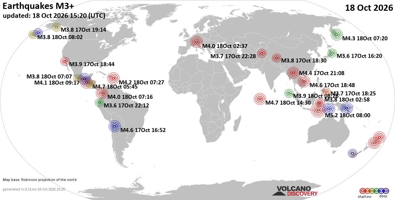
World Earthquake Report for Sunday, 18 October 2026
• M 1.9 - 70 km WSW of Akhiok, Alaska
• M 1.7 - 15 km N of Meadow Lakes, Alaska
• M 2.8 - 60 km SW of Atka, Alaska
• M 3.1 - 14 km SSW of Yarragon, Australia
• M 1.1 - 3 km W of Cobb, CA
|
|
|
Joined: Feb 2001
Posts: 678,977
Launch Director
|
|
Launch Director
Joined: Feb 2001
Posts: 678,977 |
SPC Day 2 Fire Weather OutlookSPC Day 2 Fire Weather Outlook 
Day 2 Fire Weather Outlook
NWS Storm Prediction Center Norman OK
0157 PM CDT Sun Oct 18 2026

Valid 191200Z - 201200Z

No changes were made to the Day 2/Monday Fire Weather Outlook;
please see the previous discussion for details.

..Elizalde-Garcia.. 10/18/2026

.PREV DISCUSSION... /ISSUED 0107 AM CDT Sun Oct 18 2026/

...Synopsis...
A robust mid-level trough will gradually approach the Pacific
Northwest coastline on D2/Monday as a closed mid-level low meanders
off the East Coast. Meanwhile, upper-level ridging will remain
positioned across much of the Plains and lower/mid Mississippi
Valley. Simultaneously, surface high pressure will remain anchored
across the Ohio Valley, with dry conditions persisting across the
lower MS Valley. Generally light winds will largely mitigate fire
weather concerns over this region, however. Farther west,
strengthening southwesterly surface winds ahead of the
aforementioned mid-level shortwave trough are forecast to support
elevated fire weather concerns across portions of the western Great
Basin Monday afternoon.

...Northeastern California, southern/southeastern Oregon, and
northwestern Nevada...
Southwesterly surface winds will strengthen ahead of the approach of
both a robust mid-level shortwave trough off of the Pacific
Northwest coastline and a surface front approaching from the north.
Wind speeds around 15-20 mph (with localized gusts up to 25-30 mph
possible, particularly across the northern Sierra) amid minimum
daytime RH of ~20% (locally lower) are forecast to support elevated
fire weather conditions across a region where ERCs are around the
80-90th percentiles.

...Please see www.spc.noaa.gov/fire for graphic product...
Read morehttps://www.spc.noaa.gov/products/fire_wx/fwdy2.html
|
|



CMS The Best Conveyancing solicitors conveyancing quotes throughout the UK
For any webhosting enquiries please email webmaster@aus-city.com
|
|
Forums60
Topics881,508
Posts916,305
Members2,960
| |
Most Online102,106
Jul 10th, 2026
|
|
|









































