|
|
|
0 members (),
2,079
guests, and
31
robots. |
|
Key:
Admin,
Global Mod,
Mod
|
|
S |
M |
T |
W |
T |
F |
S |
|
1
|
2
|
3
|
4
|
5
|
6
|
7
|
|
8
|
9
|
10
|
11
|
12
|
13
|
14
|
|
15
|
16
|
17
|
18
|
19
|
20
|
21
|
|
22
|
23
|
24
|
25
|
26
|
27
|
28
|
|
29
|
30
|
|
|
|
|
|
|
There are no members with birthdays on this day. |
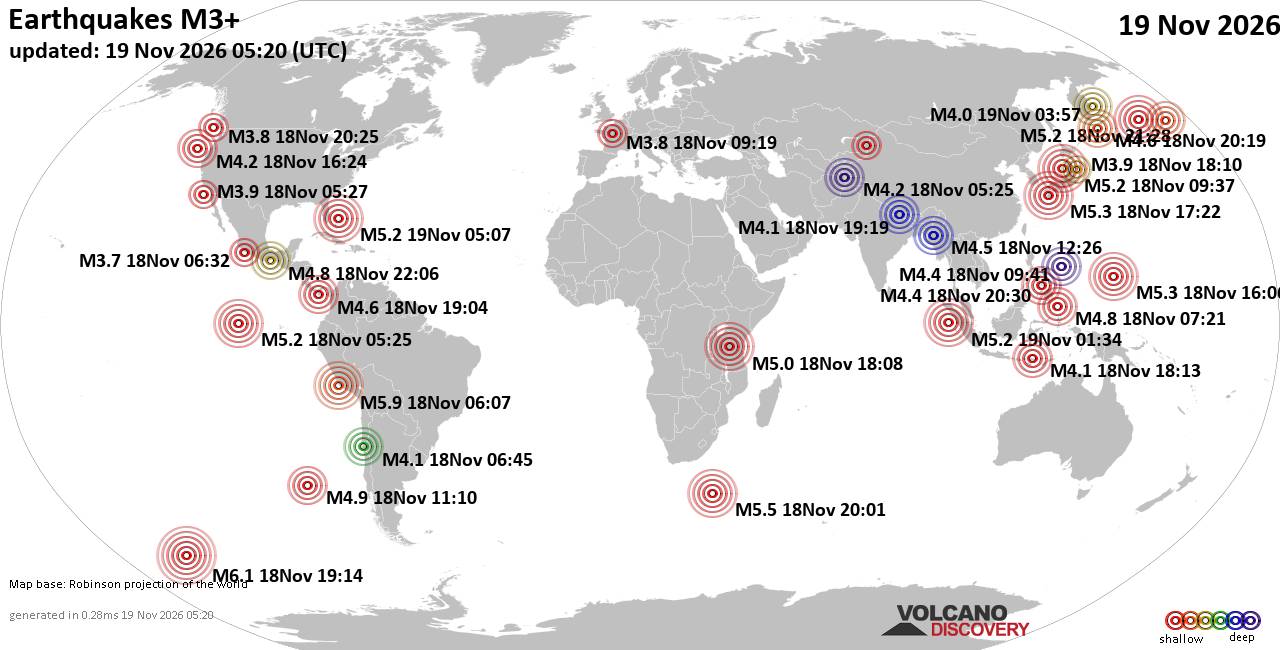
World Earthquake Report for Thursday, 19 November 2026
• Significant magnitude 5.2 quake hits 96 km east of Freeport, Bahamas, after...
• M 1.6 - 68 km WNW of Karluk, Alaska
• M 5.2 - 130 km W of Teluk Dalam, Indonesia
• Strong mag. 5.2 earthquake - Bahamas: Bahama Islands on Thursday, Nov 19, 2...
• M 5.0 - 111 km W of Petrolia, CA
|

#919929
Mon 19 Oct 2026 05:17:PM
|
Joined: Feb 2001
Posts: 800,656
Launch Director
|
|
Launch Director
Joined: Feb 2001
Posts: 800,656 |
SPC Oct 19, 2026 1730 UTC Day 2 Convective OutlookSPC 1730Z Day 2 Outlook 
Day 2 Convective Outlook
NWS Storm Prediction Center Norman OK
1214 PM CDT Mon Oct 19 2026

Valid 201200Z - 211200Z

...NO SEVERE THUNDERSTORM AREAS FORECAST...

...SUMMARY...
No severe thunderstorms are expected on Tuesday. A few strong storms
may affect parts of Arizona late Tuesday night.

...Synopsis...
High pressure will extend from eastern Canada southwestward to the
Gulf of America on Tuesday, maintaining stable conditions over most
of the central and eastern states on Tuesday. Farther west, a deep
upper trough will exist just off the West Coast, with increasing
southwest winds aloft from CA into UT and AZ.

Strong daytime heating may support isolated thunderstorms from the
Great Basin into AZ, though an inversion above 500 mb should
minimize updraft strength.

A greater chance of possibly strong thunderstorms may develop
overnight into AZ as temperatures aloft cool, and, winds increase
out of the south. This enhanced upslope may support additional
storms along and north of the Mogollon Rim, and shear will be
stronger at that time. Instability may only be marginally
supportive, with the greater risk developing after 12Z Wednesday
morning.

..Jewell.. 10/19/2026
Read morehttps://www.spc.noaa.gov/products/outlook/day2otlk_1730.html
|
|



CMS The Best Conveyancing solicitors conveyancing quotes throughout the UK
For any webhosting enquiries please email webmaster@aus-city.com
|
|
Forums60
Topics935,002
Posts969,799
Members2,960
| |
Most Online102,106
Jul 10th, 2026
|
|
|
|
|

|









































