|
0 members (),
1,534
guests, and
24
robots. |
|
Key:
Admin,
Global Mod,
Mod
|
|
S |
M |
T |
W |
T |
F |
S |
|
|
|
|
|
1
|
2
|
3
|
|
4
|
5
|
6
|
7
|
8
|
9
|
10
|
|
11
|
12
|
13
|
14
|
15
|
16
|
17
|
|
18
|
19
|
20
|
21
|
22
|
23
|
24
|
|
25
|
26
|
27
|
28
|
29
|
30
|
31
|
|
There are no members with birthdays on this day. |
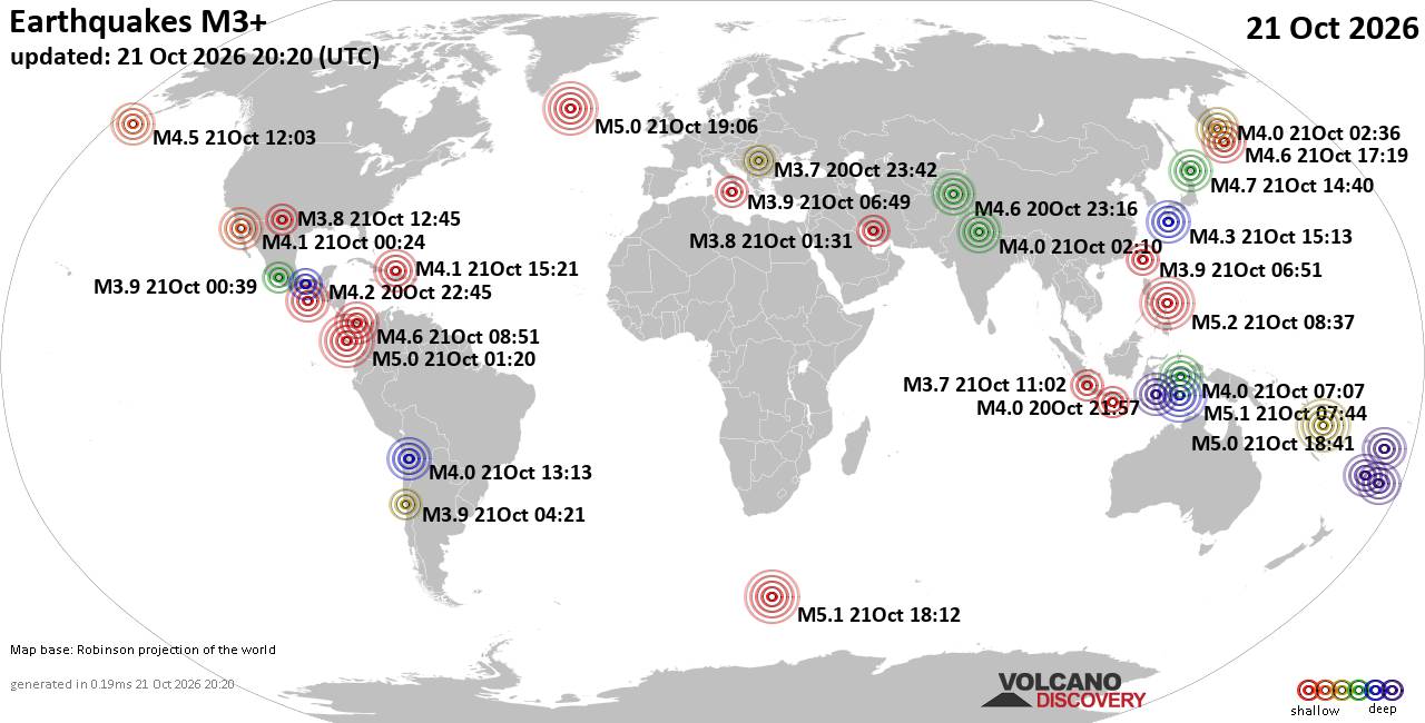
World Earthquake Report for Wednesday, 21 October 2026
• Light mag. 3.9 earthquake - Indonesia: Banda Sea on Wednesday, Oct 21, 2026...
• M 2.6 - 16 km SSW of Jal, New Mexico
• M 1.7 - 55 km E of Denali Park, Alaska
• M 1.8 - 12 km E of Happy Valley, Alaska
• M 0.4 - 10 km ENE of Cloverdale, CA
• M 2.7 - 58 km WSW of Akhiok, Alaska
|
|
|
Joined: Feb 2001
Posts: 678,977
Launch Director
|
|
Launch Director
Joined: Feb 2001
Posts: 678,977 |
SPC MD 2388MD 2388 CONCERNING TORNADO WATCH 688... FOR PARTS OF CENTRAL/NORTHERN ARIZONA 
Mesoscale Discussion 2388
NWS Storm Prediction Center Norman OK
0254 PM CDT Wed Oct 21 2026

Areas affected...Parts of central/northern Arizona

Concerning...Tornado Watch 688...

Valid 211954Z - 212130Z

The severe weather threat for Tornado Watch 688 continues.

SUMMARY...The severe risk continues across Tornado Watch #688, with
a potential focus over parts of Yavapai and Coconino Counties for
the next couple of hours.

DISCUSSION...The latest radar data from KFSX continues to depict
periodic supercells tracking north-northeastward across parts of
Yavapai into southern Coconino Counties, where forcing for ascent is
maximized with a south-southwesterly low-level jet and related
warm-air advection. Similar to earlier this morning, most of these
storms locally intensify as they interact with terrain features,
where low-level vorticity and mesoscale ascent remain maximized.
Given pockets of diurnal heating in cloud breaks and around 150-200
m2/s2 0-1 km SRH (per observed storm motions and KFSX VWP), this
area should remain locally favorable for supercells capable of
producing large hail, locally severe gusts, and a couple of
tornadoes in the near term.

..Weinman.. 10/21/2026

...Please see www.spc.noaa.gov for graphic product...

ATTN...WFO...FGZ...

LAT...LON   34541281 34801319 35081327 35461310 35751269 35991214
            36001187 35901163 35541143 34641139 34311168 34351212
            34541281

MOST PROBABLE PEAK TORNADO INTENSITY...85-110 MPH
MOST PROBABLE PEAK WIND GUST...55-70 MPH
MOST PROBABLE PEAK HAIL SIZE...1.50-2.50 IN
Read morehttps://www.spc.noaa.gov/products/md/md2388.html
|
|



CMS The Best Conveyancing solicitors conveyancing quotes throughout the UK
For any webhosting enquiries please email webmaster@aus-city.com
|
|
Forums60
Topics887,272
Posts922,069
Members2,960
| |
Most Online102,106
Jul 10th, 2026
|
|
|









































