|
0 members (),
1,410
guests, and
27
robots. |
|
Key:
Admin,
Global Mod,
Mod
|
|
S |
M |
T |
W |
T |
F |
S |
|
|
|
|
|
1
|
2
|
3
|
|
4
|
5
|
6
|
7
|
8
|
9
|
10
|
|
11
|
12
|
13
|
14
|
15
|
16
|
17
|
|
18
|
19
|
20
|
21
|
22
|
23
|
24
|
|
25
|
26
|
27
|
28
|
29
|
30
|
31
|
|
There are no members with birthdays on this day. |
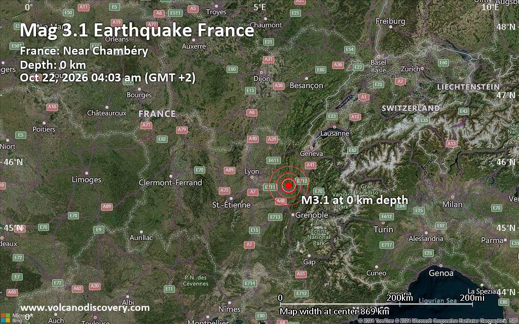
Magnitude 3.1 earthquake strikes near Chambery, Savoy, Auvergne-Rhone-Alpes, France
• M -0.2 - 11 km WNW of Dutch Harbor, Alaska
• M 7.7 - 12 km WSW of Pitaloza Arriba, Panama
• M 2.0 - 71 km WNW of Happy Valley, Alaska
• M 3.3 - 14 km SE of Petrolia, CA
• M 4.4 - 30 km NW of Albardón, Argentina
• M 2.0 - 62 km SE of Adak, Alaska
|
|
|
Joined: Feb 2001
Posts: 678,977
Launch Director
|
|
Launch Director
Joined: Feb 2001
Posts: 678,977 |
SPC Oct 22, 2026 0100 UTC Day 1 Convective OutlookSPC 0100Z Day 1 Outlook 
Day 1 Convective Outlook
NWS Storm Prediction Center Norman OK
0800 PM CDT Wed Oct 21 2026

Valid 220100Z - 221200Z

...THERE IS A SLIGHT RISK OF SEVERE THUNDERSTORMS FOR MUCH OF
ARIZONA INTO FAR SOUTHEAST NEVADA AND SOUTHWEST UTAH...

...SUMMARY...
Severe thunderstorms capable of producing large hail, a couple
tornadoes, and damaging winds remain possible tonight across parts
of Arizona and the Southwest. Isolated severe gusts and perhaps a
tornado may also occur along the central/southern California Coast.

...Southwest...
Evening water-vapor imagery showed a deep upper low off the
southwest CA coast,  with a plume of mid-level Pacific moisture
advecting into the Southwest and Four Corners. Several shortwave
perturbations were evident within the broader cyclonic flow, with
the most substantial of these moving northward from the coast of
Baja California. As the upper low drifts eastward, strong mid-level
flow will continue to overspread much of the Southwest through
tonight.

At the surface, continued southerly flow has allowed surface
dewpoints to remain quite moist from the lower deserts toward the
Mogollon Rim. While surface temperatures are cooler, especially with
northward extent where numerous storms have occurred, the very moist
conditions and steepening mid-level lapse rates beneath the
advancing cold core will continue to support weak to moderate
buoyancy (MUCAPE 1000-1500 J/kg) through the overnight hours.
Ongoing supercells will likely persist given increasingly strong
southerly wind fields ahead of the upper low. Elongated and mostly
straight hodographs will favor supercells with effective bulk shear
values of 55-65 kt.

Additional storm development, focused mainly across south-central
AZ, remains possible given the upslope flow and the approach of the
shortwave trough from Mexico late tonight into early Thursday. With
supercells expected to be the primary storm mode, large hail will be
the primary risk. However, severe gusts and a couple tornadoes also
remain possible given some low-level hodograph curvature and local
terrain influences. The primary axis of convection should gradually
shift eastward across AZ into southwest NM with the upper low into
early Thursday morning.

..Coastal Central/Southern California...
The prominent cyclone approaching the central CA Coast will continue
eastward moving onshore tonight. Cool mid-level temperatures beneath
the low and modestly moist surface conditions are supporting weak
buoyancy. A low-topped line of convection along the primary cold
front will approach the coast this evening/tonight. While updrafts
may struggle to reach sufficient depth for charge separation and
lightning production given weak buoyancy, enhanced flow and
low-level shear may support an isolated risk for severe gusts and
perhaps a tornado through the overnight hours along the CA coast.

..Lyons.. 10/22/2026
Read morehttps://www.spc.noaa.gov/products/outlook/day1otlk_0100.html
|
|



CMS The Best Conveyancing solicitors conveyancing quotes throughout the UK
For any webhosting enquiries please email webmaster@aus-city.com
|
|
Forums60
Topics887,792
Posts922,589
Members2,960
| |
Most Online102,106
Jul 10th, 2026
|
|
|









































