|
|
|
0 members (),
1,169
guests, and
26
robots. |
|
Key:
Admin,
Global Mod,
Mod
|
|
S |
M |
T |
W |
T |
F |
S |
|
|
|
|
|
1
|
2
|
3
|
|
4
|
5
|
6
|
7
|
8
|
9
|
10
|
|
11
|
12
|
13
|
14
|
15
|
16
|
17
|
|
18
|
19
|
20
|
21
|
22
|
23
|
24
|
|
25
|
26
|
27
|
28
|
29
|
30
|
31
|
|
There are no members with birthdays on this day. |
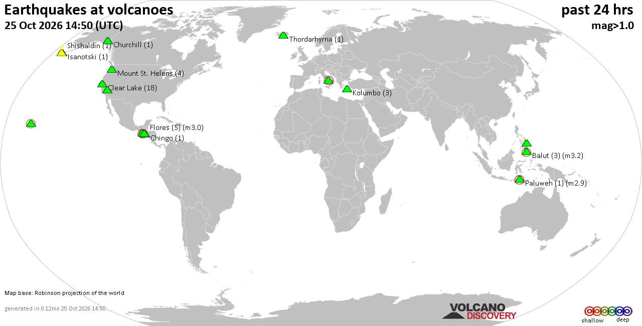
Volcano earthquake report for Sunday, 25 October 2026
• M 1.4 - 10 km ENE of Coso Junction, CA
• M 1.4 - 6 km NNE of North Shore, CA
• M 0.8 - 8 km ENE of Coso Junction, CA
• M 1.6 - 5 km WNW of Yucaipa, CA
• M 5.9 - 218 km ENE of Nagqu, China
• M 1.6 - 12 km E of Coso Junction, CA
|
|
|
Joined: Feb 2001
Posts: 678,977
Launch Director
|
|
Launch Director
Joined: Feb 2001
Posts: 678,977 |
SPC Oct 25, 2026 1300 UTC Day 1 Convective OutlookSPC 1300Z Day 1 Outlook 
Day 1 Convective Outlook
NWS Storm Prediction Center Norman OK
0718 AM CDT Sun Oct 25 2026

Valid 251300Z - 261200Z

...THERE IS A MARGINAL RISK OF SEVERE THUNDERSTORMS THIS AFTERNOON
AND EVENING ACROSS PARTS OF CENTRAL/EASTERN NEW MEXICO INTO FAR WEST
TEXAS AND THE WESTERN TEXAS PANHANDLE....

...SUMMARY...
Isolated large hail, and a tornado or two will be possible this
afternoon/evening across central/eastern New Mexico and Far West
Texas. Isolated damaging wind gusts will also be possible across Far
West Texas.

...NM/Far West TX...
A large upper trough remains over AZ, with deep southwesterly flow
across much of NM and west TX.  Water vapor imagery shows a
shortwave trough moving into northern Mexico, which will move into
eastern NM by early evening, providing support for a few
strong/severe storms - mainly over three small areas.

The first area of concern will be over central NM as a mid-level
cold pocket interacts with the western edge of residual low-level
moisture.  Forecast soundings in this area appear favorable for hail
in the strongest cells late this afternoon, although the risk of
severe hail is less certain.

Another area of risk is in southeast NM and far west TX where strong
daytime heating will yield MUCAPE values around 2000 J/kg and
slightly steeper low-level lapse rates.  Any persistent cells in
this area will pose a risk of hail and gusty winds.  Limited
coverage precludes an upgrade to SLGT at this time.

And finally, a surface baroclinic zone is expected to lie from
east-central NM into west TX (roughly east of ABQ to near DHT) early
this evening.  Multiple CAMs suggest a strong cell or two will track
along this boundary, with supercell structures possible.  Steep
lapse rates and favorable hodographs support a risk of hail and
perhaps a tornado along this corridor.

..Hart/Dean.. 10/25/2026
Read morehttps://www.spc.noaa.gov/products/outlook/day1otlk_1300.html
|
|



CMS The Best Conveyancing solicitors conveyancing quotes throughout the UK
For any webhosting enquiries please email webmaster@aus-city.com
|
|
Forums60
Topics893,380
Posts928,177
Members2,960
| |
Most Online102,106
Jul 10th, 2026
|
|
|
|
|

|









































