|
|
|
0 members (),
2,071
guests, and
25
robots. |
|
Key:
Admin,
Global Mod,
Mod
|
|
S |
M |
T |
W |
T |
F |
S |
|
|
|
|
|
1
|
2
|
3
|
|
4
|
5
|
6
|
7
|
8
|
9
|
10
|
|
11
|
12
|
13
|
14
|
15
|
16
|
17
|
|
18
|
19
|
20
|
21
|
22
|
23
|
24
|
|
25
|
26
|
27
|
28
|
29
|
30
|
31
|
|
There are no members with birthdays on this day. |
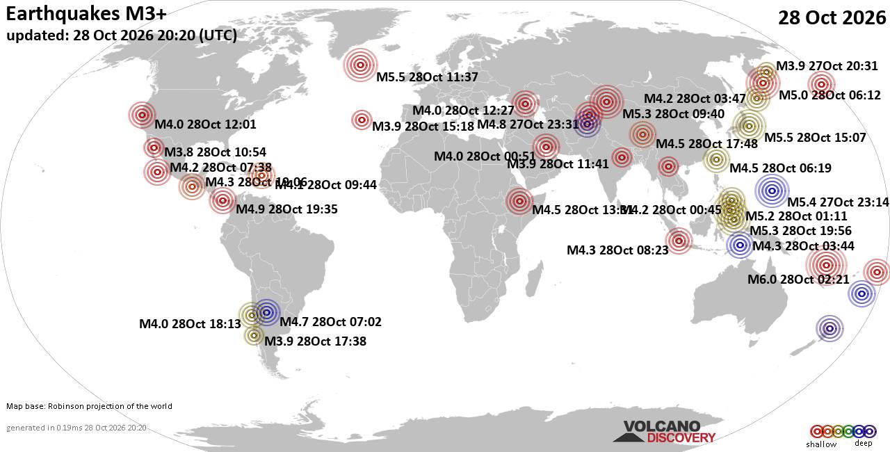
World Earthquake Report for Wednesday, 28 October 2026
• M 1.5 - 41 km S of South Van Horn, Alaska
• M 4.0 - 10 km N of Lake Pillsbury, CA
• M 2.3 - 49 km W of Nanwalek, Alaska
• M 1.6 - 7 km ENE of Adak, Alaska
• M 1.3 - 59 km ESE of McCarthy, Alaska
• M 1.2 - 3 km SW of Redlands, CA
|
|
|
Joined: Feb 2001
Posts: 678,977
Launch Director
|
|
Launch Director
Joined: Feb 2001
Posts: 678,977 |
SPC Oct 28, 2026 1300 UTC Day 1 Convective OutlookSPC 1300Z Day 1 Outlook 
Day 1 Convective Outlook
NWS Storm Prediction Center Norman OK
0713 AM CDT Wed Oct 28 2026

Valid 281300Z - 291200Z

...THERE IS A SLIGHT RISK OF SEVERE THUNDERSTORMS THIS AFTERNOON AND
EARLY EVENING FROM CENTRAL MINNESOTA INTO NORTHWEST WISCONSIN...

...SUMMARY...
A few severe thunderstorms are possible over parts of
Minnesota/Wisconsin this afternoon. Isolated tornadoes, large hail
and damaging winds will be possible.

...MN/WI...
Morning water vapor loop shows fast west-southwesterly flow aloft
across the central/northern Plains into the Midwest.  A couple of
shortwave troughs are noted - one fast-moving trough over eastern
WY, and a second lower-level trough over central KS.  These features
will track into the Midwest states by afternoon, aiding in the
development of scattered thunderstorms.  Forecast hodographs are
impressive with strong low-level veering/increasing winds with
height and 1km SRH values in the 200-300 m2/s2 range.

Wind fields would be conditionally favorable for supercells and
tornadoes, but the thermodynamics are the primary forecast
uncertainty.  Low-level moisture across the region is quite limited
at this time, but strong southerly low-level winds ahead of the
approaching troughs will help dewpoints to rise to near 60F across
southern MN. Forecast soundings suggest this is barely sufficient
for surface-based storms.  The corridor most likely to see a few
intense storms would be from central MN into northwest WI, mainly
from 20-01z.  Storms may transition to fast-moving bowing structures
in WI, with a risk of damaging winds if they can remain
surface-based.

...IA/NE...
Isolated thunderstorm development is also possible southward along
the cold front into southwest IA/eastern NE.  Storm coverage in this
area will be low, but any storm that persists could pose a risk of
hail.

...Southeast NM/Far West TX...
An isolated strong thunderstorm is possible again today along/east
of the Guadalupe Mountains of southeast NM.  Forcing is weak and
overall confidence is not high enough for severe probabilities.
Nevertheless, a storm or two could pose a risk of hail later today.

..Hart/Dean.. 10/28/2026
Read morehttps://www.spc.noaa.gov/products/outlook/day1otlk_1300.html
|
|



CMS The Best Conveyancing solicitors conveyancing quotes throughout the UK
For any webhosting enquiries please email webmaster@aus-city.com
|
|
Forums60
Topics899,352
Posts934,149
Members2,960
| |
Most Online102,106
Jul 10th, 2026
|
|
|
|
|

|









































