|
|
|
0 members (),
1,371
guests, and
26
robots. |
|
Key:
Admin,
Global Mod,
Mod
|
|
S |
M |
T |
W |
T |
F |
S |
|
|
|
|
|
1
|
2
|
3
|
|
4
|
5
|
6
|
7
|
8
|
9
|
10
|
|
11
|
12
|
13
|
14
|
15
|
16
|
17
|
|
18
|
19
|
20
|
21
|
22
|
23
|
24
|
|
25
|
26
|
27
|
28
|
29
|
30
|
31
|
|
There are no members with birthdays on this day. |
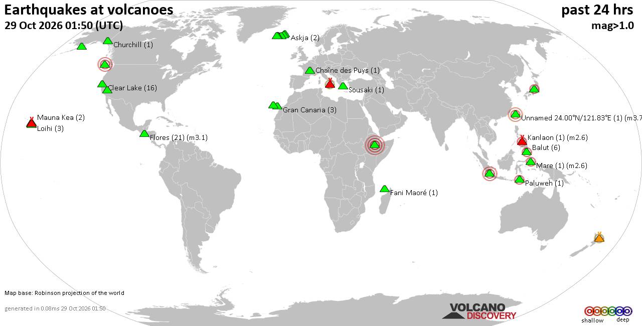
Volcano earthquake report for Thursday, 29 October 2026
• M 2.7 - 46 km W of Nanwalek, Alaska
• M 4.1 - 0 km SSW of Leones Arriba, Panama
• Moderate mag. 4.1 earthquake - 16 km southeast of Mawlaik, Sagaing Region, ...
• M 4.2 - south of the Fiji Islands
• M 4.4 - 14 km ESE of Cañas, Panama
|
|
|
Joined: Feb 2001
Posts: 678,977
Launch Director
|
|
Launch Director
Joined: Feb 2001
Posts: 678,977 |
SPC Oct 29, 2026 0600 UTC Day 1 Convective OutlookSPC 1200Z Day 1 Outlook 
Day 1 Convective Outlook
NWS Storm Prediction Center Norman OK
1252 AM CDT Thu Oct 29 2026

Valid 291200Z - 301200Z

...NO SEVERE THUNDERSTORM AREAS FORECAST...

...SUMMARY...
Severe thunderstorms are not forecast across the U.S. today or
tonight.

...DISCUSSION...
A mid-level ridge will become established in the central U.S. today,
as a cold front advances southward through the region. To the south
of the front, a somewhat moist airmass will be in place from the
central Plains into the mid Mississippi Valley. In spite of limited
large-scale ascent, thunderstorm development will be possible near
the front over parts of the mid Missouri Valley. Thunderstorms will
also be possible in parts of the southern Rockies and southern High
Plains, within the western part of the moist airmass. Over the
continental U.S. in areas with convective potential, instability and
deep-layer shear are forecast to be relatively low, and will be
insufficient for severe thunderstorm development.

..Broyles/Halbert-E.. 10/29/2026
Read morehttps://www.spc.noaa.gov/products/outlook/day1otlk_1200.html
|
|



CMS The Best Conveyancing solicitors conveyancing quotes throughout the UK
For any webhosting enquiries please email webmaster@aus-city.com
|
|
Forums60
Topics899,965
Posts934,762
Members2,960
| |
Most Online102,106
Jul 10th, 2026
|
|
|
|
|

|









































