|
|
|
0 members (),
1,371
guests, and
26
robots. |
|
Key:
Admin,
Global Mod,
Mod
|
|
S |
M |
T |
W |
T |
F |
S |
|
|
|
|
|
1
|
2
|
3
|
|
4
|
5
|
6
|
7
|
8
|
9
|
10
|
|
11
|
12
|
13
|
14
|
15
|
16
|
17
|
|
18
|
19
|
20
|
21
|
22
|
23
|
24
|
|
25
|
26
|
27
|
28
|
29
|
30
|
31
|
|
There are no members with birthdays on this day. |
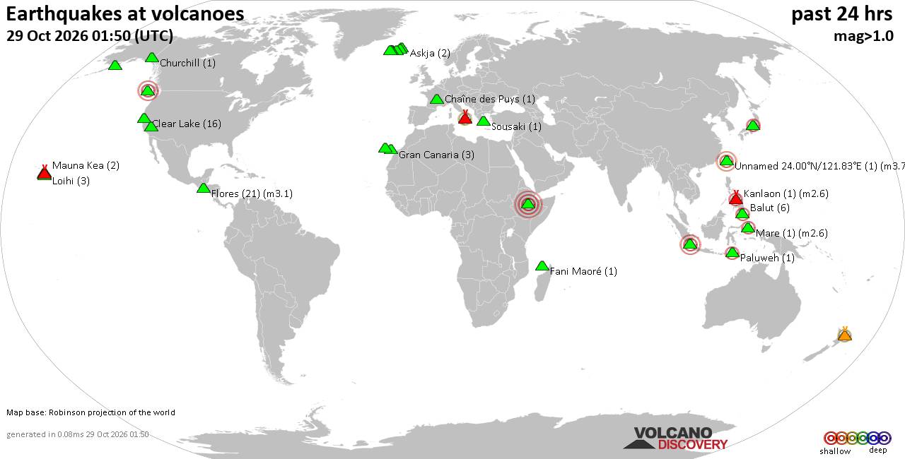
Volcano earthquake report for Thursday, 29 October 2026
• M 2.7 - 46 km W of Nanwalek, Alaska
• M 4.1 - 0 km SSW of Leones Arriba, Panama
• Moderate mag. 4.1 earthquake - 16 km southeast of Mawlaik, Sagaing Region, ...
• M 4.2 - south of the Fiji Islands
• M 4.4 - 14 km ESE of Cañas, Panama
|
|
|
Joined: Feb 2001
Posts: 678,977
Launch Director
|
|
Launch Director
Joined: Feb 2001
Posts: 678,977 |
SPC Oct 29, 2026 0600 UTC Day 2 Convective OutlookSPC 0600Z Day 2 Outlook 
Day 2 Convective Outlook
NWS Storm Prediction Center Norman OK
1216 AM CDT Thu Oct 29 2026

Valid 301200Z - 311200Z

...THERE IS A MARGINAL RISK OF SEVERE THUNDERSTORMS ACROSS PARTS OF
ARIZONA...

...SUMMARY...
Isolated strong to severe thunderstorms are possible across portions
of southern/central Arizona on Friday. Damaging wind gusts and large
hail will be possible with the strongest storms.

...Synopsis...

A mid/upper shortwave disturbance will migrate through larger-scale
ridging over the Plains on Friday. This shortwave trough will lift
slowly northeast from the southern Rockies/Rio Grande vicinity to
the Mid/Lower MO Valley by early Saturday. Further west, another
mid/upper trough off the Pacific coast will pivot northeast across
the Lower CO Valley and Four Corners vicinity. Widespread showers
and thunderstorm activity are expected with these features, though
severe thunderstorm potential will be focused across AZ.

...AZ...

Mid/upper south/southwesterly flow around 20-40 kt will overspread
50s to low 60s F dewpoints Friday morning into the afternoon.
Diurnal heating may be muted in some locations due to early
thunderstorm development and cloudiness. Nevertheless, cool
temperatures aloft (around -12 to -15 C at 500 mb) will support
500-1250 J/kg MLCAPE. Vertically veering wind profiles, increasing
in speed in the midlevels, will result in 20-30 kt effective shear
magnitudes and modestly elongated hodographs. While muted heating
will limit stronger destabilization, and the expected widespread
nature of convection may quickly lead to convective overturning, at
least some risk of severe wind/hail will accompany stronger, better
organized convection through early evening, particularly across
southern to central AZ.

..Leitman.. 10/29/2026
Read morehttps://www.spc.noaa.gov/products/outlook/day2otlk_0600.html
|
|



CMS The Best Conveyancing solicitors conveyancing quotes throughout the UK
For any webhosting enquiries please email webmaster@aus-city.com
|
|
Forums60
Topics899,965
Posts934,762
Members2,960
| |
Most Online102,106
Jul 10th, 2026
|
|
|
|
|

|









































