|
|
|
0 members (),
1,505
guests, and
26
robots. |
|
Key:
Admin,
Global Mod,
Mod
|
|
S |
M |
T |
W |
T |
F |
S |
|
1
|
2
|
3
|
4
|
5
|
6
|
7
|
|
8
|
9
|
10
|
11
|
12
|
13
|
14
|
|
15
|
16
|
17
|
18
|
19
|
20
|
21
|
|
22
|
23
|
24
|
25
|
26
|
27
|
28
|
|
29
|
30
|
|
|
|
|
|
|
There are no members with birthdays on this day. |
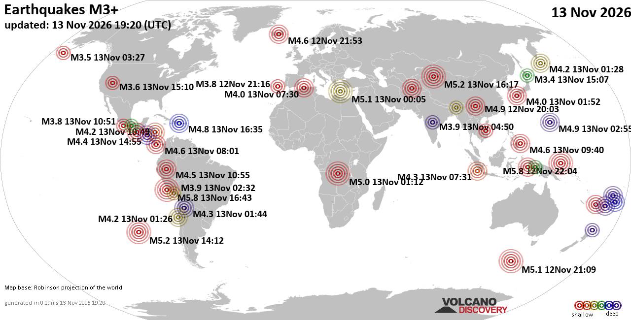
World Earthquake Report for Friday, 13 November 2026
• M 0.5 Other Event - 62 km ENE of Pedro Bay, Alaska
• M 0.5 Other Event - 64 km ENE of Pedro Bay, Alaska
• M 0.4 Other Event - 65 km ENE of Pedro Bay, Alaska
• M 4.5 - Mid-Indian Ridge
• M 0.4 Other Event - 63 km ENE of Pedro Bay, Alaska
• M 1.6 - 89 km NNW of Rachel, Nevada
|

#942714
Mon 02 Nov 2026 12:44:AM
|
Joined: Feb 2001
Posts: 800,656
Launch Director
|
|
Launch Director
Joined: Feb 2001
Posts: 800,656 |
SPC Nov 2, 2026 0100 UTC Day 1 Convective OutlookSPC 0100Z Day 1 Outlook 
Day 1 Convective Outlook
NWS Storm Prediction Center Norman OK
0641 PM CST Sun Nov 01 2026

Valid 020100Z - 021200Z

...THERE IS A SLIGHT RISK OF SEVERE THUNDERSTORMS ACROSS PARTS OF
NEW MEXICO INTO THE TEXAS AND OKLAHOMA PANHANDLES...

...SUMMARY...
Thunderstorms capable of producing severe wind gusts and a few
tornadoes are expected this evening into the overnight from parts of
New Mexico into the southern and central High Plains.

...New Mexico/Southern and Central High Plains...
Water vapor imagery shows a mid-level trough moving through southern
California with a lead shortwave trough over far eastern Arizona and
western New Mexico. Strong southwesterly flow is present in the
mid-levels from New Mexico eastward into the southern and central
High Plains. Ahead of the lead shortwave trough, thunderstorms have
recently developed in the higher terrain of north-central New Mexico
in response to strong large-scale ascent. These storms are expected
to move east-northeastward into parts of northeast New Mexico and
southeast Colorado this evening, and will likely have a potential
for severe wind gusts.

Further to the east, a lee surface trough is located over eastern
New Mexico with a moist airmass extending from near the trough
eastward into the southern High Plains. Surface dewpoints have
recently increased into the lower to mid 60s F over parts of eastern
New Mexico, where the RAP has an axis of moderate instability with
MLCAPE in the 1000 to 1800 J/g range. To the west of the instability
axis, a band of strong storms is expected to develop this evening
over central New Mexico. Short-term model forecasts have this line
becoming organized this evening, moving east-northeastward across
eastern and northeastern New Mexico into Texas Panhandle. Ahead of
this line, severe wind gusts are expected. The faster moving bowing
segments may produce wind gusts above 70 mph. Supercells will also
be possible within the line due to strong deep-layer shear. The
latest WSR-88D VWP at Amarillo has 0-3 km storm-relative helicity
near 350 m2/s2, suggesting that tornadoes will be possible...see MCD
2424.

The severe threat associated with the line of storms is expected to
persist into the overnight period, with the line moving into parts
of northwestern Oklahoma and south-central Kansas where isolated
severe gusts will be possible.

..Broyles.. 11/02/2026
Read morehttps://www.spc.noaa.gov/products/outlook/day1otlk_0100.html
|
|



CMS The Best Conveyancing solicitors conveyancing quotes throughout the UK
For any webhosting enquiries please email webmaster@aus-city.com
|
|
Forums60
Topics926,339
Posts961,136
Members2,960
| |
Most Online102,106
Jul 10th, 2026
|
|
|
|
|

|









































