|
|
|
0 members (),
2,044
guests, and
26
robots. |
|
Key:
Admin,
Global Mod,
Mod
|
|
S |
M |
T |
W |
T |
F |
S |
|
1
|
2
|
3
|
4
|
5
|
6
|
7
|
|
8
|
9
|
10
|
11
|
12
|
13
|
14
|
|
15
|
16
|
17
|
18
|
19
|
20
|
21
|
|
22
|
23
|
24
|
25
|
26
|
27
|
28
|
|
29
|
30
|
|
|
|
|
|
|
There are no members with birthdays on this day. |
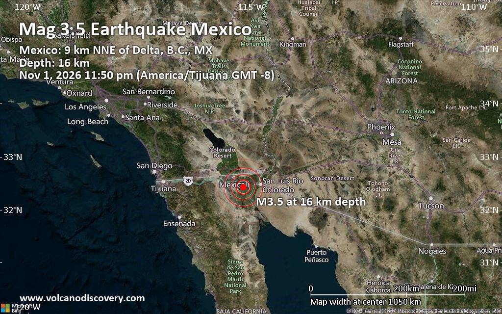
Magnitude 3.5 earthquake 34 km southeast of Mexicali, Mexico
• M 1.0 - 10 km ESE of Gilroy, CA
• M 3.7 - 17 km SSW of Weston, Colorado
• M 0.5 - 61 km ENE of Pedro Bay, Alaska
• M 1.6 - 7 km E of Ridgecrest, CA
• M 1.8 - 3 km NW of Nikiski, Alaska
|
|
|
Joined: Feb 2001
Posts: 678,977
Launch Director
|
|
Launch Director
Joined: Feb 2001
Posts: 678,977 |
SPC Nov 2, 2026 0700 UTC Day 2 Convective OutlookSPC 0700Z Day 2 Outlook 
Day 2 Convective Outlook
NWS Storm Prediction Center Norman OK
1255 AM CST Mon Nov 02 2026

Valid 031200Z - 041200Z

...THERE IS A MARGINAL RISK OF SEVERE THUNDERSTORMS FROM FAR EASTERN
TEXAS AND CENTRAL LOUISIANA INTO SOUTHEAST MISSOURI AND SOUTHWEST
ILLINOIS...

...SUMMARY...
Scattered storms will occur from the Sabine and Lower Mississippi
Valleys northward into the Mid Mississippi Valley on Tuesday. A few
thunderstorms may produce damaging gusts, and a brief tornado cannot
be ruled out.

...Discussion...
A highly amplified upper trough will move out of the Plains and
toward the MS Valley on Tuesday, with moderate southerly winds
aloft. Height falls will occur over MO and AR during the day, and
into IL and western KY and TN overnight.

At the surface, low pressure will be located over southern MN,
nearly stationary, with a front extending south across IA, MO, and
into the Sabine Valley during the afternoon.

Southerly low-level winds with 30-40 kt at 850 mb will aid moisture
transport, with mid 60s F dewpoints as far north as the Missouri
Bootheel. Rain and thunderstorms will be ongoing along the front
early, though a diurnal uptick in intensity is expected from the
Sabine River into southern MO.

The primary mitigating factor on Tuesday will be widespread clouds,
rain, and weak lapse rates ahead of the front. Still, at least
isolated severe gusts, or a brief tornado or two may occur as shear
profiles overall will favor rotation with storms along the front, or
possible cells ahead of the front from LA into AR.

..Jewell.. 11/02/2026
Read morehttps://www.spc.noaa.gov/products/outlook/day2otlk_0700.html
|
|



CMS The Best Conveyancing solicitors conveyancing quotes throughout the UK
For any webhosting enquiries please email webmaster@aus-city.com
|
|
Forums60
Topics906,323
Posts941,120
Members2,960
| |
Most Online102,106
Jul 10th, 2026
|
|
|
|
|

|









































