|
|
|
0 members (),
3,371
guests, and
15
robots. |
|
Key:
Admin,
Global Mod,
Mod
|
|
S |
M |
T |
W |
T |
F |
S |
|
1
|
2
|
3
|
4
|
5
|
6
|
7
|
|
8
|
9
|
10
|
11
|
12
|
13
|
14
|
|
15
|
16
|
17
|
18
|
19
|
20
|
21
|
|
22
|
23
|
24
|
25
|
26
|
27
|
28
|
|
29
|
30
|
|
|
|
|
|
|
There are no members with birthdays on this day. |
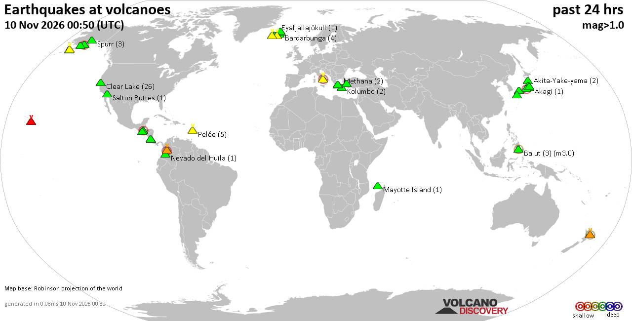
Volcano earthquake report for Tuesday, 10 November 2026
• M 2.6 - 11 km E of Pāhala, Hawaii
• M 5.4 - Pulau Pulau Tanimbar, Indonesia
• M 5.4 - Pulau Pulau Tanimbar, Indonesia
• M 4.9 - north of Franz Josef Land
• M 4.9 - north of Franz Josef Land
|

#947914
Wed 04 Nov 2026 07:11:PM
|
Joined: Feb 2001
Posts: 800,656
Launch Director
|
|
Launch Director
Joined: Feb 2001
Posts: 800,656 |
SPC Nov 4, 2026 1930 UTC Day 3 Severe Thunderstorm OutlookSPC 1930Z Day 3 Outlook 
Day 3 Convective Outlook
NWS Storm Prediction Center Norman OK
0110 PM CST Wed Nov 04 2026

Valid 061200Z - 071200Z

...THERE IS A MARGINAL RISK OF SEVERE THUNDERSTORMS ACROSS PORTIONS
OF THE EASTERN CAROLINAS AND SOUTHEAST VIRGINIA...

...SUMMARY...
A few strong to severe storms are possible Friday over parts of the
eastern Carolinas and southeast Virginia.

...Eastern NC and vicinity...

An upper low and attendant trough oriented from the Great Lakes to
the TN Valley will become more progressive on Friday, shifting east
toward the Eastern Seaboard and New England. This will bring a belt
of enhanced southwesterly deep-layer flow across the Carolinas,
northward through the Northeast. At the surface, low pressure will
deepen over the Mid-Atlantic and move offshore through the period,
with a trailing front shifting east across eastern VA/NC/SC/GA and
northern FL.

Ahead of the front, mid-60s F dewpoints will be in place as far
north as southeast VA. This will aid in weak destabilization across
the eastern Carolinas toward southeast VA within the pre-frontal
warm advection regime. However, cloudiness and possible ongoing
showers/thunderstorms across portions of the region will inhibit
stronger destabilization despite cooling aloft and favorable
boundary layer moisture. Nevertheless, strengthening vertical shear
is anticipated by midday, and where pockets of stronger
heating/destabilization can occur, isolated strong to severe storms
will be possible. These stronger storms could produce sporadic wind
damage, and a Level 1/Marginal risk has been included with the Day 3
update.

..Leitman.. 11/04/2026
Read morehttps://www.spc.noaa.gov/products/outlook/day3otlk_1930.html
|
|



CMS The Best Conveyancing solicitors conveyancing quotes throughout the UK
For any webhosting enquiries please email webmaster@aus-city.com
|
|
Forums60
Topics919,545
Posts954,342
Members2,960
| |
Most Online102,106
Jul 10th, 2026
|
|
|
|
|

|









































