|
|
|
0 members (),
2,647
guests, and
23
robots. |
|
Key:
Admin,
Global Mod,
Mod
|
|
S |
M |
T |
W |
T |
F |
S |
|
1
|
2
|
3
|
4
|
5
|
6
|
7
|
|
8
|
9
|
10
|
11
|
12
|
13
|
14
|
|
15
|
16
|
17
|
18
|
19
|
20
|
21
|
|
22
|
23
|
24
|
25
|
26
|
27
|
28
|
|
29
|
30
|
|
|
|
|
|
|
There are no members with birthdays on this day. |
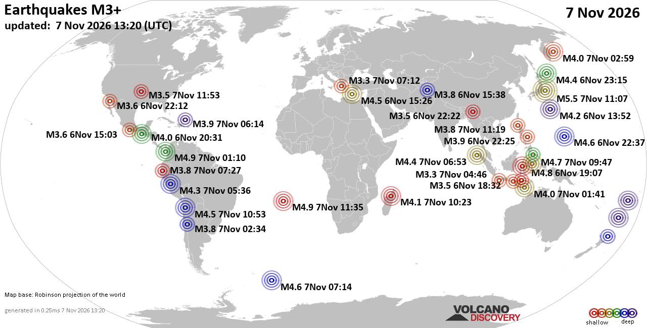
World Earthquake Report for Saturday, 7 November 2026
• M 7.7 - 10 km WSW of Pitaloza Arriba, Panama
• M 3.8 - 41 km NNE of Petersville, Alaska
• M 1.1 - 15 km ESE of Julian, CA
• M 1.9 - 26 km ESE of Naalehu, Hawaii
• M 4.5 - 162 km NW of Port-Olry, Vanuatu
|
|
|
Joined: Feb 2001
Posts: 800,656
Launch Director
|
|
Launch Director
Joined: Feb 2001
Posts: 800,656 |
SPC Nov 7, 2026 1300 UTC Day 1 Convective OutlookSPC 1300Z Day 1 Outlook 
Day 1 Convective Outlook
NWS Storm Prediction Center Norman OK
0646 AM CST Sat Nov 07 2026

Valid 071300Z - 081200Z

...NO SEVERE THUNDERSTORM AREAS FORECAST...

...SUMMARY...
Organized severe thunderstorms are not forecast through tonight.

...Synopsis and Discussion...
An upper trough/low over the lower Great Lakes this morning will
move eastward across the Mid-Atlantic and Northeast today. Modest
low-level warm advection and cool mid-level temperatures may support
weak but sufficient MUCAPE for occasional lightning flashes with
convection that develops across parts of New England through the
day. Instability is expected to remain too limited to support
organized severe thunderstorms.

Mainly elevated thunderstorms should occur through the period across
parts of west/central/south TX, as a separate mid-level trough/low
translates east-southeastward from the Southwest into north-central
Mexico. A surface front will generally remain offshore from the
lower TX Coast, but large-scale ascent preceding the upper trough
and a modest increase in low-level warm advection late this
afternoon into tonight will aid the development of MUCAPE up to 500
J/kg, which should support some lightning with this elevated
activity.

Across the coastal Pacific Northwest, a low-topped line of
convection is forecast to approach the WA Coast after 00Z, with
strong low and mid-level winds expected to be present ahead of an
approaching upper trough. Low 50s surface dewpoints and minimal
diurnal heating both appear marginal to support more than very weak
surface-based instability, and updrafts may not reach sufficient
height to induce charge separation and lightning flashes. Even so,
strong/gusty winds may occur with this convection as it spreads
inland across parts of coastal WA this evening/tonight. However,
given the very limited thermodynamic environment, confidence in
severe gusts remains too low to include any severe probabilities.

..Gleason.. 11/07/2026
Read morehttps://www.spc.noaa.gov/products/outlook/day1otlk_1300.html
|
|



CMS The Best Conveyancing solicitors conveyancing quotes throughout the UK
For any webhosting enquiries please email webmaster@aus-city.com
|
|
Forums60
Topics915,868
Posts950,665
Members2,960
| |
Most Online102,106
Jul 10th, 2026
|
|
|
|
|

|









































