|
|
|
0 members (),
2,809
guests, and
23
robots. |
|
Key:
Admin,
Global Mod,
Mod
|
|
S |
M |
T |
W |
T |
F |
S |
|
1
|
2
|
3
|
4
|
5
|
6
|
7
|
|
8
|
9
|
10
|
11
|
12
|
13
|
14
|
|
15
|
16
|
17
|
18
|
19
|
20
|
21
|
|
22
|
23
|
24
|
25
|
26
|
27
|
28
|
|
29
|
30
|
|
|
|
|
|
|
There are no members with birthdays on this day. |
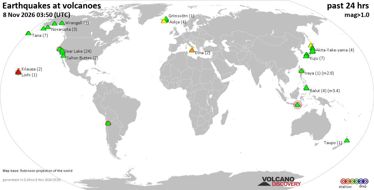
Volcano earthquake report for Sunday, 8 November 2026
• Light mag. 3.9 earthquake - Departamento de Santa Rosa, 26 km west of Jutia...
• M 4.7 - 46 km NW of Huara, Chile
• World Earthquake Report for Sunday, 8 November 2026
• M 1.9 - 27 km ESE of Naalehu, Hawaii
• M 0.6 - 5 km NW of The Geysers, CA
|
|
|
Joined: Feb 2001
Posts: 800,656
Launch Director
|
|
Launch Director
Joined: Feb 2001
Posts: 800,656 |
SPC Nov 8, 2026 1300 UTC Day 1 Convective OutlookSPC 1300Z Day 1 Outlook 
Day 1 Convective Outlook
NWS Storm Prediction Center Norman OK
0640 AM CST Sun Nov 08 2026

Valid 081300Z - 091200Z

...THERE IS A MARGINAL RISK OF SEVERE THUNDERSTORMS ACROSS A SMALL
PART OF SOUTH TEXAS...

...SUMMARY...
Strong to locally severe thunderstorms may occur today across parts
of south Texas. Isolated damaging winds and perhaps a brief tornado
appear possible.

...South Texas...
Downstream of a mid/upper-level trough/low over northern Mexico,
thunderstorms are ongoing this morning across parts of south TX. A
weak surface low/inverted trough is also analyzed across this
region, with greater low-level moisture (upper 60s to low 70s
surface dewpoints) present across the lower TX Coast. Weak
surface-based instability should develop this morning as filtered
daytime heating occurs, and strong to locally severe thunderstorms
may occur near the coast in the vicinity of Corpus Christi. Modest
enhancement to the low-level winds (southeasterly around 20-25 kt;
reference 12Z CRP observed sounding) and sufficient deep-layer shear
should exist for organized updrafts, including marginal supercell
structures (with one attempt already observed southwest of KCRP).
While low/mid-level lapse rates will remain poor, any sustained
surface-based supercell could produce isolated severe/damaging winds
and perhaps a brief tornado given effective SRH around 100 m2/s2.
Otherwise, elevated thunderstorms are forecast across a broader
portion of south-central TX, as large-scale ascent preceding the
upper trough/low overlaps with a weakly unstable airmass inland.

...Pacific Northwest...
Thunderstorm potential should continue to diminish this morning as
large-scale ascent associated with a strong mid/upper-level trough
moves inland across the Pacific Northwest and western Canada. But,
occasional lightning flashes may still occur with post-frontal
low-topped convection in the short term, as cold mid-level
temperatures support weak MUCAPE.

..Gleason/Wendt.. 11/08/2026
Read morehttps://www.spc.noaa.gov/products/outlook/day1otlk_1300.html
|
|



CMS The Best Conveyancing solicitors conveyancing quotes throughout the UK
For any webhosting enquiries please email webmaster@aus-city.com
|
|
Forums60
Topics917,041
Posts951,838
Members2,960
| |
Most Online102,106
Jul 10th, 2026
|
|
|
|
|

|









































